All of the Trip Planning Links You Will Ever Need

Last updated: November 18, 2018

Trip Planning Resources


Please note: newly added links are in bold font below.

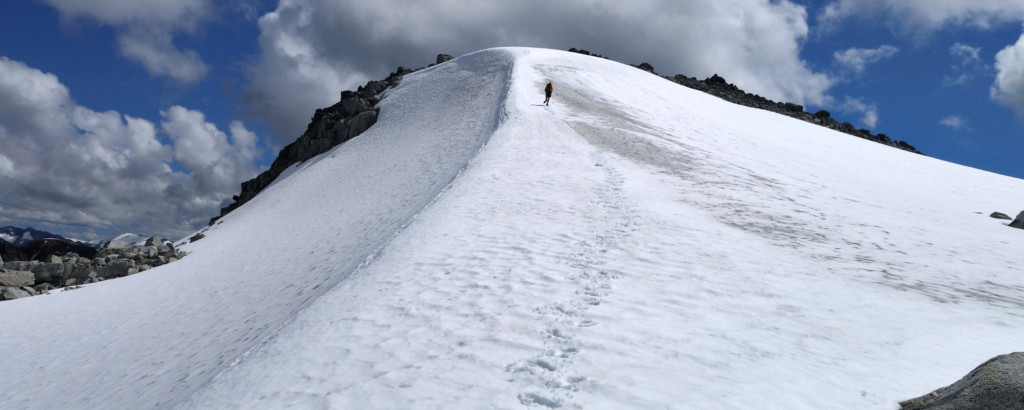
Everyone has their own method to the madness of trip planning – some plan extensively, some don’t see the value in planning, and some may not know how or where to start. There is an abundance of information available online to help you decide where to go, when to go, how to pack, and more. I can’t comment on the accuracy of the sites out there, but I do have several go-to sites I like to check out for local updates and area-specific conditions before heading out. Personally, Ryan & I have dozens of links and webcams we pull up when making plans – especially during periods when weather can be marginal. And this was pretty much how we came up with the idea of creating this post – instead of googling different things for different areas, we decided to create a one-stop shop of links and resources for various adventure needs.

About Trip Planning Links

Ryan and I have compiled two charts of informational links, weather forecasts, webcams, and more to help plan trips and stay safe in the outdoors all year round. This is the product of years of bookmarking and Ryan’s experience as a North Shore Rescue member. These links are for you if you:

  • generally know your way around the outdoors (what to take, how to stay safe).
  • understand FSR and trail conditions can be ever changing in some areas.
  • are looking for up-to-date information on a particular area within the South Coast of BC.
  • are experiencing a season change and need information on current conditions.

First, we’ve put together a comprehensive list of South Coast webcams and condition links to help you understand current weather conditions to help with trip planning. Next, we’ve compiled a second table of related outdoors links that you may find interesting and informative for your adventures, be it hiking, camping, backpacking, skiing, 4x4ing, kayaking, etc.

If you have an idea of where you want to go, or you’re trying to decide between regions, Chart 1 offers additional information on current trail conditions, snow/avalanche updates, and recent trip reports. It also provides a definitive list of South Coast webcams to enable you to check (very close to) real-time conditions at or near your destination of choice. This chart is based on regions in southwest BC. Once your regional planning is done, you may need more information on outdoors-related topics. You’ll find an abundance of information on Chart 2, including snow/avalanche conditions, general weather forecasts, Northern Lights forecast (and where to go for optimal viewing), club/forum links, and beyond. Chart 2 contains a comprehensive list for those in the Lower Mainland/South Coast of BC.

If we’ve missed any links or if you have any suggestions for improvement, please feel free to leave a comment below.

Chart 1: Webcams and Condition Updates
Lower Mainland
 Webcams:
 Downtown/North Van  http://www.vancam.ca/vancam.jpg
 Canada Place/North Van
 http://webcam.visioncritical.com/webcam.jpg
 Downtown/West Van  http://www.cbc.ca/bc/webcam/hd/vcr_hd_320.png
 UBC/West Van  http://towercam.arts.ubc.ca/view/viewer_index.shtml?id=45561
 Jericho/North Van  http://jsca.bc.ca/services/streamcam/
 English Bay  http://www.katkam.ca/
 Deep Cove  http://www.deepcovekayak.com/webcam/new/i6173710.jpg
 Cypress Mountain  http://snowstakecam.cypressmountain.com/axis-cgi/jpg/image.cgi?resolution=1024×768
 http://panocam.cypressmountain.com/axis-cgi/jpg/image.cgi?resolution=1024×768
 Grouse Mountain  https://www.grousemountain.com/web-cams/chalet-cam
 Mt. Seymour  http://www.mountseymour.com/webcam_image.php
 Trail & Conditions Updates:
 Burke Mountain
 https://www.burkeandwidgeon.com/trail-updates/
 Tri Cities Area
 https://www.facebook.com/BurkeMountainNaturalists
 Mt. Seymour trail report
 http://www.env.gov.bc.ca/bcparks/explore/parkpgs/mt_seymour/trail_report.pdf
 Cypress Mtn trail report
 http://www.env.gov.bc.ca/bcparks/explore/parkpgs/cypress/trail_report.pdf
 Avy Forecast
 http://www.avalanche.ca/map/forecasts/south-coast
Sea to Sky
 Webcams:
 Sea to Sky Gondola  http://webcam.seatoskygondola.com:8082/Streaming/channels/101/picture
 Squamish (downtown/Chief)  https://squamish.ca/assets/webcam/MCDonaldsIntersection.jpg
 Squamish (Smoke Bluffs)  https://squamish.ca/assets/webcam/ACSmokebluffs.jpg
 Squamish (Chief)  https://squamish.ca/assets/webcam/CityhallChief.jpg
 Squamish (Downtown/Garibaldi)  https://squamish.ca/assets/webcam/MuniHallGaribaldi.jpg
 Squamish (Tantalus)  https://squamish.ca/assets/webcam/BPTantalusMnts.jpg
 Squamish (Squamish Valley)  https://squamish.ca/discover-squamish/webcams/
 Squamish Chief Cam & Weather  https://chiefcam.com/
 NAV Canada – Squamish  http://www.metcam.navcanada.ca/dawc/lb/cameraSite.jsp?lang=e&id=80
 NAV Canada – Cheakamus Canyon  http://www.metcam.navcanada.ca/dawc/lb/cameraSite.jsp?lang=e&id=78
 Brohm Ridge (BTSC)  http://www.btsc.ca/cpages/webcams
 Callaghan – Biathlon Range  https://www.whistlersportlegacies.com/sites/default/files/webcams/biathlon.jpg?itok=8060843181335516637
 Callaghan – view to Brandywine/Metal Dome  https://www.whistlersportlegacies.com/sites/default/files/webcams/brandywine.jpg?itok=977424184353325016
 Callaghan – view South  https://www.whistlersportlegacies.com/sites/default/files/webcams/stadium.jpg?itok=7812772632127307663
 Trail & Conditions Updates:
 Garibaldi Trail Report  http://www.env.gov.bc.ca/bcparks/explore/parkpgs/garibaldi/trail_report.pdf
 Sea to Sky District FSR Conditions  https://www2.gov.bc.ca/gov/content/industry/natural-resource-use/resource-roads/local-road-safety-information/sea-to-sky-natural-resource-district-road-safety-information/road-conditions-in-sea-to-sky-district
 Avy Forecast
 http://www.avalanche.ca/map/forecasts/sea-to-sky
Whistler & Pemberton
 Webcams:
 Whistler  http://www.whistlerweather.org/library/bd_web.html
 Whistler  http://files.whistler.com/webcam/crabapple.jpg
 Whistler (Olympic Plaza)  https://www.whistler.com/images/webcam/olympic_plaza/olympic_plaza.jpg
 Whistler Blackcomb – mountain cams  https://www.whistlerblackcomb.com/mountain-info/snow-report#mountain-cams
 NAV Canada – Whistler  http://www.metcam.navcanada.ca/dawc/lb/cameraSite.jsp?lang=e&id=77
 NAV Canada – Pemberton  http://www.metcam.navcanada.ca/dawc/lb/cameraSite.jsp?lang=e&id=64
 Pemberton  Meadows  http://meadows.enviromedia.ca/squirrelcam1.jpg
 Pemberton – Big Sky Golf  http://bigskygolf.ca/wp-content/uploads/2015/webcam/big-sky-webcam.jpg
 DriveBC – Duffy  http://images.drivebc.ca/bchighwaycam/pub/cameras/182.jpg
 Trail & Conditions Updates:
 Garibaldi Trail Report  http://www.env.gov.bc.ca/bcparks/explore/parkpgs/garibaldi/trail_report.pdf
South Chilcotin, Bridge River Valley, Lillooet, Lytton
 Webcams:
 South Chilcotin
 http://www.southchilcotin.ca/southchilcotincam.jpg
 Gun Lake  http://www.southchilcotin.ca/gunlake/gunlakecam.jpg
 NAV Canada – Lillooet  http://www.metcam.navcanada.ca/dawc/lb/cameraSite.jsp?lang=e&id=111
 Lytton to Lillooet  http://visiwisp.lyttonnet.com/app/camcon.php
 Trail & Conditions Updates:
 Hurley  http://isurvivedthehurley.com/
 South Chilcotin Trail Report  http://www.env.gov.bc.ca/bcparks/explore/parkpgs/south_chilcotin_mts/
 South Chilcotin – Other  https://www.facebook.com/southchilcotin/
Fraser Valley, Hemlock, Crowsnest Hwy, OR East
 Webcams:
 Sasquatch Mountain Resort  https://sasquatchmountain.ca/weather-and-conditions/webcams/
 NAV Canada – Hope
 http://www.metcam.navcanada.ca/dawc/lb/cameraSite.jsp?lang=e&id=96
 NAV Canada – Manning Park
 http://www.metcam.navcanada.ca/dawc/lb/cameraSite.jsp?lang=e&id=16
 Trail & Conditions Updates:
 Manning Park Trail Report  http://www.env.gov.bc.ca/bcparks/explore/parkpgs/ecmanning/
 Avy Forecast  http://www.avalanche.ca/map/forecasts/south-coast-inland
 Chilliwack District FSR Conditions  http://bcgov03.maps.arcgis.com/apps/webappviewer/index.html?id=0f792275b1b2417a8579998255dd6195

Chart 2: Snow, Avalanche, Weather, Water, Sky, FSRs, Wildfires

 Online Trip Plan https://www.adventuresmart.ca/tripplan/tripplan.php

Snow – Depths and Forecasts
 BC Automated Snow Pillow Data  http://bcrfc.env.gov.bc.ca/data/asp/realtime/index.htm
 NOAA Snow Depth
 http://www.nohrsc.noaa.gov/nsa/
 Ski Hill Snow Reports  http://www.onthesnow.ca/vancouver/skireport.html
 Snow Forecast and Freezing Levels  http://www.snow-forecast.com/maps/dynamic/van
 Whistler Snow Report
 https://www.whistlerblackcomb.com/mountain-info/snow-report
Avalanche –  Forecasts, Conditions and Information
 ACMG Mountain Conditions Report
 https://www.mountainconditions.com/
 Avalanche Canada  http://www.avalanche.ca/map
 Avalanche Canada’s Arfi  http://arfi.avalanche.ca/
 Online Avalanche Course
 http://old.avalanche.ca/cac/training/online-course
 Wayne Flann Avalanche Blog  http://www.wayneflannavalancheblog.com/
Weather – General Forecasts
 Accuweather (Whistler)  http://www.accuweather.com/en/ca/whistler/v0n/weather-forecast/53264
 Government of Canada (Whistler)  https://weather.gc.ca/city/pages/bc-86_metric_e.html
 Mountain Weather Forecast
 http://www.avalanche.ca/weather/forecast
 North Shore Alpine Forecast (RWDI)
 http://www.northshorerescue.com/avalanche-info/
(scroll to bottom)
 SpotWX
 https://spotwx.com/
 The Weather Network (Whistler)  https://www.theweathernetwork.com/ca/weather/british-columbia/whistler
 Weather Underground (Whistler)  https://www.wunderground.com/ca/bc/whistler
YR Weather  https://www.yr.no/forsida.aspx?spr=eng
Weather – Other
 Cliff Mass Weather Blog  http://cliffmass.blogspot.ca/
 Mountain Forecast  http://www.mountain-forecast.com/
 Rescue Dynamics Weather Links  http://www.rescuedynamics.ca/wx/canMTNwx.htm
 Weather Station Archive  http://carroll.org.uk/weather/
 Wind Map  https://earth.nullschool.net/#current/wind/surface/level/orthographic=-114.35,48.44,1701/loc=-122.845,49.275
 Whister Blackcomb Weather System  http://online.whistlerblackcomb.com/weather/Default.aspx
 Whistler Weather  http://www.whistlerweather.org/
Water
 Flood Warnings & Advisories  http://bcrfc.env.gov.bc.ca/warnings/index.htm
 Real Time Hydrometric Data
 https://wateroffice.ec.gc.ca/google_map/google_map_e.html?searchBy=p&province=BC&doSearch=Go
 Tide Forecast (Squamish)  https://www.tide-forecast.com/locations/Squamish-British-Columbia/tides/latest
Sky
 Aurora Forecast  http://services.swpc.noaa.gov/images/aurora-forecast-northern-hemisphere.jpg
 Clear Sky Charts  http://www.cleardarksky.com/csk/prov/British_Columbia_map.html
 Dark Sky Finder
 http://darksitefinder.com/maps/world.html
 Real Time Lightning Map
 https://www.lightningmaps.org/?lang=en#m=sat;r=0;t=3;s=0;o=0;b=;n=0;y=49.6942;x=-122.8077;z=7;d=2;dl=2;dc=0;
Forest Service Roads (General)
 FSR Updates  https://www2.gov.bc.ca/gov/content/industry/forestry/managing-our-forest-resources/ministry-of-forests-lands-and-natural-resource-operations-region-district-contacts
Wildfires
 BC Wildfire Status  https://governmentofbc.maps.arcgis.com/apps/webappviewer/index.html?id=a1e7b1ecb1514974a9ca00bdbfffa3b1
 Canadian Wildland Fire IS  http://cwfis.cfs.nrcan.gc.ca/interactive-map
 FireSmoke
 http://firesmoke.ca/forecasts/viewer/run/ops/BSC-WC-01/current/
Clubs/Organizations/Online Forums
 ACC Vancouver  http://accvancouver.ca/
https://www.facebook.com/groups/accvancouver/
 BC 4×4  http://bb.bc4x4.com/forum.php
 https://www.facebook.com/4wdabc/
 4×4 Rescue and Recovery Group  https://www.facebook.com/groups/746862598711452/
 BCMC
 https://bcmc.ca/forum/
 Bivouac
 http://bivouac.com/
 Cascade Climbers  http://cascadeclimbers.com/forum/
 ClubTread  http://forums.clubtread.com/
 Friends of Manning Park  https://facebook.com/FriendsOfManningPark/
 Live Trails
 https://www.livetrails.com/
 North Shore Hikers
 http://northshorehikers.org/
 Ridge Meadows Outdoor Club
 http://rmoutdoorclub.ca
 Tetrahedron Outdoor Club
 http://tetoutdoor.ca
 Trail Peak  http://trailpeak.com/
 UBC VOC  http://www.ubc-voc.com/
 Vancouver Trails  https://www.vancouvertrails.com/
 Wanderung
 http://www.wanderung.ca/
https://www.facebook.com/groups/2389686598/
Other
 BC Hydro Rec Sites  https://www.bchydro.com/community/recreation_areas.html
 BC Parks – Reservations  http://www.elp.gov.bc.ca/bcparks/
 Drive BC Road Conditions
 http://www.drivebc.ca/#mapView&z=7&ll=50.169861746007314,-123.51928710937501
 GPS Coordinates from Smartphone
 http://www.northshorerescue.com/education/location-services/
 How to Kill Yourself Snowshoeing  http://blog.oplopanax.ca/2010/10/how-to-kill-yourself-snowshoeing/
 iMap BC  http://www2.gov.bc.ca/gov/content/governments/about-the-bc-government/databc/geographic-data-and-services/imapbc
 Mountain Aerial Photography  https://www.jaggedridgeimaging.com
 Online Trip Plan  https://www.adventuresmart.ca/tripplan/tripplan.php
 Open Street Map  https://www.openstreetmap.org/#map=16/50.1499/-123.0912
 Recreation Sites and Trails BC  http://apps.gov.bc.ca/pub/dmf-viewer/?siteid=5140114829009675607
 Sharphooks – Fishing Reports  http://www.sharphooks.com/search.aspx
 Strava Global Heatmap  https://labs.strava.com/heatmap/#15.00/-123.11056/50.15986/blue/all
 The 10 Essentials
 http://www.northshorerescue.com/education/what-to-bring/

7 Comments on “All of the Trip Planning Links You Will Ever Need

  1. Nice list of links. I quite like

    https://www.yr.no/forsida.aspx?spr=eng (if it comes up in Norwegian, there’s a place to select language in upper right).

    Just type in (say) Vancouver and you will find a wealth of data. It seems to use different models from Environment Canada. I like that is gives wind speeds and directions.

Leave a Reply to Yuji Cancel reply

Your email address will not be published. Required fields are marked *