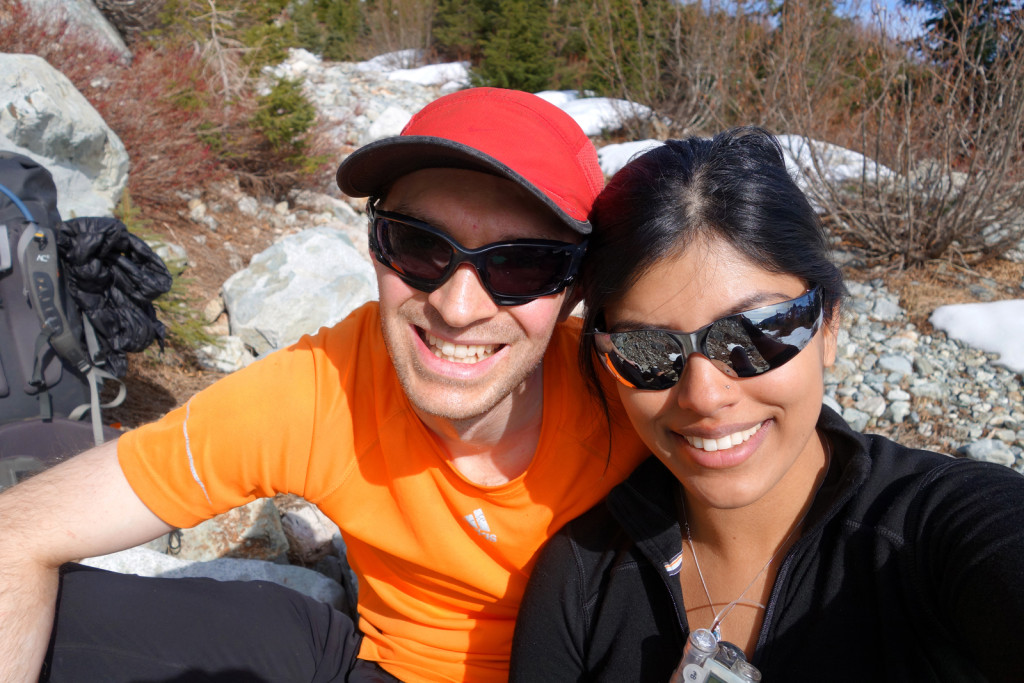
Ashika Morasiewicz
Outdoor Adventurer from the North Shore, BC
‘Winter’ Camping on the Howe Sound Crest Trail (HSCT) – March 8-9, 2015
Usually, during winter months, I make like the bears and hibernate. I put away my hiking boots, store my pack, grab some sort of gym membership, and I stay indoors until my surroundings warm up and the snow starts to melt. This season, Ryan and I have made a point of getting outdoors to keep our hiking momentum going and to train for bigger trips we have planned this summer.
Winter is a stunning season; as the snow falls, our world transforms into a bare, bright, and frozen landscape. The summer hiking crowds disperse, making the trails and mountains more peaceful and remote.
I was stoked when Ryan & I made plans to go winter camping last weekend. This was my first winter camping experience and my first time on the Howe Sound Crest Trail (HSCT). The plan was to camp in the Magnesia meadows. With Ryan’s ‘Hat Trick‘ trip in mind, I was eager to complete a Winter Hat Trick over the course of 2 days – this would involve summiting Hat, Brunswick and Harvey mountains. Of course, this didn’t end up happening.
We had a weekend full of sketchy ascents, traversing slopes, route-finding, winter camping, light scrambling, and bushwhacking – all in that order. I can’t say I bit off more than I could chew, because we did make it. I’d say I bit off more than I would have liked to chew, but I still had an incredible learning experience.
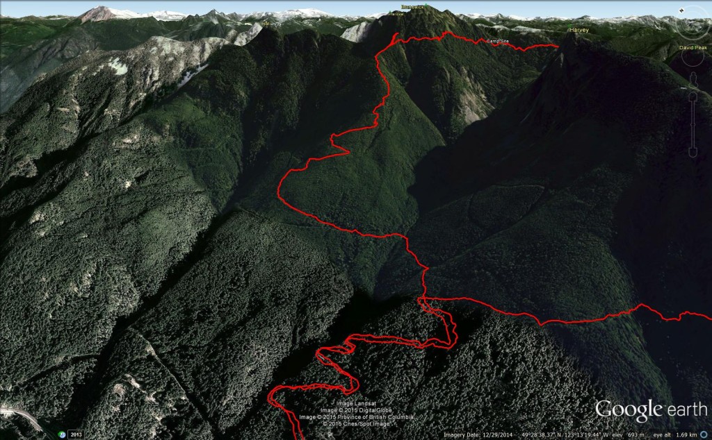
We set off for Lions Bay, early in the morning, and stopped for breakfast along the way. Upon arrival, we parked about a block away from the normal parking lot as the normal lot does not allow overnight parking. Our plan was to ascend Hat Peak and Mt. Brunswick on Saturday, drop down into Magnesia Meadows for a camp and head up Mt. Harvey (via the east side) on our way out on Sunday.
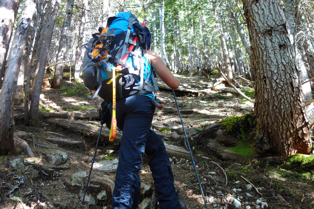
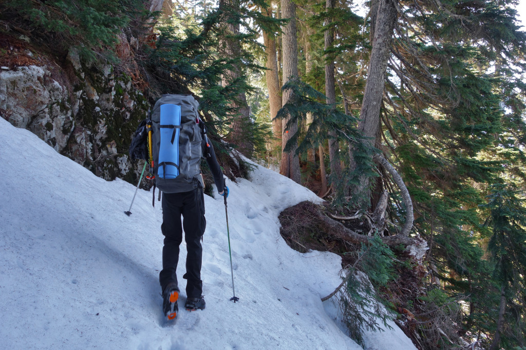
We geared up and set off for our first stop, Hat Peak. This was my first trip carrying both overnight and winter gear. I was probably carring 40-45lbs on my pack. We moved at a slow and steady pace with minimal breaks. Though we were moving at an efficient pace, I wildly underestimated the logging road slog and the elevation gain. It’s much quicker and easier with a 20-25lb pack during summer months!
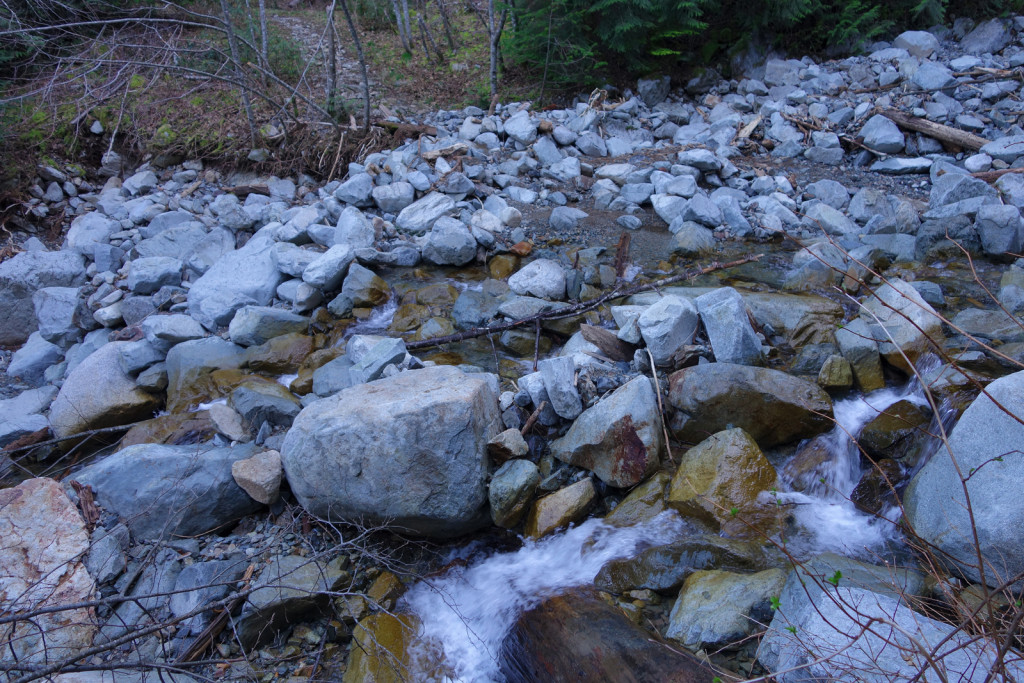
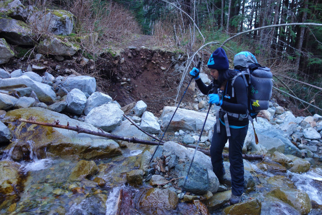
The Lions/Brunswick junction was our first brief rest point. Upon reaching Magnesia Creek, we were shocked to see what the heavy rainfalls from the winter had done. In a normal season, the creek crossing can result in some wet boots, depending on the level of water run-off. It appeared a good 1-2 metres of material had been scoured from the creek bed and we had to scamper down an eroded cliff to get to the crossing. The water level was low and we were easily able to rock hop across without getting our boots wet.
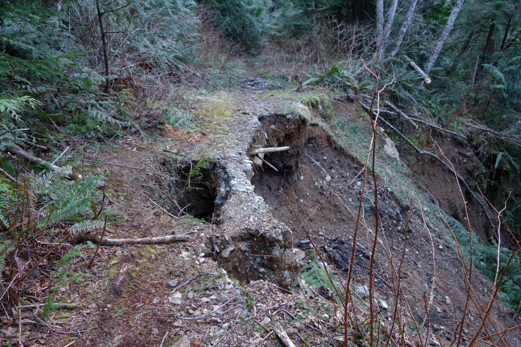
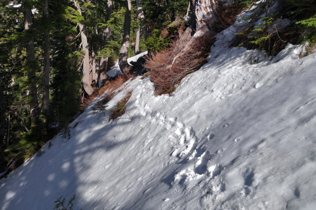
There was more evidence of the destructive, heavy winter rains a little further up the trail, with a landslide area consuming the trail.
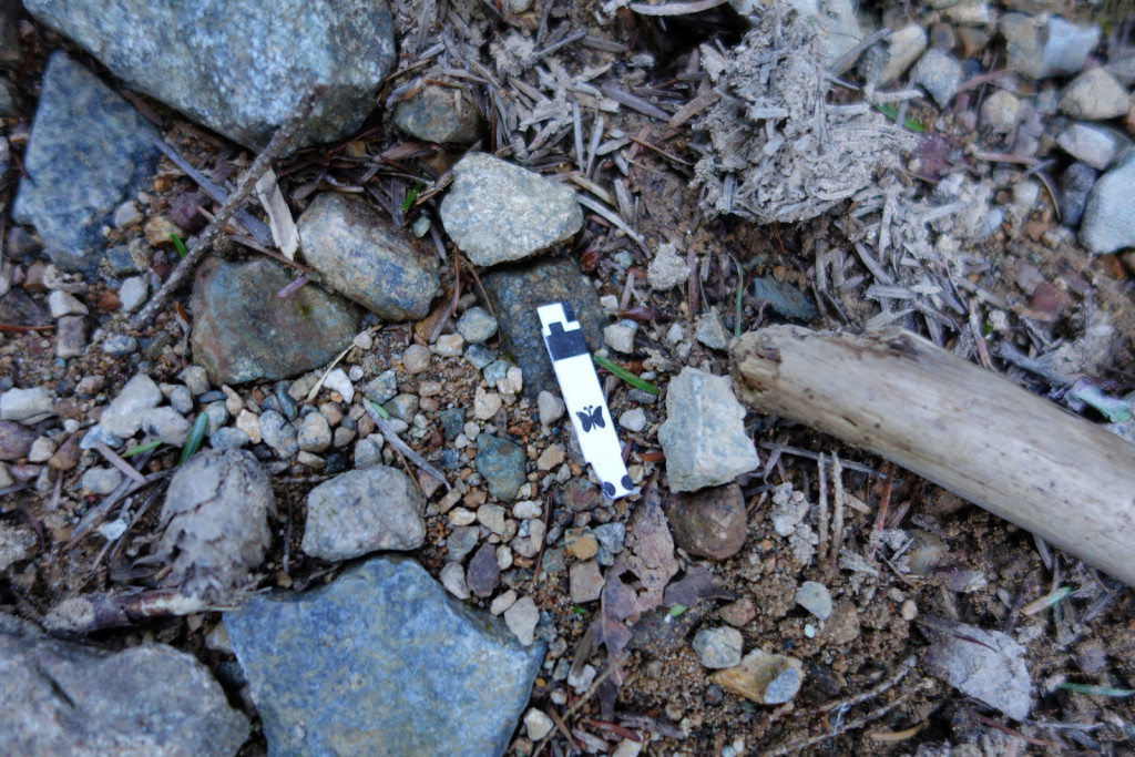
Further along the Brunswick trail, something caught my eye; a blood sugar test strip (that wasn’t mine). I’m always stoked to see evidence of other Type 1s in the outdoors. I see more evidence of type 1s than I do actual type 1s! We tried to assess how long it’s been there and if it was possibly from any of the hikers we met earlier on. I can’t help but think, we are everywhere!
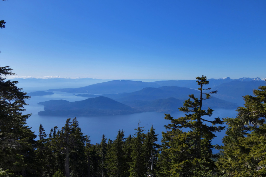
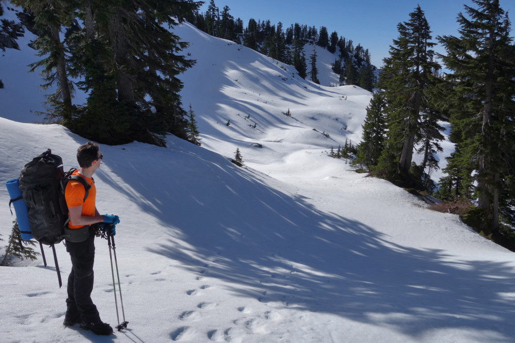
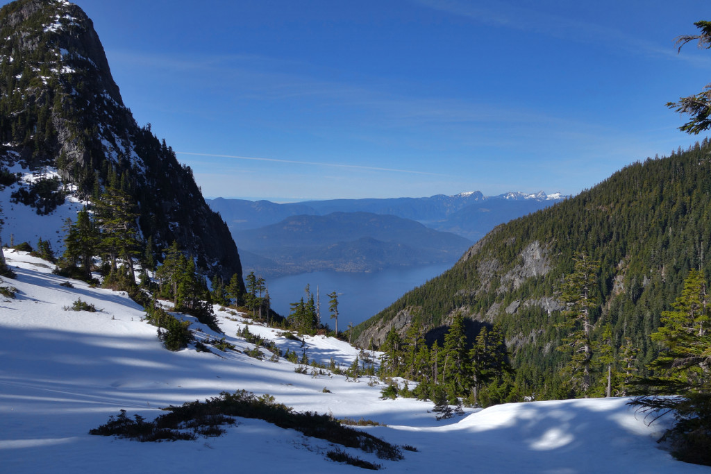
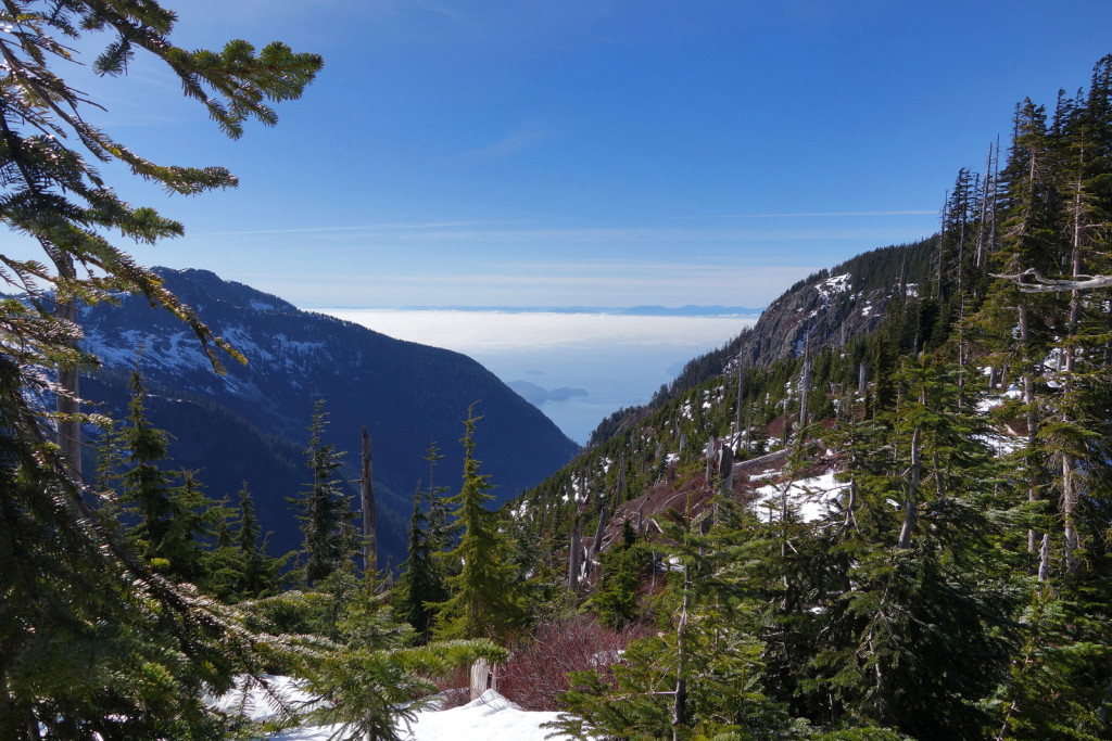
Our next stop was the Howe Sound view point, just before the hard left switchback on to the next stretch of the Brunswick trail. I realized we likely weren’t going to make Hat and we should try for Brunswick before heading over to Magnesia Meadows.
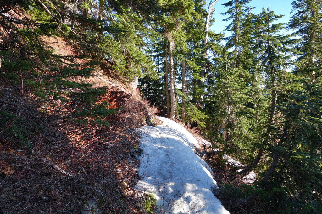
We continued up the steep trail. We found small traces of snow in the forest and well off trail. There was very little snow until the HSCT junction.
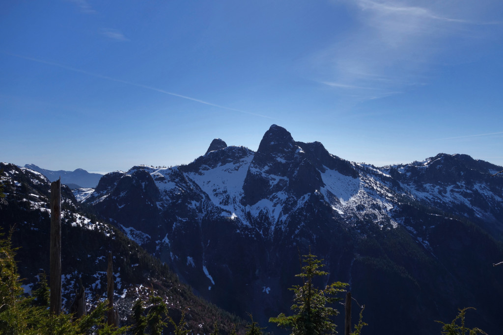
We took another a break just before the HSCT junction. From this point, the snow was consistent on the ridge. We put our crampons on approximately 20-30 metres before the junction. We dropped some weight a short ways in on the HSCT, since the plan was to bag Brunswick and return to the same path. There was no sense in lugging all of our winter camping gear up and down.
Along the Brunswick ridge, we used ice axes to assist with grip in the snow and left our poles with the winter gear. The snow, where people had stepped, was compact and somewhat slippery; the snow off the trail was softer with the heat of the day.
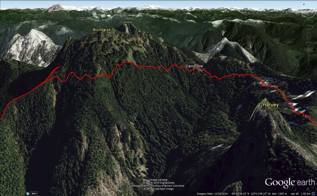
I hit my turn around point next to a pinnacle on the ridge. I stayed while Ryan continued up to check out the conditions. He came back and said it looked sketchy; he was not sure we should continue for the summit, given we still had to hike to Magnesia meadows and set up camp. We met a hiker coming down who confirmed conditions and we decided to turn around and head for the meadows.
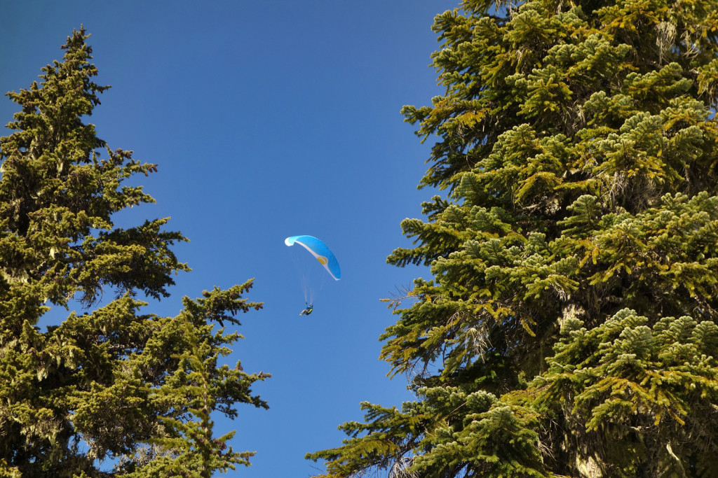
As we made our way down, a paraglider launched off of Brunswick and circled overhead. He had passed us earlier on the way up carrying his heavy pack; we were jealous of his easy way down.
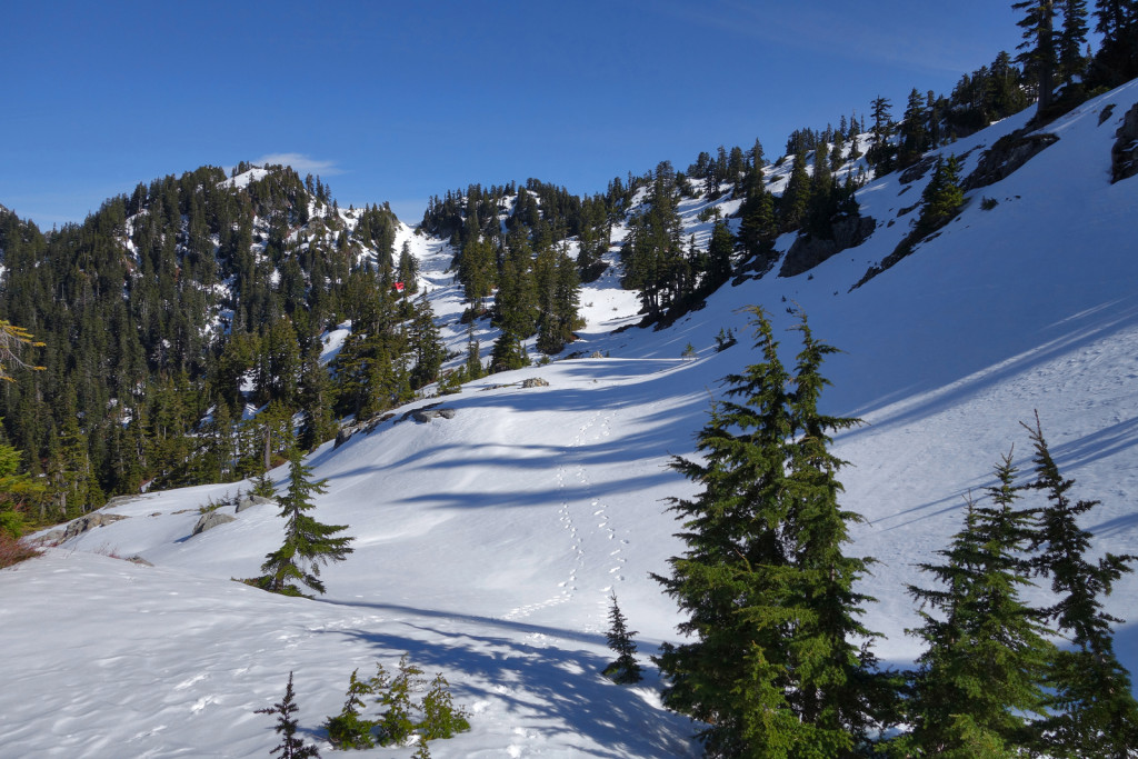
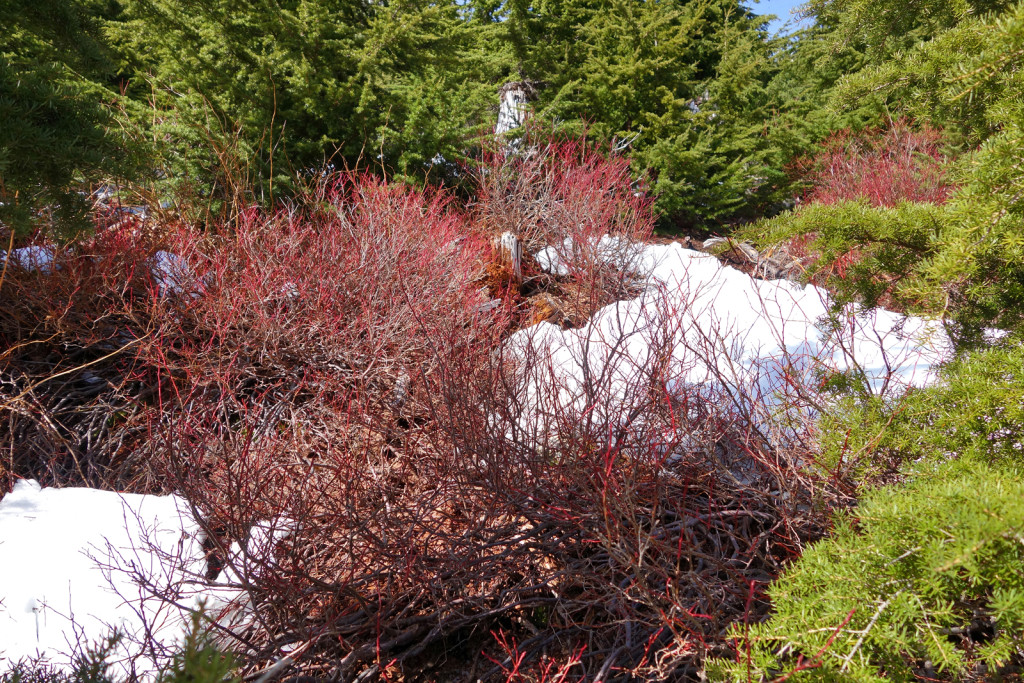
We returned to the HSCT junction, picked up our gear, and continued along the trail; conditions were not at all what we expected. With south-facing slopes, we assumed most of the snow would have been melted off (snow on Brunswick trail had started just before the HSCT junction and we were following the HSCT to Magnesia). This was not the case, we prematurely took our crampons off and ended up putting them back on along the trail. The shade from the trees must have kept the snow lingering longer. The snow was hard/icy, despite it being a bluebird day and temperatures reaching about 13 degrees.
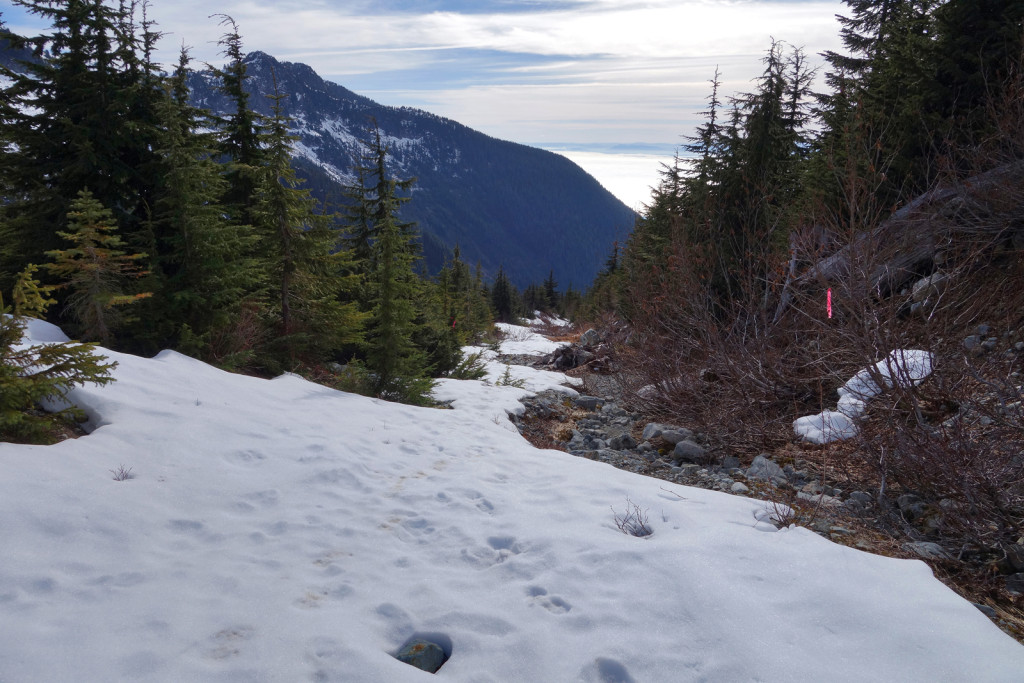
There were atleast 2-3 sets of footprints heading along HSCT from the junction. They were following the marked trail (we could not see the actual trailbed because it was covered in snow, but we could see markers in trees).
We made slow progress along the trail due to hard/icy snow conditions and the need for careful foot placement because the trail traversed steep slopes. There were more ups and downs than I anticipated.
We turned on our headlamps about 2/3 of the way to Magnesia, after the sunset.
As we continued on, we realized the tracks we were following had gone off trail. We lost sight of the markers and the tracks continued down a steep section. I was skeptical to follow because the trail down was steep and we had no way of knowing if it was in the right direction. With only our headlamps for light, it was hard to tell how steep the drop was and whether we would get cliffed out near the bottom.
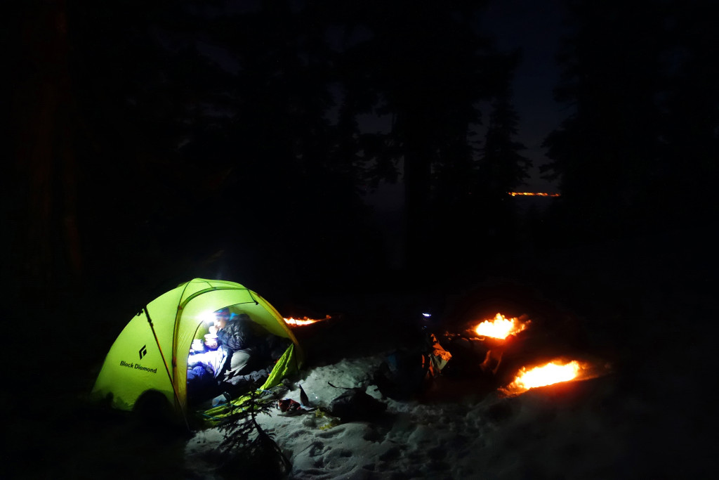
Ryan decided to follow the track to see where it lead. He returned and confirmed it rejoined the marked trail at the bottom of the slope. Once we were back on the trail, we continued along until it swung south and crossed the small creek that drains the south-east corner of Brunswick. Just before the drop into the creek, there was a nice, flat, open area. We decided to set up camp here.
We quickly put up the tent, set up a few candles to light the area, melted snow with the stove, and made ourselves dinner: buffalo pemmican, Mr. Noodles, and freeze-dried spaghetti and meat sauce (our new backcountry favourite by Mountain House). We stored our food and wrappers in ziplocks which were placed in a dry bag. We hung this in a tree down-wind of camp; our concern was rodents, not bears which were likely still hibernating.
We had mild temperatures for the night, hovering at 0 degrees Celsius. In terms of winter-camping, we each used a Thermarest with high R value to insulate us from the snow. We unpacked our sleeping bags from their compression sacks and allowed enough time to let them loft up before we crawled in. I used a Mountain Hardwear Switch 20 sleeping bag with a -7 degrees Celsius temperature rating and found it to be very comfortable. Once camp was set up, we changed out of our hiking clothes and into warmer layers. My layers included:
- Smart wool long sleeve shirt
- Fleece sweater
- Down sweater
- Down jacket
- Smart wool long johns
- Fleece pants
- Extra thick wool socks
- Toque
- Extra warm mitts
Just before turning in for the night, we boiled some extra water to make a hot water bottle using a Nalgene. We also opened 2 pairs of chemical hand warmers to put in our socks and boots to ensure warm toes and warm boots in the morning. We made sure the ventilation windows of our single wall tent were wide open to reduce condensation. As a result of all of our preparation, we slept comfortably through the night.
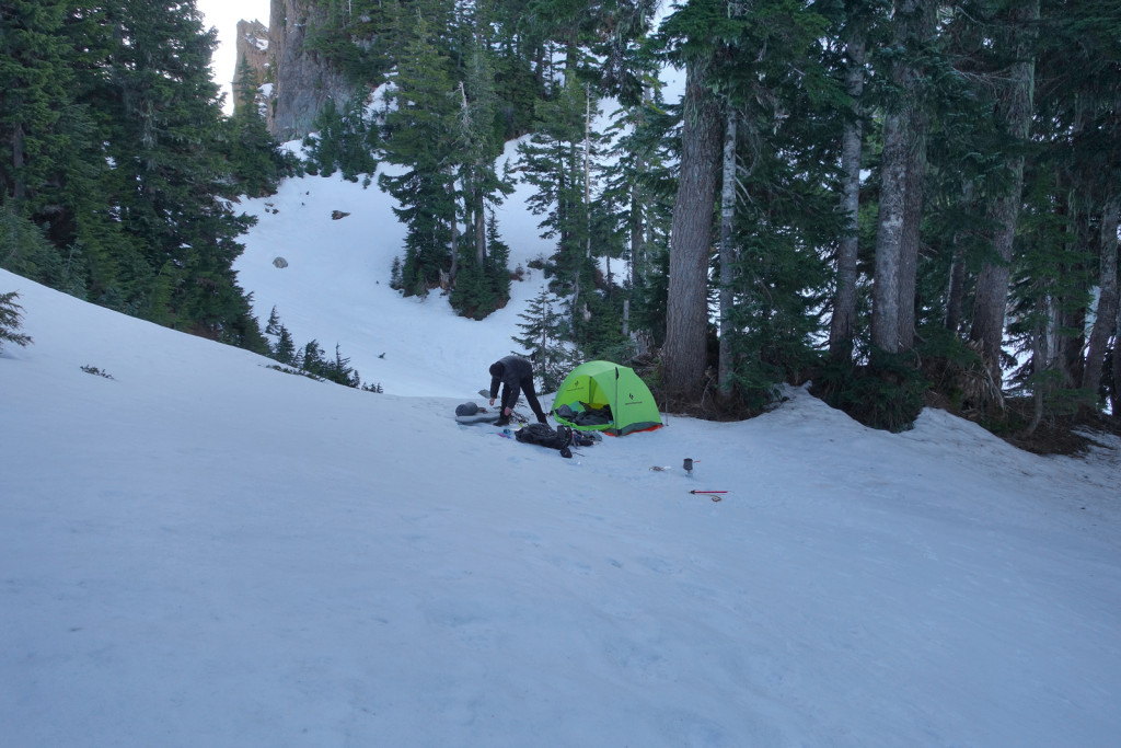
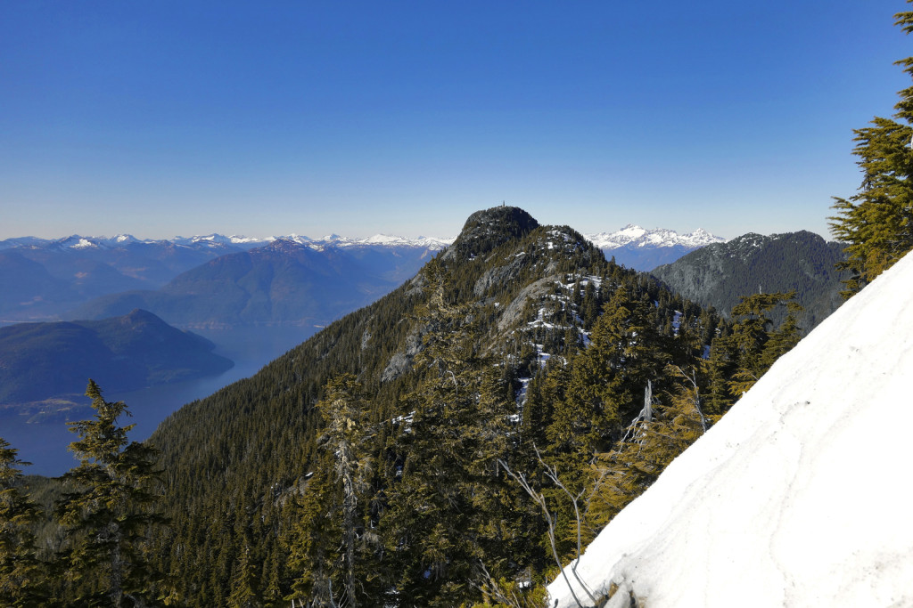
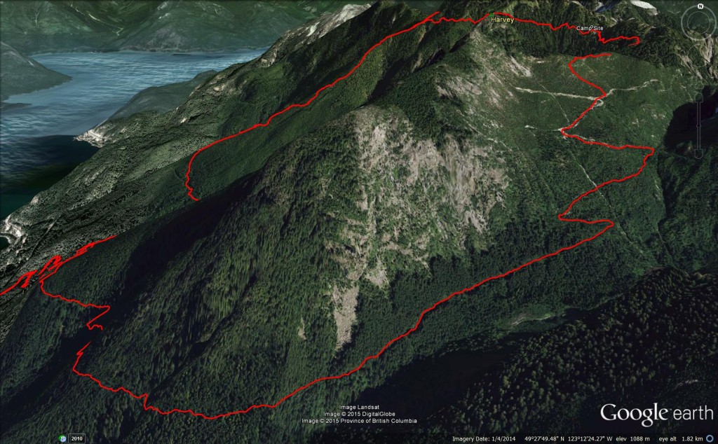
The next morning, we decided to hike out via the old logging road in the Harvey basin, an area that had been logged many decades ago. We had originally wanted to hike up and over Mt. Harvey (via the east face) to get back to the car, but neither of us were feeling up to it with heavy packs and decided to make a loop around Harvey instead.
To get to Magnesia Meadows, we had to traverse a series of steep, snow covered slopes in the trees. I was uncomfortable with the exposure because a slip would have resulted in a long slide and potential injuries. Ryan made sure to kick good steps and helped me on the crux sections. We both wore our crampons, which provided good grip in the crusty snow.
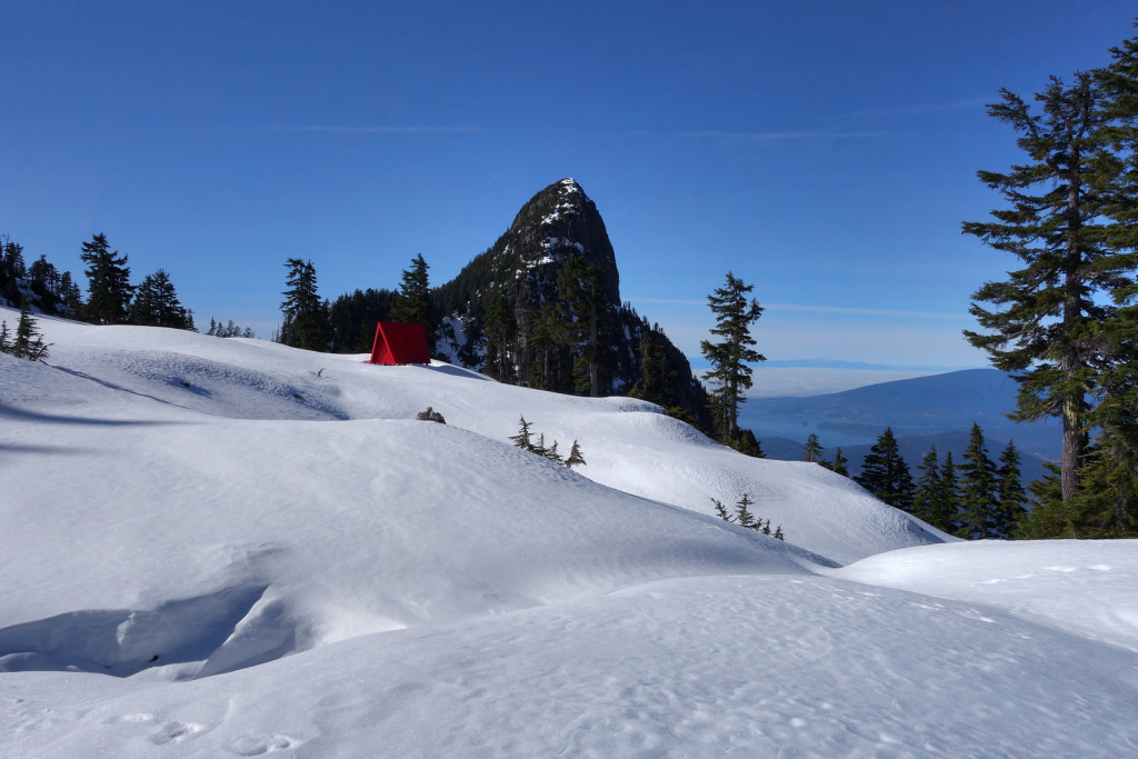
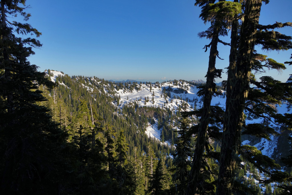
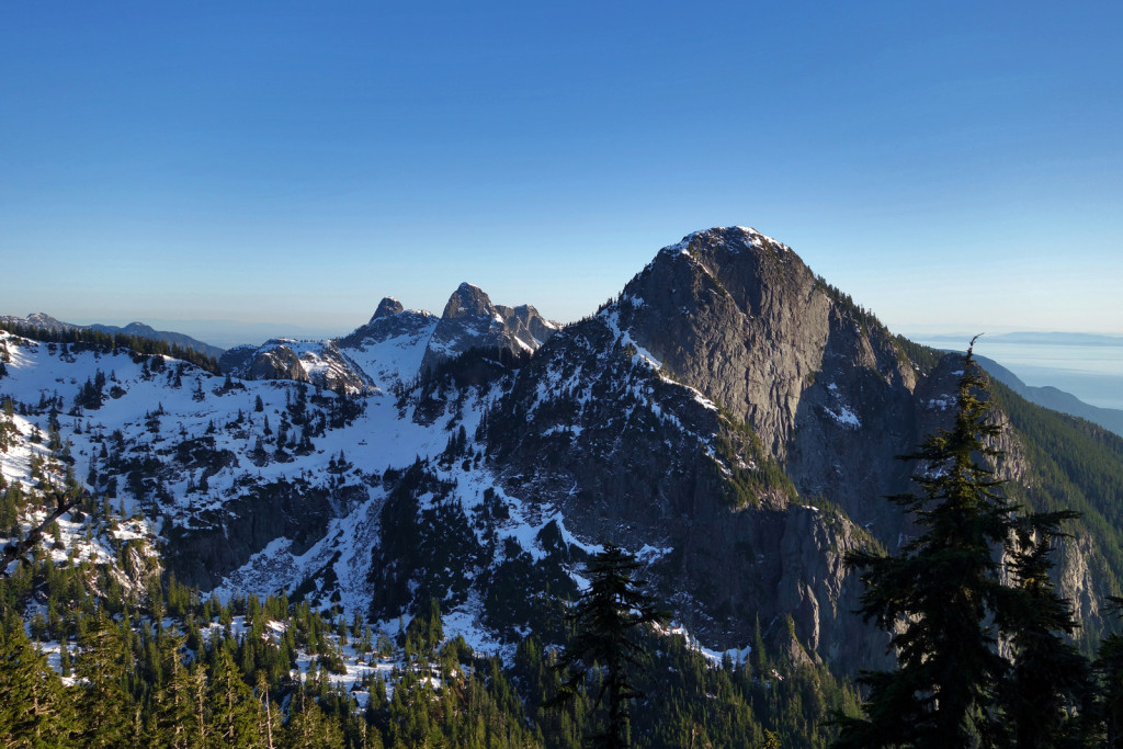
Soon, we emerged out of the trees and into the meadows themselves. The bright red Emergency Shelter stood out in the blanket of snow. The views of Mt. Harvey, the surrounding slopes, and Howe Sound were absolutely beautiful. There was a little less than a meter of snow – more than we had encountered elsewhere on the trail, but still far less than the typical amount in the area for this time of year (based on previous trip reports).
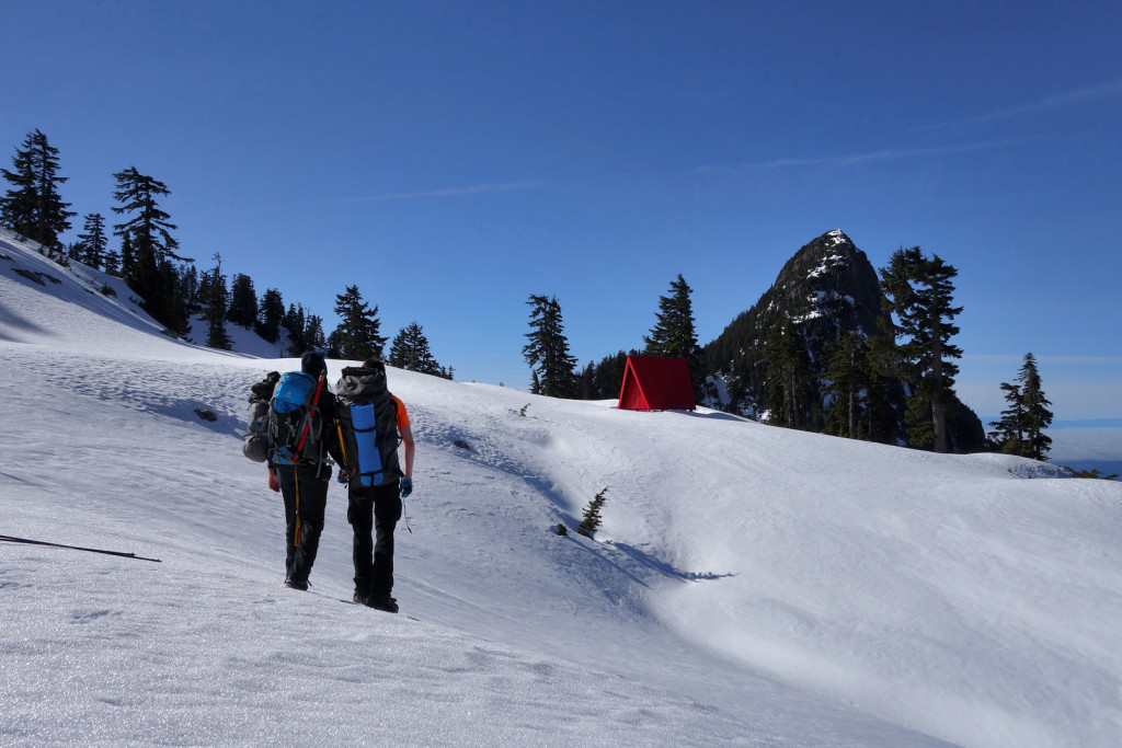
We made our way over to the Emergency Shelter for a food/water break and to sign the guest book. Based on the guestbook entries, this area of the HSCT does not get a lot of traffic; the last entry was from October, 2014. We enjoyed the warmth of the sun and after a quick break, continued south towards the Harvey basin.
We assumed conditions for the basin would be similar to the south side of Brunswick and what we had seen in Magnesia Meadows – mostly snow covered, allowing for quick travel down to the logging road. Unfortunately, this was not the case.
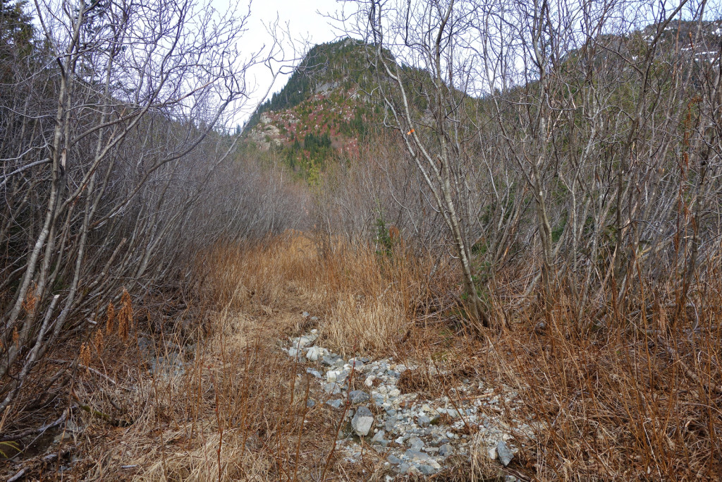
There was surprisingly little snow in the basin, which required us to thrash our way down through thick stands of conifer, bush, and occasional devils club through the regenerating cut block. Occasional snow patches allowed for short stretches of butt-sliding, but we had a slow overall pace of approx. 0.5km/hour, as we picked our way through the path of least prickly resistance. The old logging road was marked on our GPS; we were able to aim ourselves to intersect it in the shortest possible distance.
We reached the road fairly high up in the basin. While the road has long since been deactivated, it was still quite open along this stretch. The road bed was rocky and eroded from runoff. Still, compared to the bushwhack we had descended, it was like a highway. We followed the old road as it switchbacked down the basin. Further down, it became more overgrown with alder encroaching from the sides. There had definitely been some trail work done in the last few years, as the larger alder trees were cut back to allow for a decent singletrack path. Occasional flagging marked where this path ducked and weaved back and forth on the either side of the road; we were easily able to follow where we needed to go.
Eventually, the road opened up more and we soon reached the junction where the Lions (Binkert) trail joined the road. From here down, we were on familiar ground. We made good time past the Harvey turnoff and back down to the Brunswick junction, where we had left the road the previous day. By then, the sun was setting and we broke out the headlamps for the remaining 20 minutes back down to the car.
Diabetes Management:
My blood sugars were stable all weekend. I kept up my regular routine of reducing my basal to 50% and consistently eating every 45-60 minutes. I did not take the time to waypoint all blood sugar entries and snacks along the trip because we were focused on covering as much ground as possible, quickly.
I kept my basal reduced overnight to 70%; this was to make sure I did not crash during the night and to keep my blood sugars stable for the next day during our hike out. This was a great idea because I woke up with normal blood sugars and remained steady the rest of the day.
Post Script:
My first winter camp is an experience I’ll never forget. I’m stoked to check out the 29km Howe Sound Crest Trail in the summer months, in fact, I’m already planning a camping trip.
Stats for the weekend:
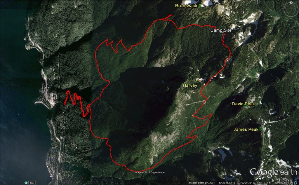
Google Earth Birdseye View of Route
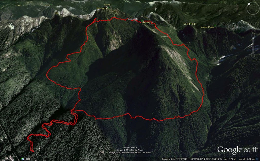
Google Earth 3D View of Route
Google Earth 3D Brunswick Trail
Google Earth 3D HSCT – Magnesia Meadows
Google Earth 3D Harvey Basin
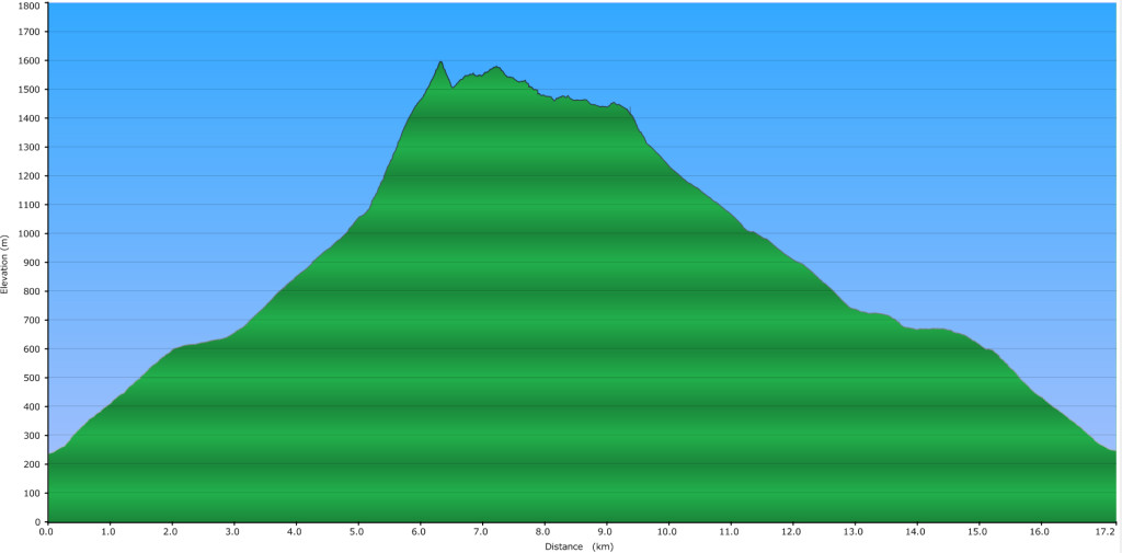
Elevation Profile
Total Distance: 17.2km
Cumulative Elevation Gain: 2172m
– Ash
We’ll have to see if we recognize each other when we cross paths 🙂 Thanks for the kind words – I’d like to be able to write more, but time just doesn’t allow it…
Wow – that shot of Magnesia Creek is something else! Another great report and photos – we’re also looking at trying to fit in the HSCT this summer.
Andy, thanks for reading! I visited your blog, great posts. Looks like we venture in similar areas. Keep us posted when you head out this summer :).