Ashika Morasiewicz
Outdoor Adventurer from the North Shore, BC
Lake La Mare | Burkholder Lake | South Chilcotin, BC
Date: April 2-5, 2015
Trip Report: We spent Easter long weekend in the South Chilcotin. We visited Lake Lamare, Burkeholder Lake, and explored the Yalakom Valley.
When the Easter long weekend was coming up, we were eager to get away and spend a night or two in the mountains. We decided our local mountains weren’t quite what we wanted this weekend, we wanted to get out a bit further. After some brainstorming, the South Chilcotin came to mind; specifically the Bridge River and Yalakom valleys.
We reached out to several Bridge River and Lillooet locals/companies for snowline updates.
Bridge River Valley Updates:
- TLH Heliskiing advised the Taylor Basin road is snow-covered in the east and west valley.
- Tyax Adventures advised Marshall Creek road was ploughed to the lake as of December, due to recent logging.
- A local advised the ice had just come off of Marshall lake and the alpine still has quite a bit of snow.
New Update on Motorized Vehicles:
- http://www2.news.gov.bc.ca/news_releases_2013-2017/2015FLNR0059-000518.htm
- Areas including China Head, 9 Mile Ridge, Red & French Mountains, and Hogback Mountain are now closed to all vehicle traffic.
We decided to get into a new area and explore the Yalakom FSR to scout Summer trips. The plan was to check out a few ridge walks and hike to Burkholder lake.
Thursday, April 2, 2015
We had our bags packed and ready to leave, after work, on Thursday night. We headed north on hwy 99, made a quick stop in Squamish for dinner and continued up the Duffey. We decided to set-up camp at the Cinnamon Rec site, about 20km southwest of Lillooet. We were surprised to see the rec site completely empty. The temperature was very mild and we had a cozy night out.
-

- Cinnamon Rec Site, Duffey Highway
Friday, April 3, 2015
The next morning, we packed up and headed north to Lillooet and the Yalakom FSR. We stopped for fuel at Lightfoot Gas, just outside of Lillooet. They are the only gas station in town with extended hours (7am-11pm) and surprisingly reasonable prices.
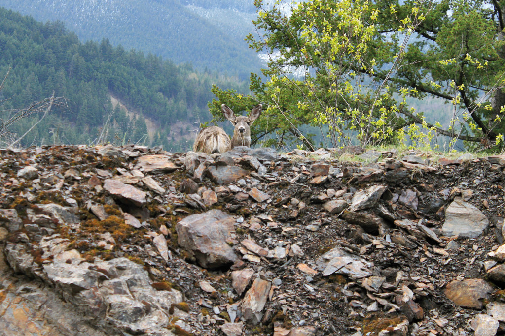
We set off on the Bridge River road (highway 40) and quickly arrived at the Yalakom FSR junction. With the exception of some small rockfall from roadside slopes, the road is more or less 2wd-able.
-
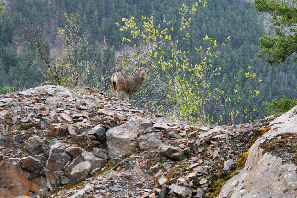
- Deer Along Yalakom FSR

-

- Deer Along Yalakom FSR
After ~8 km, we arrived at the Yalakom Rec Site. Again, we were surprised to find it completely empty with no sight of long weekend campers. We didn’t linger; our goal was to take the Lake La Mare FSR branch to check out the rec site, head back to the main line, and drive up the valley as far as possible. Plans changed when we arrived at the La Mare junction; it was blocked by a backhoe and truck, working to level a steep, loose section of the road. Not knowing how long they would be, we decided to head further up the Yalakom.
We passed a number of spurs, as we continued north up the valley; they seemingly lead to active logging (or other industrial traffic). Snow was scarce, aside from a few small patches along the creek. The road was still in excellent shape, apart from a few places where rocks had fallen from slopes above. After ~25km, we turned into the Beaverdam Rec Site. Once again, it was completely free of any long weekend traffic. We returned to the mainline, crossed the bridge over Beaverdam Creek, and found the Yalakom FSR was blocked by deadfall across the road. Since we were not carrying a chainsaw, this was as far as we went.
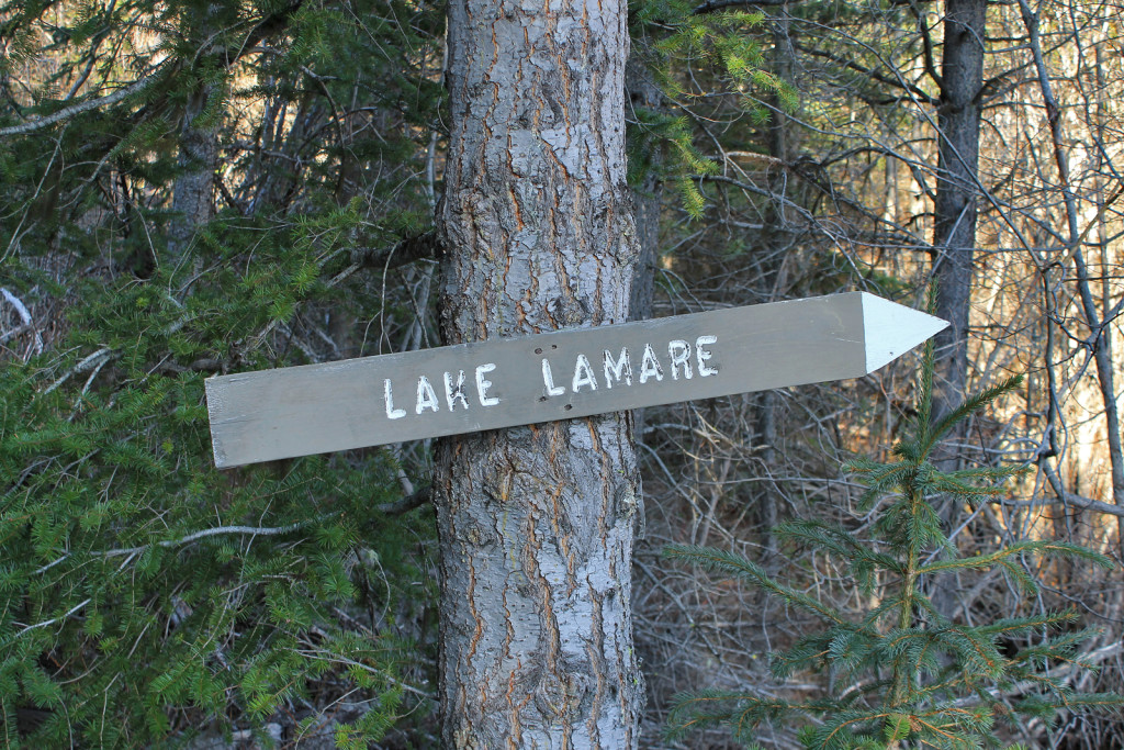
We retraced our steps, back to the La Mare FSR, and found the backhoe was gone and the start of the road was clear and smooth. We drove up, ignoring all minor spurs. At the first major junction, we turned left; at the next two, we turned right (both junctions had signs pointing to Lake La Mare). The road was not nearly as rough as we thought it might be – in fact, the next day, a family driving a 1970’s Peugeot, arrived and spent a few hours looking around.
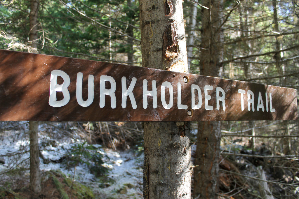
-

- Lake La Mare Sign
-

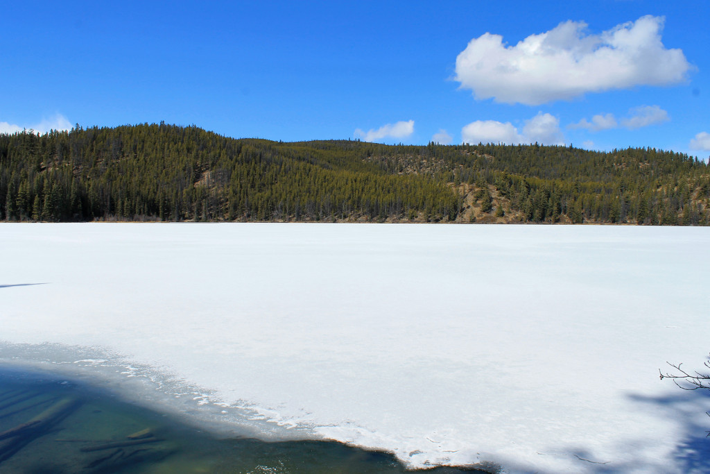
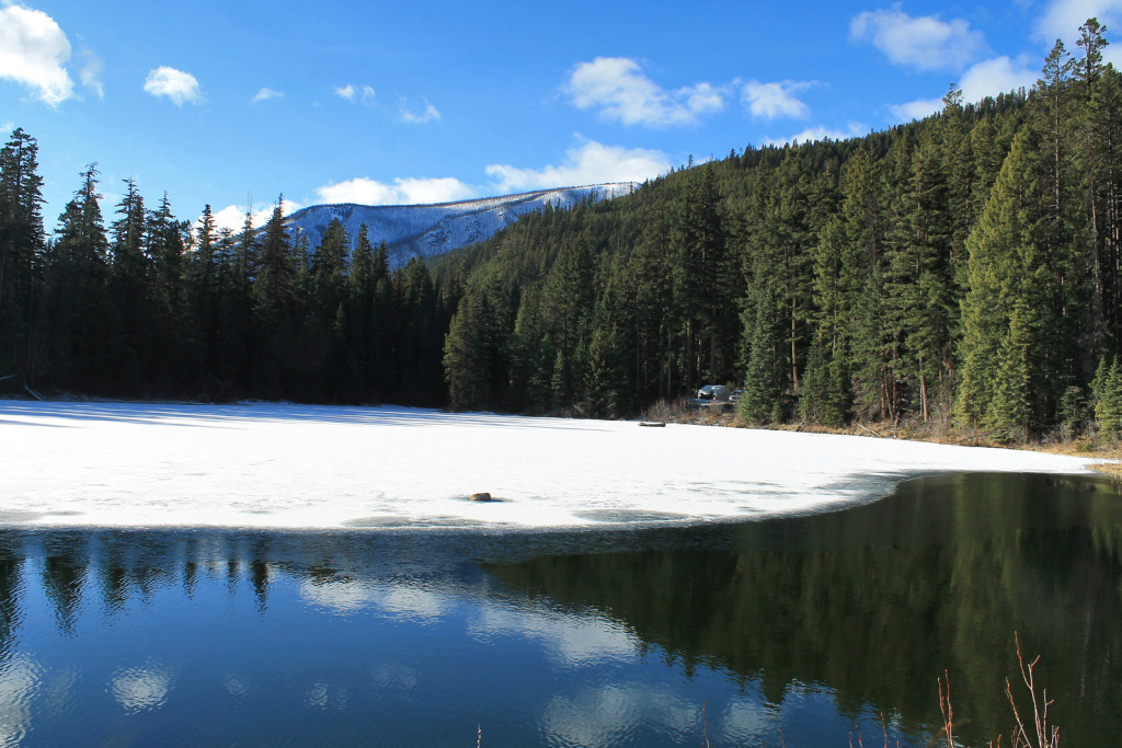
- Lake La Mare
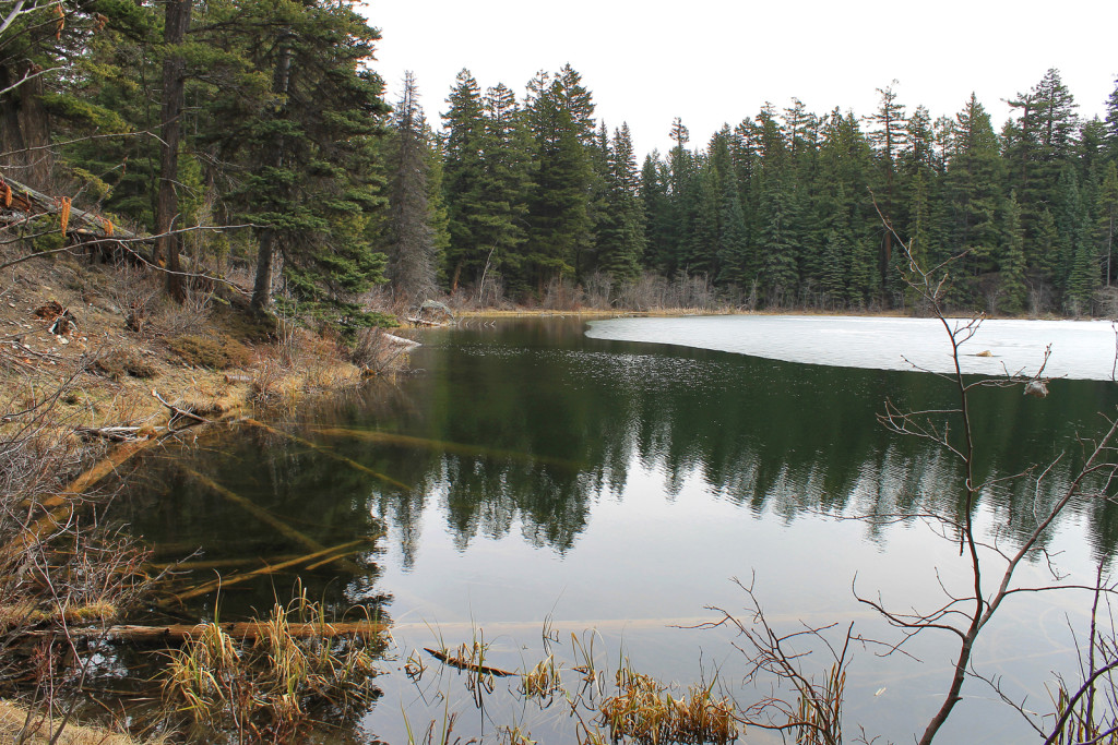
The Lake La Mare Rec Site has three camp sites – one at the start of the lake and two at the far end. We were surprised to see campers settled in at the first site. We drove past and continued on the road around the lake to the far end. The 2 camp sites on our end were unoccupied; we decided on the spot with the best lake view. We quickly set up our XTerra sleep quarters and the rest of our camp.
-

- Lake LaMare Rec Site
-
- Not a Bad Spot to Spend a Night or 2

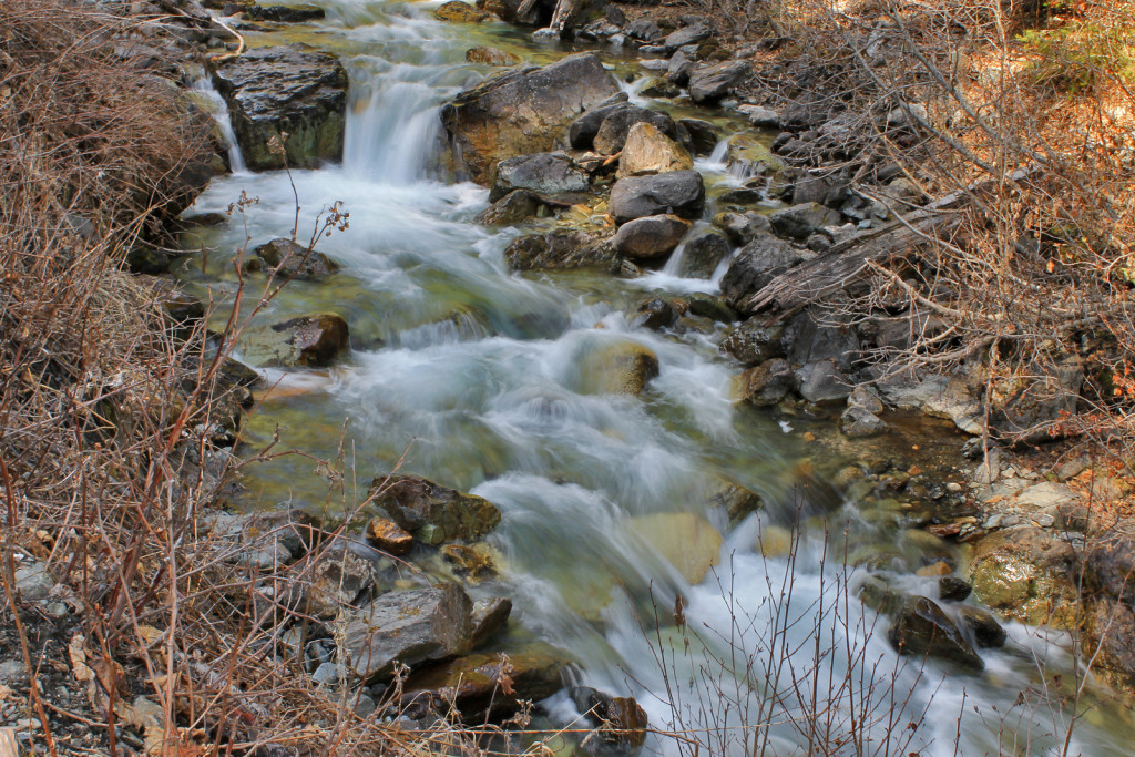
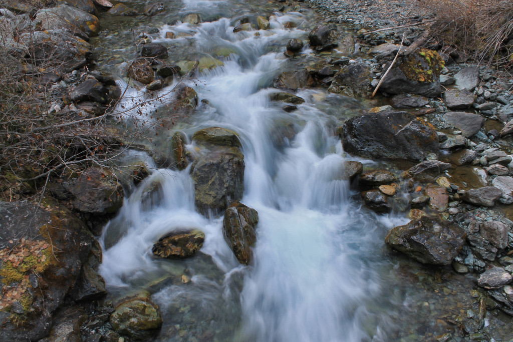
With plenty of daylight left, we took our cameras for a walk and explored our site and the lake shore. We followed a faint trail, looping around the lake. The trail seemed to disappear and we ended up bushwhacking our way through.
-

- Creek Near Lake La Mare
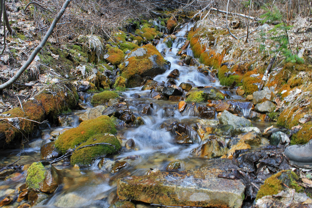
-
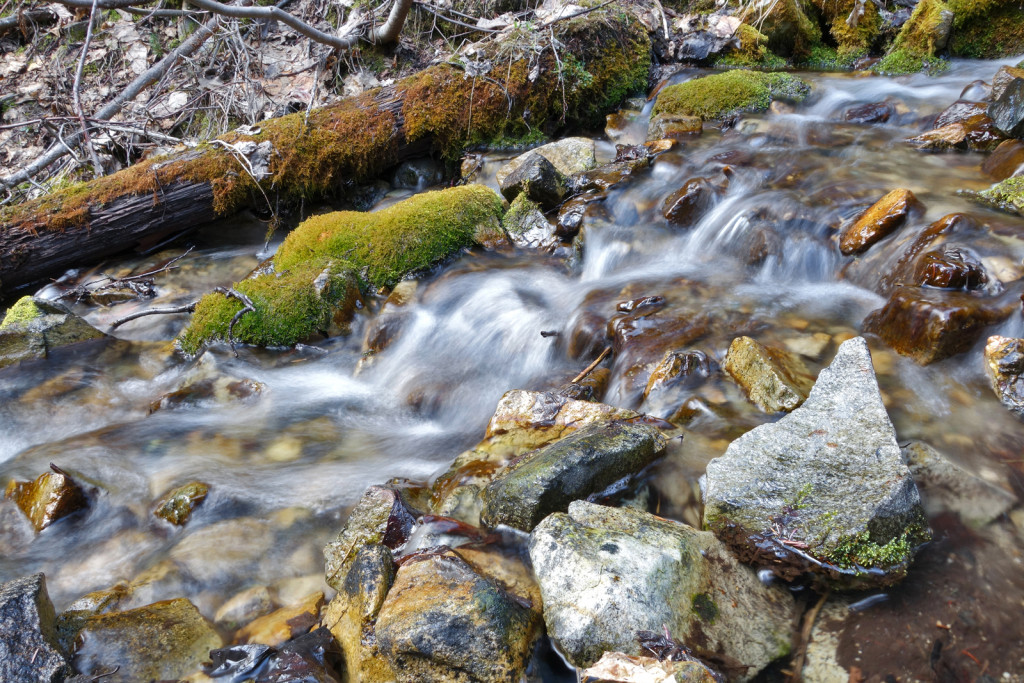
- Creek Near Lake La Mare

Interested in further exploring the area, we jumped back in the truck and poked up the other La Mare FSR branches until we hit the snowline.
-

- Exploring the Lake La Mare Roads
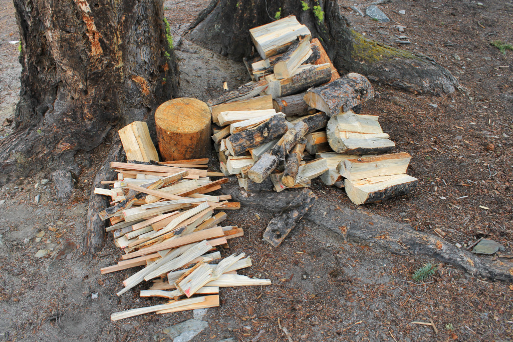
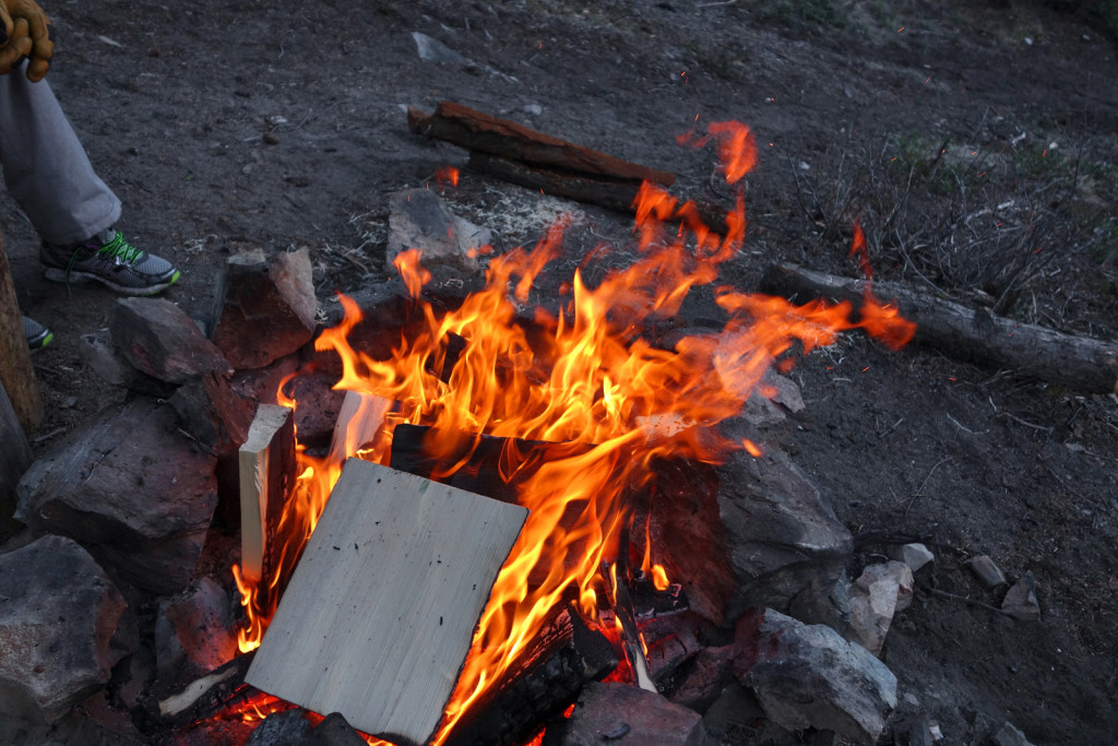
We returned to our site to find our neighbour had dropped off a heaping load of firewood, which Ryan chopped.
-

- Stock For a Cold Night
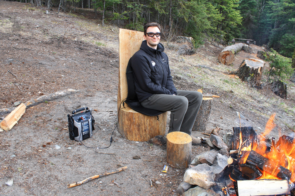
Our site was equipped with an excellent high-backed chair. This gave Ryan the chance to set up an idea he had been wanting to try for some time: heated car seat cover (cigarette lighter-powered) + portable jump-starter/battery pack (with cigarette lighter port) = luxury car-camping.
-
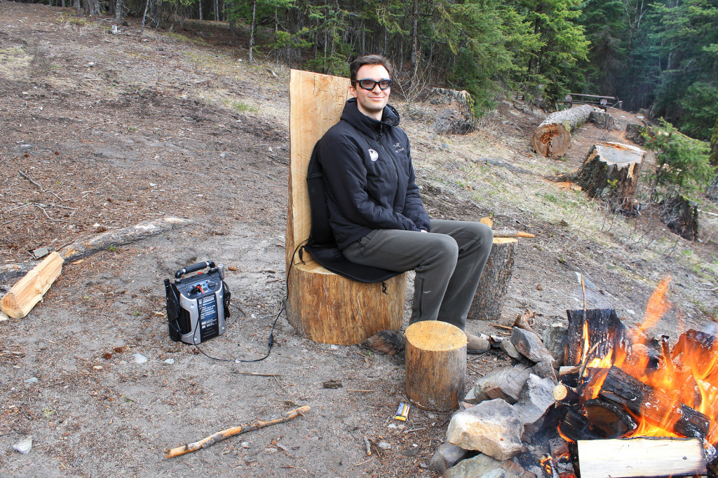
- Ryan on his Throne
We wandered over to our neighbours to say hi and learned he and his wife were locals from Lillooet. They had been coming to Lake La Mare for many years. They also mentioned their spot was the best in the rec site, as the two on our side of the lake were subject to cold wind blowing off the ridges (we had, indeed, noticed the cool breeze when we were setting up camp). With the streak of warm weather, they were hoping to spend some time fishing on the lake. With the lake still frozen over and no auger in sight, they were able to make a small enough opening for a good set-up.
-
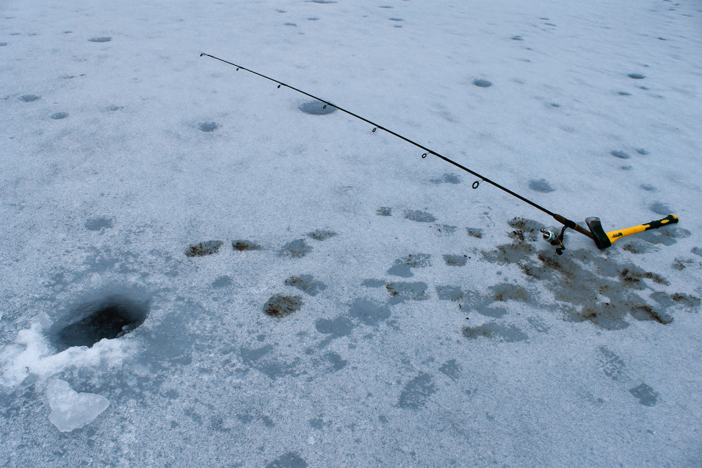
- Icefishing on Lake La Mare

-
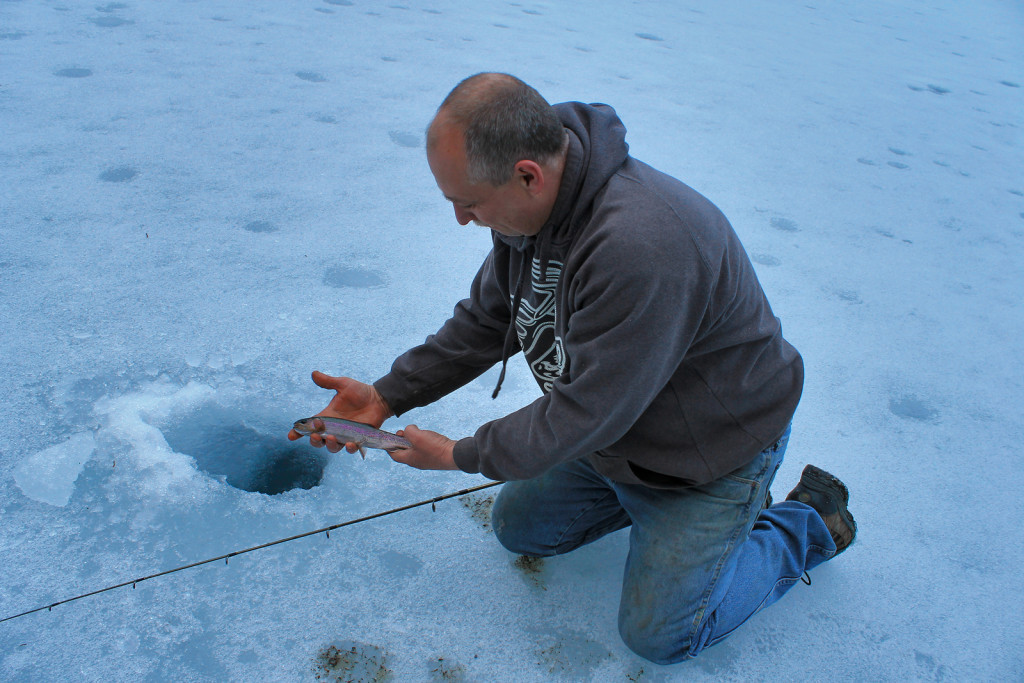
- Icefishing on Lake La Mare

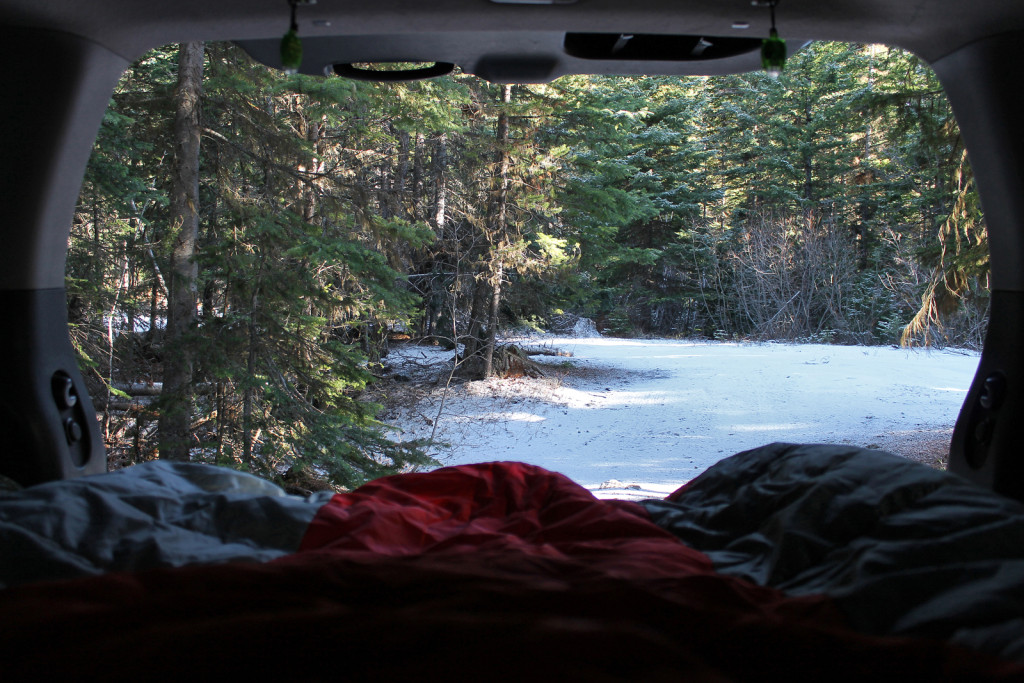
When the sun set, we decided to turn in early and get a good nights sleep. We had recently purchased an inflatable mattress from Canadian Tire and we were eager to try it out in the back of the XTerra, with our double sleeping bag. We figure the temperature dropped down to about -8C, possibly colder with the windchill. Unfortunately, the inflatable mattress did not provide much insulation.
-

- Warming up for the Night
Saturday, April 4, 2015
The next morning we woke up at sunrise to find the ground covered with a light dusting of snow.
-

- Fresh Dusting of Snow in the Morning
We relaxed a bit in the morning and geared up for our hike to Burkholder Lake. Our neighbours had advised there should be at least a foot of snow at the lake and we could assume the trail will not be broken-in; we packed microspikes just in case.
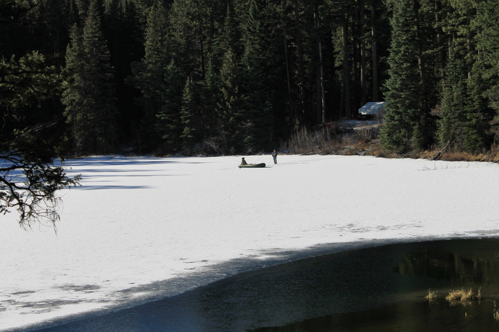
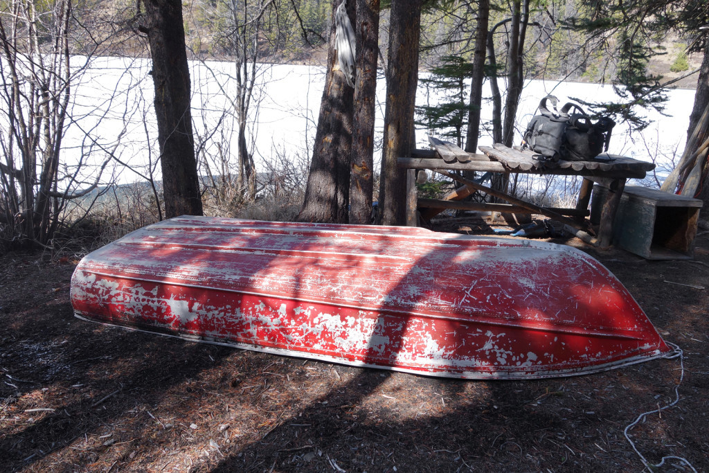
As we were packing, we noticed our neighbours across the lake. They were setting up for a solid day themselves.
-

- Dingy on Lake La Mare
-
- View of Lake La Mare

The trail for Burkholder Lake started halfway along the road that connects the 2 campsites on Lake La Mare. We followed directions from the Canyon to Alpine Guidebook by the Lillooet Naturalist Society.
-

- Burkholder Lake Trailhead
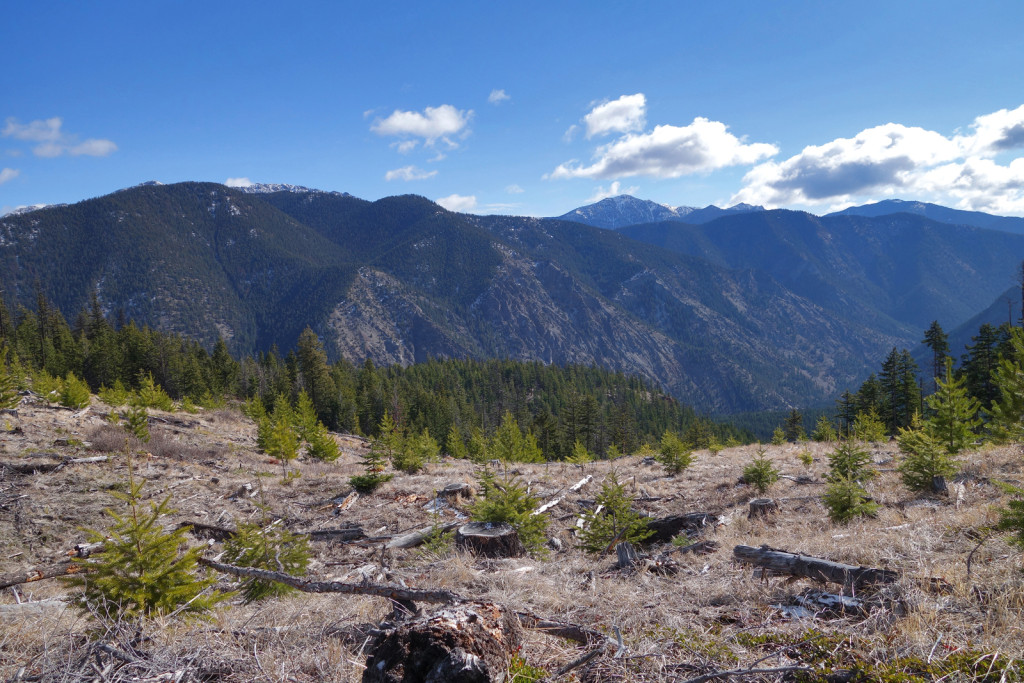
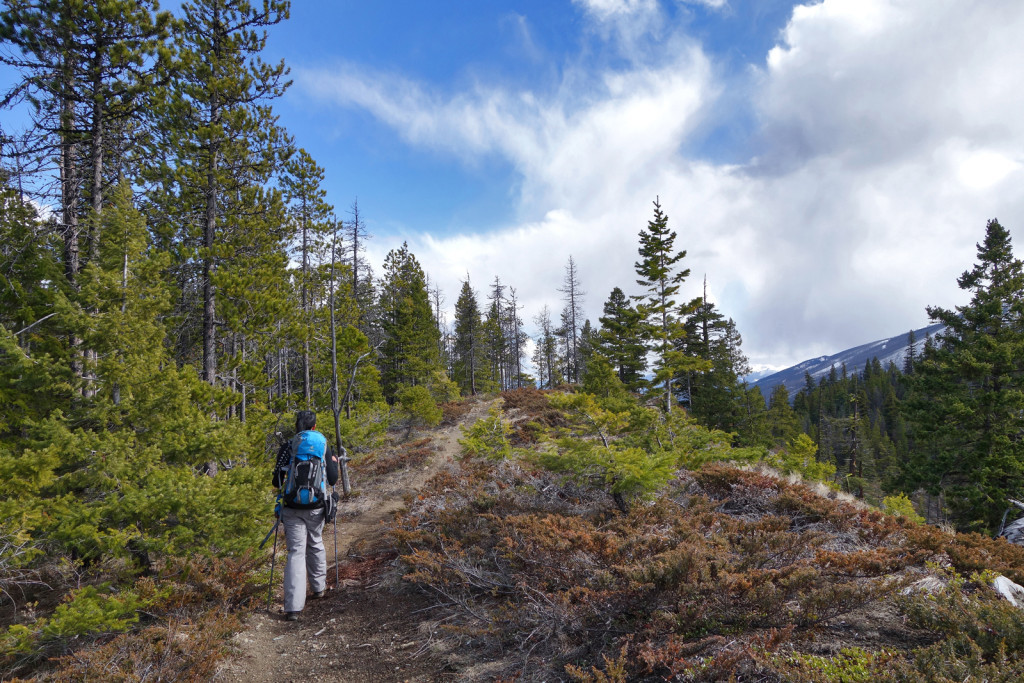
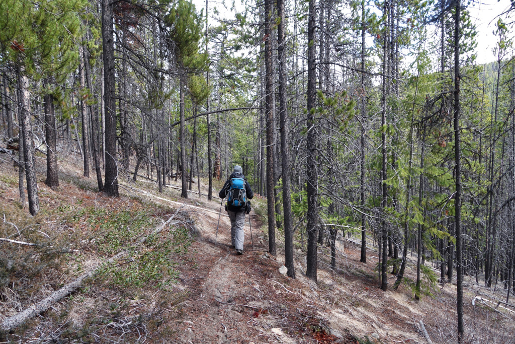
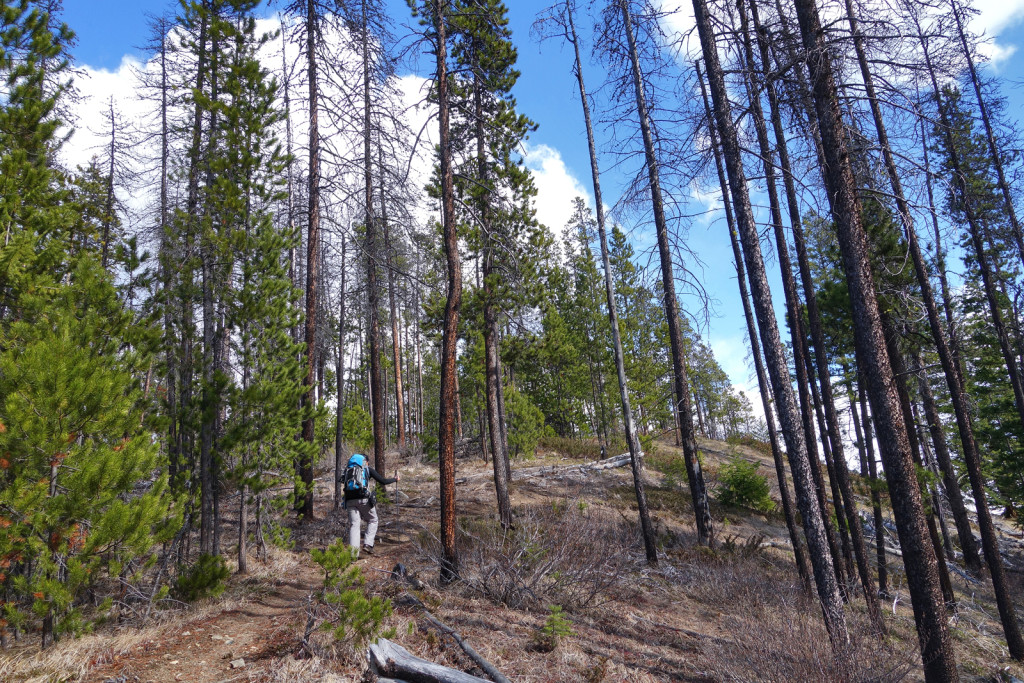
The trail was well-worn and easy to follow. The start of the trail followed steeply uphill, along an old spur road. Initially, the trail skirted around a cutblock which provided views of the Yalakom Valley.
-
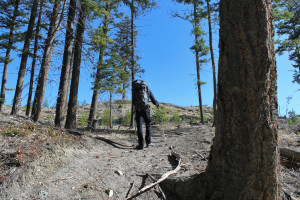
- Ryan Hiking through a Cut Block
-
- View of Yalakom Valley
-

- Cut Block Along the Trail
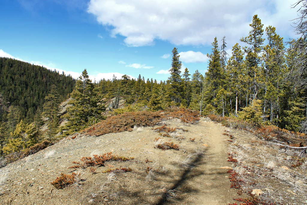
We noticed the trail was surprisingly sandy. This is ash from a massive volcanic eruption from Mount Meager. This massive explosion took place about 2,400 years ago and is known as Canada’s largest volcanic eruption in 10,000 years.
Fun fact: It’s deposit, known as Bridge River Ash, can be found as far as Alberta, 530km from the volcano.
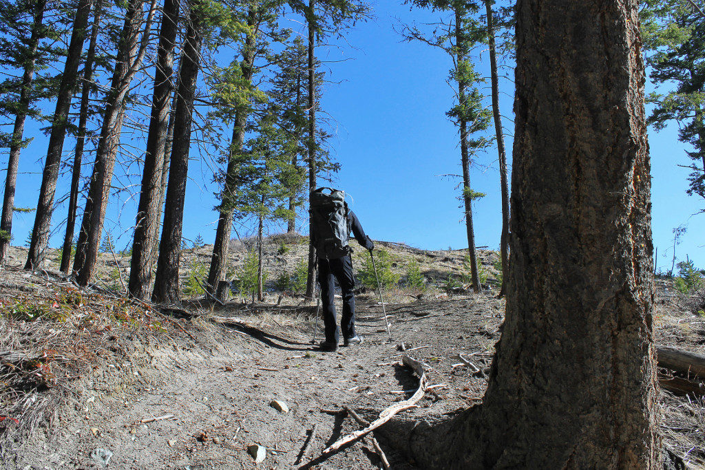
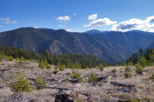
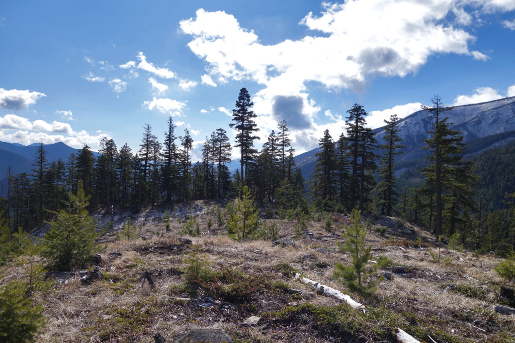
Next, the trail climbed steadily to a ridge with views of the surrounding hills.
-
- View Along the Ridge

-
- Hiking Along the Ridge

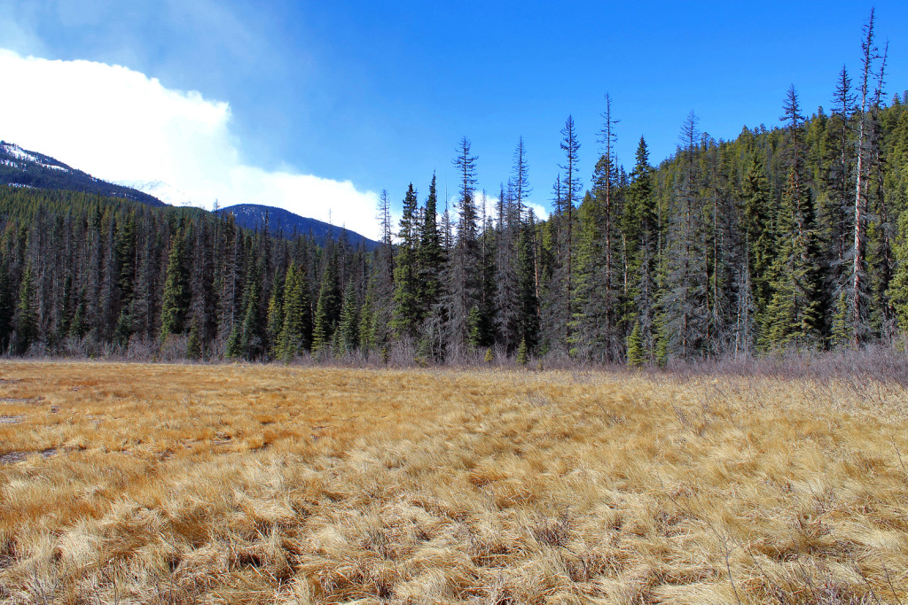
The trail slowly descended off the ridge and continued north through a lodgepole pine forest. After hiking up and down a few small hills, the trail passed above a small pond and dropped to a grassy meadow area.
-
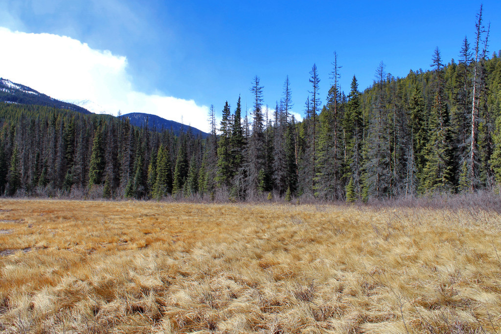
- View of Grassy Meadows
Shortly after the meadows, we reached a bridge crossing over a creek. The access was blocked by deadfall and we could not find a viable way up or down the stream; we thrashed our way through the tree to reach the bridge.
-
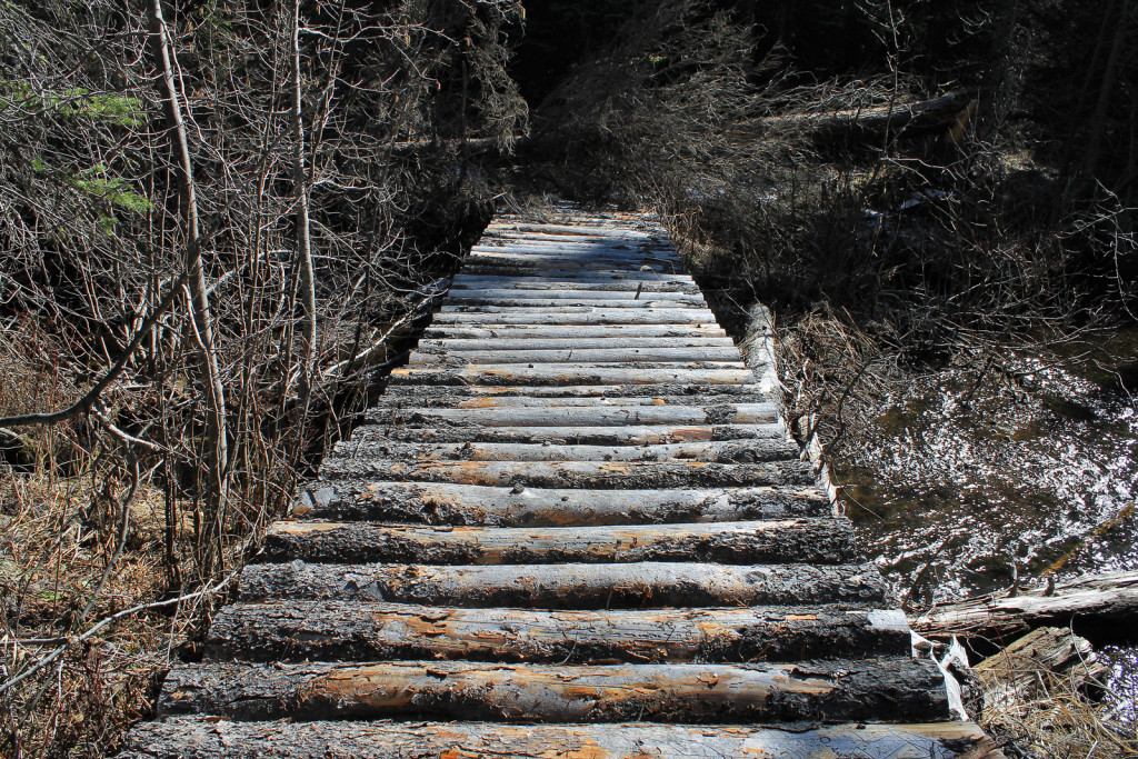
- Bridge Along the Trail

After the creek crossing, we followed a gentle climb along a slope which lead to Burkholder Lake.
-

- Final Stretch to Burkholder Lake
At the lake outlet, we found an old horse camp.
-

- Horse Camp Near the Burkholder Lake Outlet
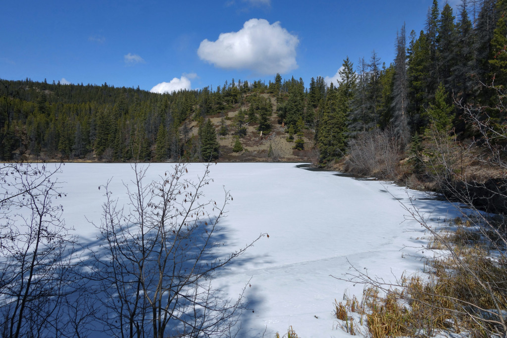
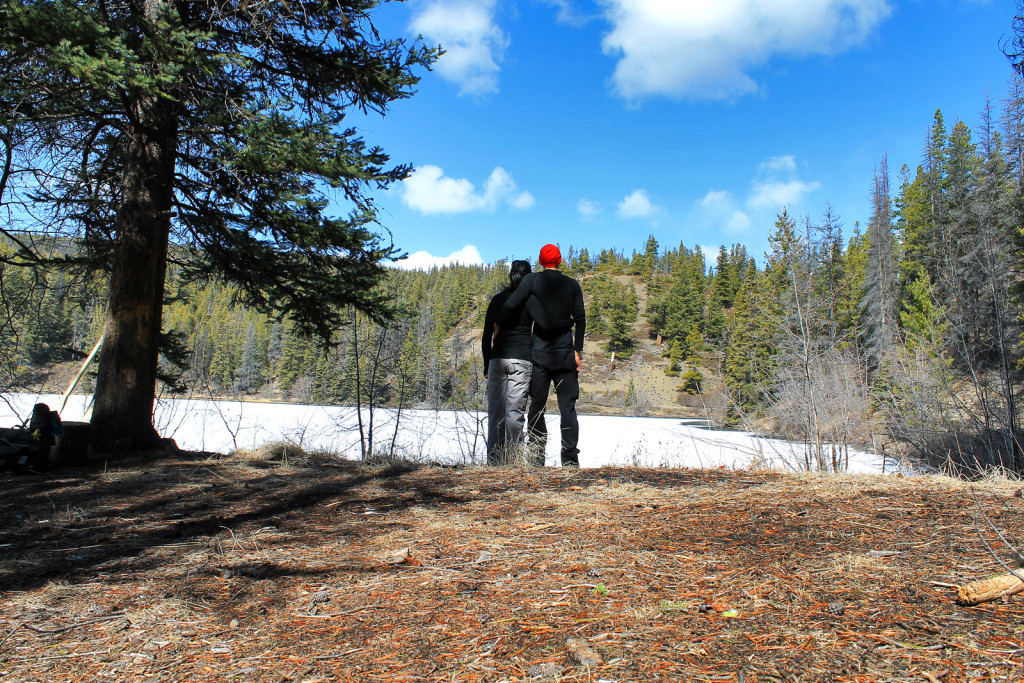
We followed the trail along the south-east side of Burkholder Lake. As we followed the treed shores of the lake, views started to open up. With the exception of 1 or 2 meters at the outlet, the lake was still frozen.
-

- View of Burkholder Lake
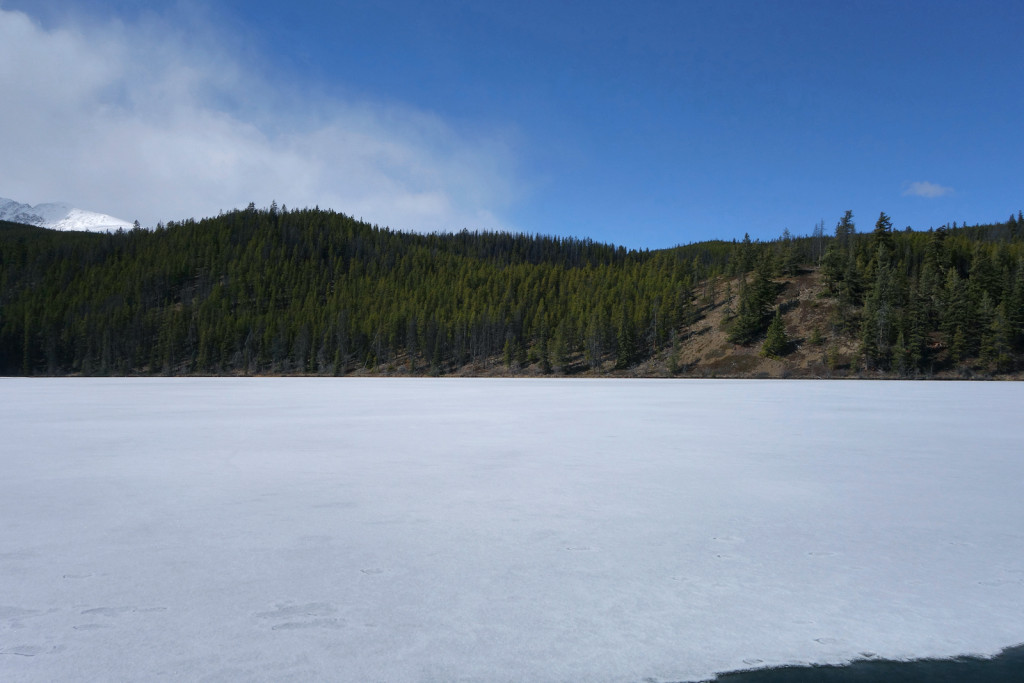
-

- View of Burkholder Lake
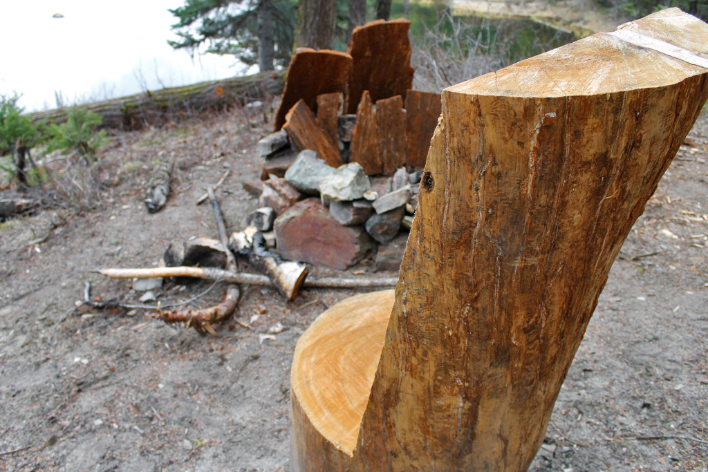
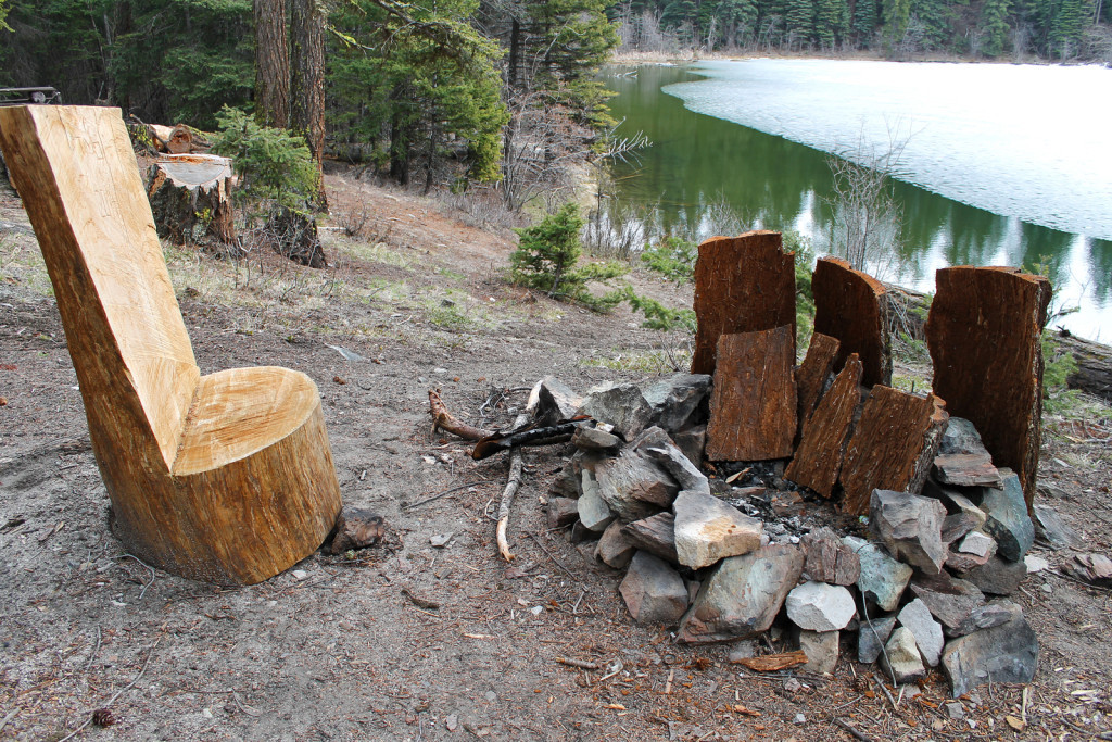
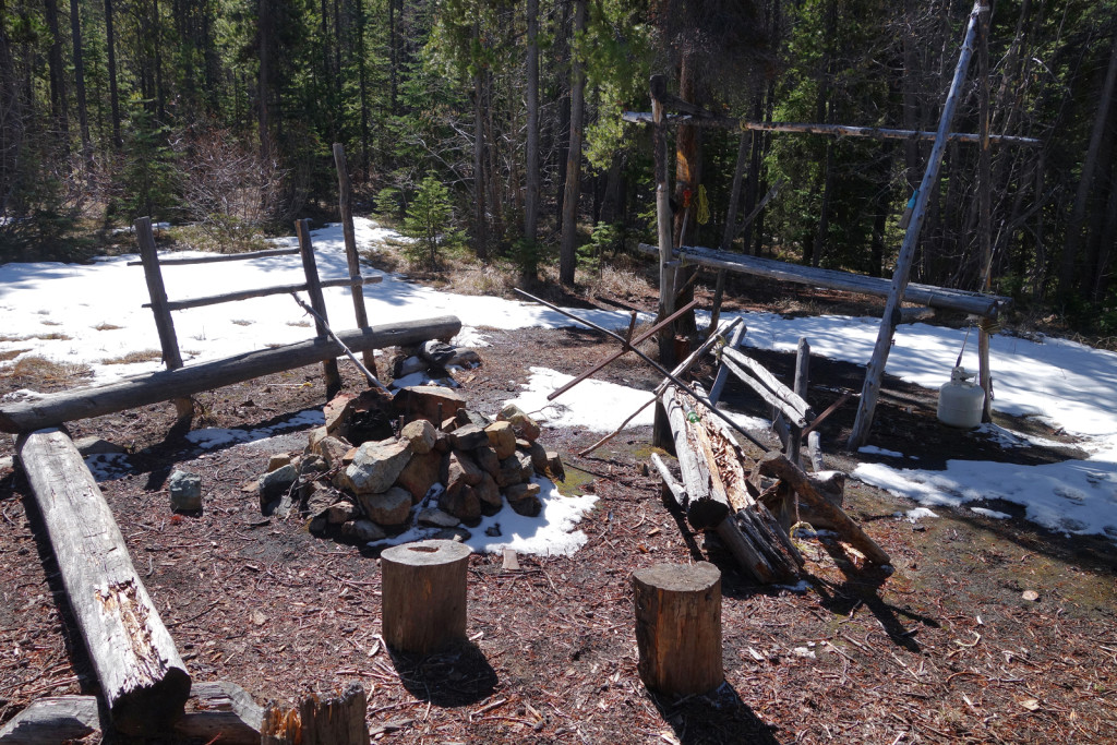
We found a camp site equipped with a rudimentary bench, fire ring, and row boat.
-
- Rowboat on Burkholder Lake Trail

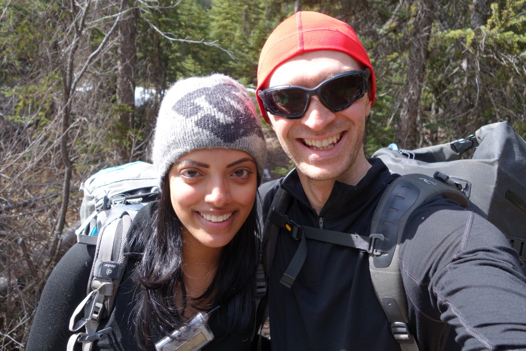
We had a quick snack, continued along the trail and enjoyed the views. After a short break, we made our way back to Lake La Mare.
-
- Ryan and I Looking out on Burkholder Lake

-

- Ryan and I near the Lake
-

- Heading Back Along the Trail
Aside from a few minor patches of snow (a few centimeters worth), we did not see any snow along the trail. This is a relatively easy hike and perfect for the Spring, if you’re looking to get outdoors without hitting snow. We shared a conditions update with our neighbours and they were shocked to hear the trail was snow free and the lake was starting to open – it looks like the melt is atleast 1 month ahead of schedule.
We had lots of time to spare and decided to hang out on the lake.
-
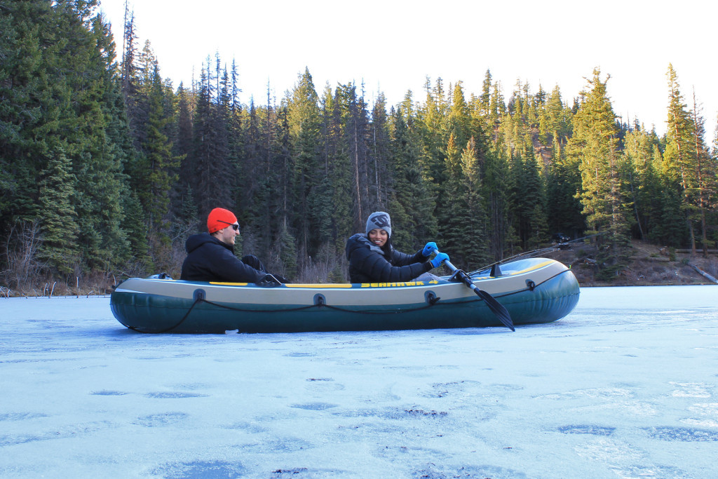
- On Thin Ice!

We spent our last night at the lake and headed back via the Duffey in the morning.
Sunday, April 5, 2015
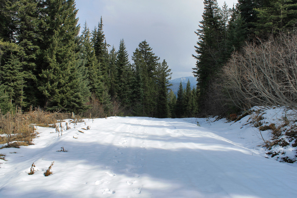
On our way back, we took a bit of a detour up the Downton Creek FSR. We were hoping to get an idea of where the snow line was. Only 4.4km up the road, our path was blocked by an avalanche runout. The snow was icy, ~1.5 meters deep, and a few meters wide. Based on tracks, it looked like an ATV or 2 had made it across. We headed back home from here.
When we arrived back home, I was buzzing with curiosity about the area we just visited. Our neighbour at Lake La Mare referred us to the authors of the Canyon to Alpine Guidebook; he suggested sending an email to gain more hiking recommendations of the area. I thought to contact the authors to see if they knew more about the history of the area. Based on their insight and further research online, I learned the following information:
- Both Lake La Mare and Burkholder lakes were stocked with fish by early miners to provide a source of food to feed their operations.
- The name Burkholder comes from the original homesteaders of the Yalakom Valley. The family settled in the valley some time between 1904 and 1907.
- The trails in the area have a lot of history, but the story varies, depending on who you ask.
- Burkholder lake may have been used as a guiding, hunting trail by locals, dating back to the late 1800s and First Nations before that.
- This may explain the network of old and often disappearing trails throughout the area.
Throughout the long weekend, I realized everything about the outdoors fascinates me. Whether I’m scrambling high above the tree line, taking in views that allow me to see forever, or hiking through a cutblock – along an old spur road built decades ago. I’m constantly intrigued and wanting to learn more.
– Ashi
I just want to say thank you for your suggestion and for the information that you provided. It was amazing and it was like I was with you on the trail.
I would like to post this on our web page and thank you so much for sharing. It is trips like these that some people really enjoy and for people with the desire to find adventure like you to go out and find it. Thank you again!!
Thanks, Beverly! I sent an email in reply.