Ashika Morasiewicz
Outdoor Adventurer from the North Shore, BC
Hike to Blanca Lake, Squamish, BC
Trip Date: October 2, 2016
I was scrolling online, as one does on a Thursday night in attempt to make weekend plans and get a sense of trail conditions paired with inspiration so they might get out somewhere during the upcoming weekend to take a break from the midweek grind, when there it was, a report of a hike to Blanca Lake. The area was new to us, it looked stunning in pictures, so Ryan & I went for it on the following Sunday.
Blanca Lake is located in the Elaho Valley, Squamish, BC. There isn’t a ton of info online so we didn’t know what to expect. Blanca Lake itself was great, but I fell in love with the nearby, smaller tarns. We could have easily spent a full day or two connecting the nearby ridges – we’ll be back for longer trips in the future.
Stats
The Hike
We left Vancouver a little later than anticipated and started our 2.5 hour drive to the trail head. We took the Squamish Valley road to the Squamish mainline to the Elaho mainline. When we arrived at the trail head, there were two trucks already parked in the pullout.


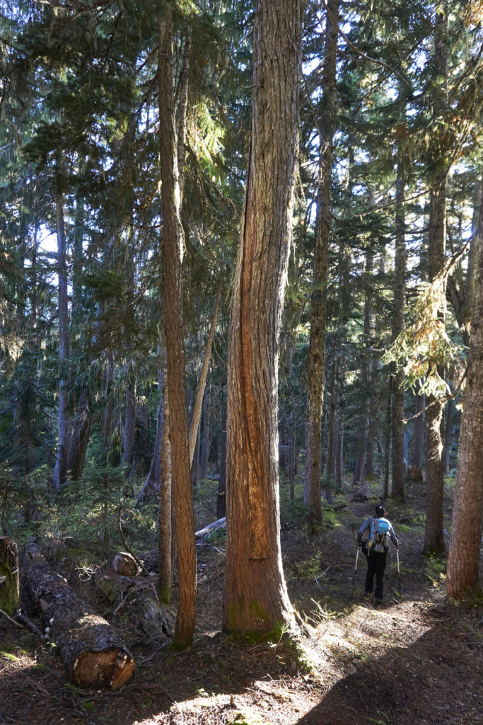
The spur at the pullout was deactivated; we walked to the end of it and picked up the trail. The trail was well maintained with flagging and a very obvious trailbed. We saw copious amounts of flags that may have been marking a new road; our guess is more logging is planned in the area. If so, the first 0.5km or so of the trail may be obliterated by this new road/cutblock, which is too bad because it was a nice walk through the forest.

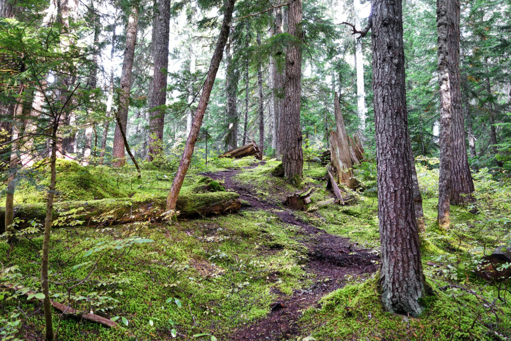
Along the trail we passed some trees that looked like they may have been culturally modified. There were several large trees with long pieces of bark stripped from the trunk; some scars were very prominent, but with our lack of knowledge on reading scars, we couldn’t tell how old or recent they were. After following up with a friend, I learned this is called cedar barking – a seasonal practice of stripping bark for use in cedar weaving. Here is one of several we came across:

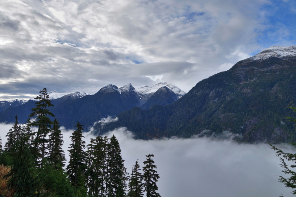
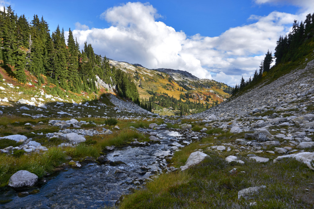
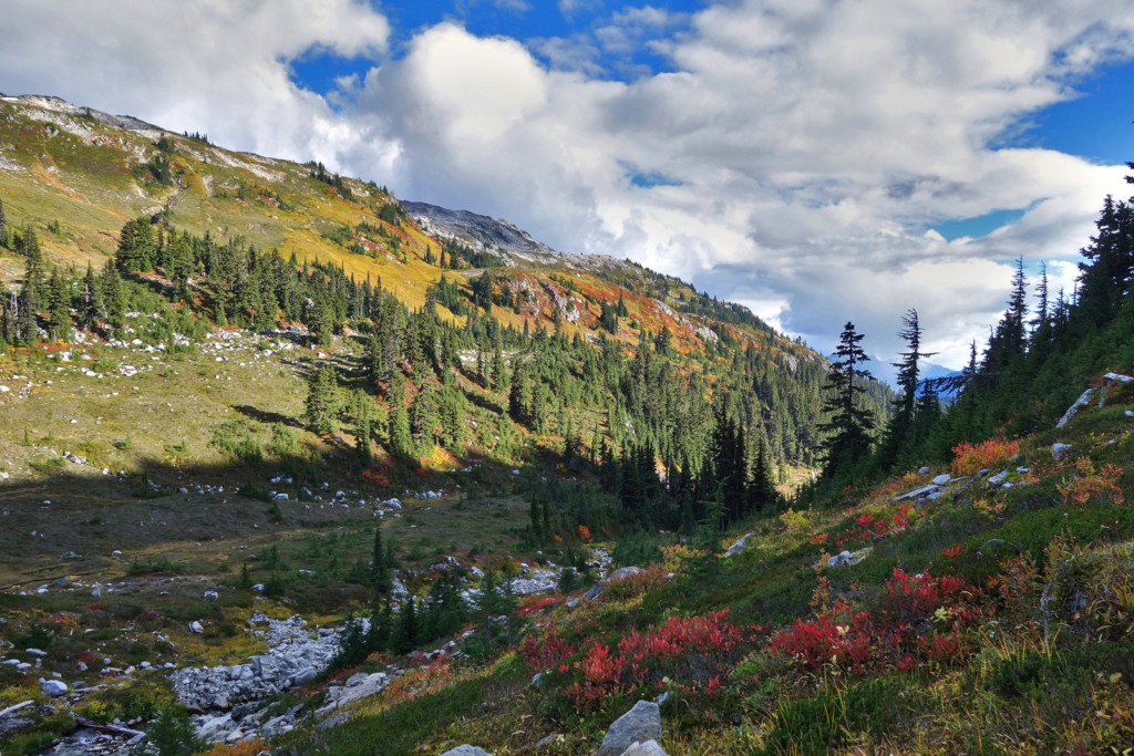
We followed the steep trail and switchbacked our way up to the eastern fork of Blanca Creek. From here, we swung right (uphill) and climbed an old avalanche slope. Once we topped out on the slope, we turned left and followed a bench across a beautiful upper meadow. The fall colours were incredibly rich – our timing couldn’t have been better!


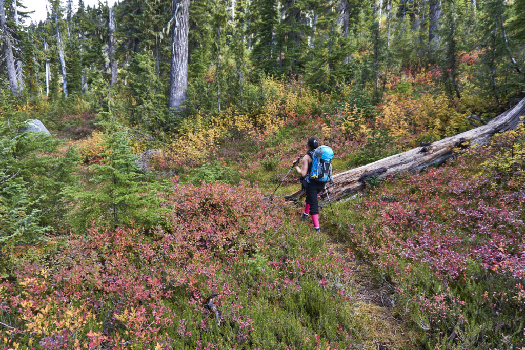
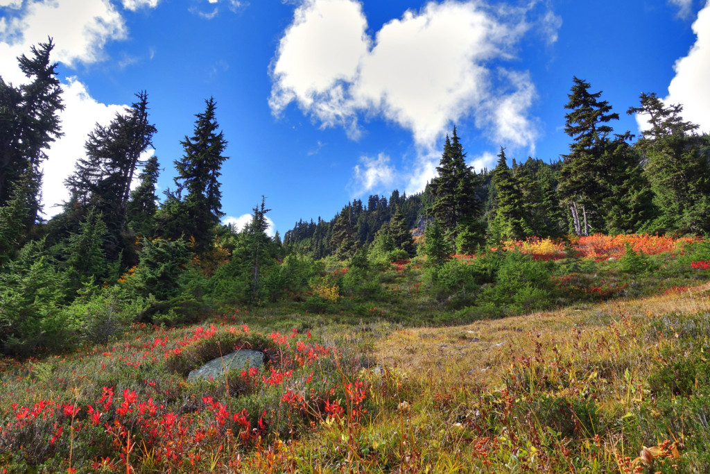
We followed a muddy slope cross a small streamlet and down into a larger meadow. We traversed across these meadows and rock hopped across Blanca Lake’s outflow. Following the left side of the creek, we gained more elevation until we were in the alpine. Just before topping out in the alpine, I experienced my worst low blood sugar of the day. It was an odd feeling, looking up at the crest which was only 100-150 meters away, and having to stop for an extended break to bring up my blood sugars (see ‘Diabetes Management’ section below for more details).
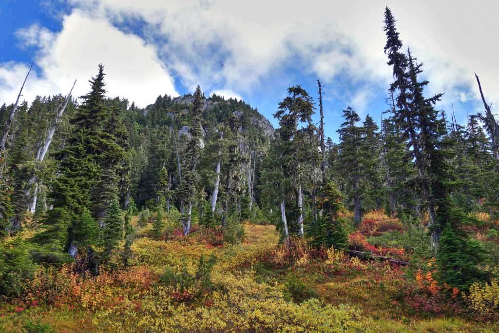
We headed up the the final slope and came across our first tarn. I’ve said it before and I’ll say it again, I like big tarns and I can not lie :).

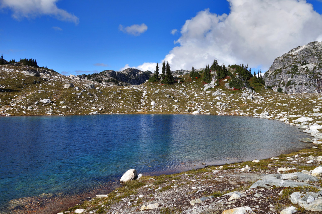
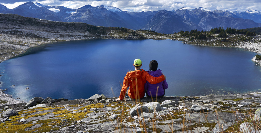
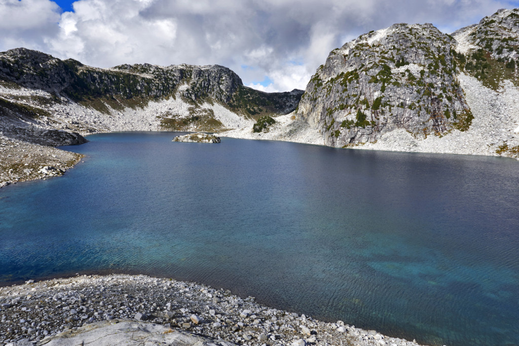
We took our time wandering around the barren rock from one tarn to the next, taking pictures and soaking up the amazing views. We made our way over to Blanca Lake itself and went up a small bluff overlooking the lake.

Views of Blanca Lake:


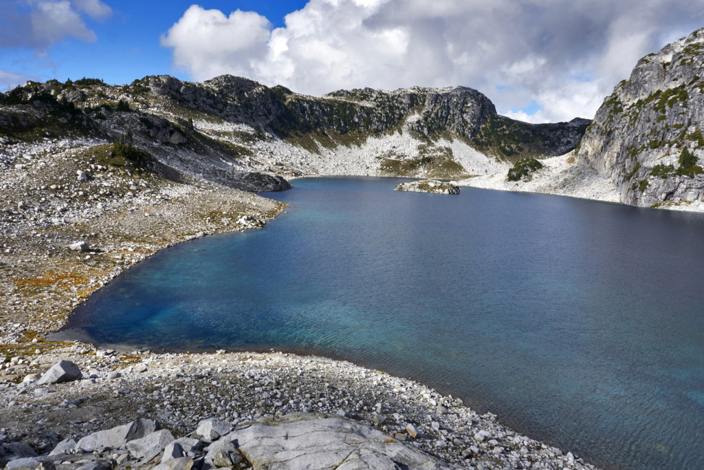
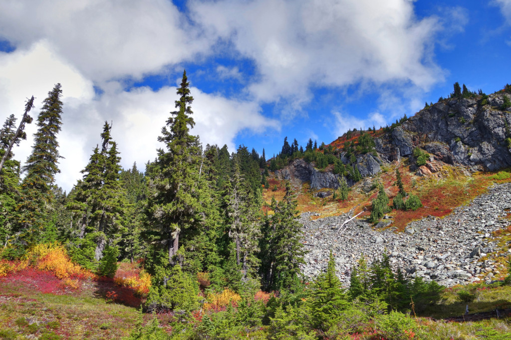
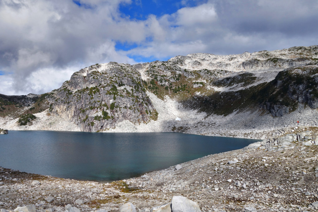
From there we wandered west up and over another bluff to another large tarn.

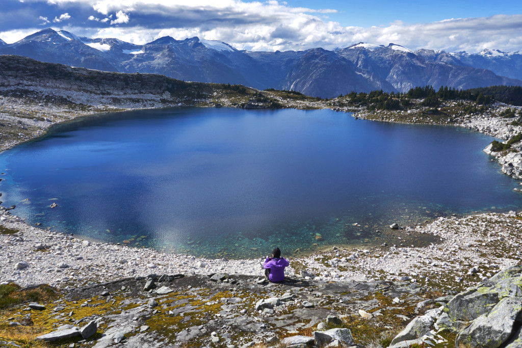
After many, many more pictures (I seriously couldn’t get enough of this tarn), we decided to retrace our steps and headed back to the meadow.


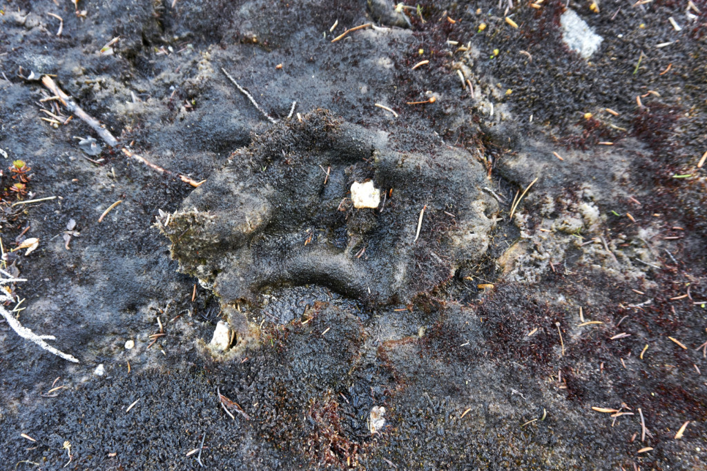
As we hiked down through the meadows, Ryan checked out the muddy stretches and noticed a fresh track we hadn’t seen on our way up; it looked like a grizzly track. While the print itself was small (possibly a youngling?), the large claws were very obvious. We made lots of noise as we continued through the meadows and thankfully never saw the little (well, big) guy.

We had downloaded a track for Blanca Lake from an online hiking site, but it had followed a different route for the middle part of the hike; it paralleled Blanca Creek rather than going up and then over the way we had. We wanted to follow this different route down to make a loop, but as we exited the meadows and followed the stream towards a canyon-like stretch, we couldn’t figure out where it went and saw no obvious path or flags. We decided to play it safe and headed uphill, away from the creek, and joined up with our up-track and followed it out.
Diabetes Management
I started the day with my basal at 50%. My blood sugars were ‘off’ throughout the day. My CGM acted up by reading relatively inaccurate sugar levels – I’ve never seen this much inaccuracy and I’m not sure what may have caused it. I calibrated in the morning when my blood sugars were steady (and had been for hours) and I was on the 6th day of using the sensor. The CGM reflected higher blood sugars compared to my manually checked blood sugars, for example, when the CGM read 7.3mmol steady, a manual check showed 3.8mmol. This persisted for hours and I relied on manual blood sugar checks most of the day.
After most of the elevation gain was done, just before our last push into the alpine, I had a low which we took an extended break for; I loaded up on gummie candies and some ShotBloks to bring up my levels.
Pack List
✓ The 10(+6) Essentials
✓ 2L of water
✓ Snacks
✓ Day pack
✓ Hiking boots
✓ Warm layers
✓ Camera + tripod
Do i need a high clearance 4wd???
I drive a rav4? Do u think this will be sufficient??
Elaho branch e300 freash logging at top of road on weekends lots of cars trucks parked at trail head
Thanks Ashika for sharing these beautiful pictures.
I was always wondering what the lake looked like.
I did a two day ski trip a few winters ago to that lake but under couple of meters of snow everything looks different.
Great report thanks. How long is roughly the drive on the logging road. Would it be around 45-60 min when we got into the Squamish valley road with 4wd ?
Hi, thanks for touching base. It’s about 60 minutes after you hit the Squamish Valley FSR.
Hi Ashi
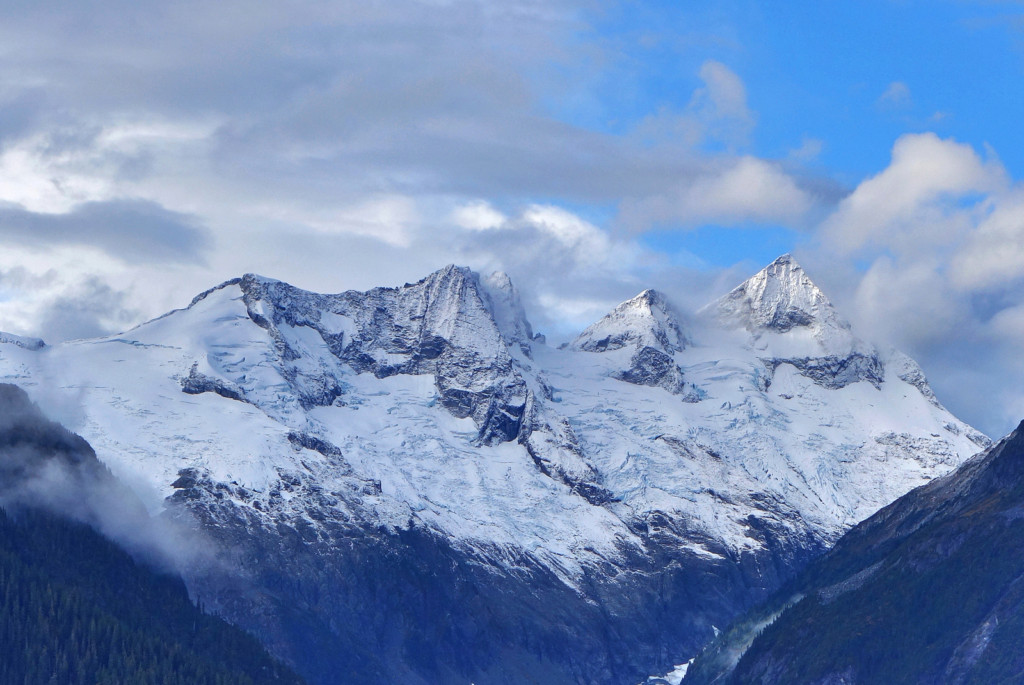
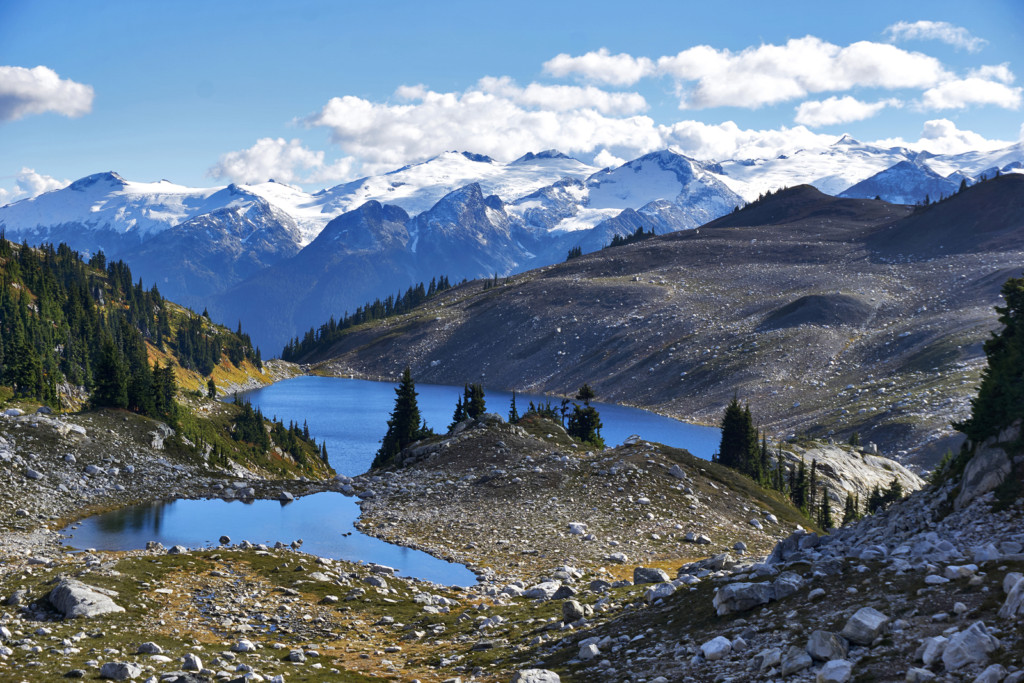
Nice report of a beautiful area. I especially like the last photo; looks so pristine.
Inaccurate readings with your CGM device can be dangerous. I had read that taking acetaminophen can cause false high BG readings. A journal article states that sleep position (sleeping on the device) can affect blood and oxygen flow and temperature at the sensors and affect readings. Restricted blood flow can produce false low readings. False high readings occur with increase in body temperature (taking a shower, exercise). Something to keep in mind.
Ron
Hi Ron, thanks for the info. I’ve read about acetaminophen causing false high readings too. I haven’t taken any in a while, so not sure what else may have caused it. This hasn’t happened on other equally demanding hikes. The only other thing I can think is maybe 6 days on the sensor was pushing it. I’m usually ok on a sensor for ~7 days, beyond that, I tend to see a decline in accuracy. It’s possible I may have slept on the sensor too. I’ve swapped it out a few times since the hike and the readings have been fine. Definitely something I’ll keep an eye on going forward. I’ve lucked out with high sensitivity – when my CGM was only reading 7-odd mmol and I felt much lower, I stopped to check right away.
Ashi
my friends saw grizzlies in tricouni meadows at the end of september, so there are definitely some in that area!
Lovely hike, will be sure to add it to the list for next year! 😉
Marissa, good to know, they’re definitely getting around. I remember reading about a High Falls Creek closure off of Squamish main because of grizzly activity earlier this year. Glad you enjoyed the post, enjoy your winter!