Ashika Morasiewicz
Outdoor Adventurer from the North Shore, BC
Hike to Kidney Lakes & Gotcha Peak – July 17-18
Trip Date: July 17-18, 2015
Ryan and I checked out the Blowdown area, including Kidney Lakes & Gotcha Peak. We set up camp at Blowdown Lake and made our way around.
Stats:
Kidney Lakes:
- Elevation gain: 164m
- Distance: 2.94km


Gotcha Peak:
- Elevation gain: 635m
- Distance: 6.86km


Notes:
- Blowdown FSR is 4WD-able to Blowdown Pass which offers stunning views of the adjacent peaks and alpine lakes.
- Quick access into the alpine.
- Beware of the black flies and mosquitoes.
Access
From Pemberton:
- Continue east along the Duffey Hwy (Hwy 99) through Mt. Currie towards Lillooet.
- Continue past Duffey Lake. The Blowdown FSR is on your right, just after the avalanche control gate.
- Stay on the Blowdown mainline past all spurs for ~10km.
- Most people park here and walk the final ~5km (“Branch 6”) to Blowdown Lake, but it can be driven with an aggressive 4wd.
The Hike
On Thursday night, Ryan and I packed up the truck and headed towards Blowdown FSR, via the Fraser Canyon. We anticipated a lot of traffic between Whistler and Pemberton, due to the Music Festival, and thought to drive the long way around via Lillooet.
The lower stretches (first 10km) of the FSR are in fairly good shape – 2WDable with the exception of a few spots where water bars or washouts require higher clearance. Ryan’s truck is equipped for rough roads, so we decided to drive up branch 6. Few notes re: the road condition:
- The final 5km, starting at branch 6, is a very rough 4WD.
- Many people park in the wide pullout area (near branch 6) and walk in from there.
- A few spots were significantly eroded or washed out and needed careful driving.
- We found 2 spots where the upper bank is starting to collapse, this required a sloping drive with exposure.
Needless to say, it was a fun drive!
We packed up and hiked the short trail down to Blowdown Lake. The meadows at the lake outlet were lush and beautiful. Clouds of purple butterflies sprang up whenever we walked around a puddle on the road or trail.

After checking out potential camp sites around the lake, we followed a distinct trail leaving from the SW end of the lake. The trail contoured around a boulder field before starting a steep ascent up a grassy slope. We figured this trail lead to the Kidney Lakes in the plateau above. We intended to explore the further reaches of the valley, further west, so we left the trail here and started bushwhacking through the forest.

I have very little bushwhacking experience and found this stretch of our hike frustrating. For future trips, I’ll be sure to wear pants, regardless of temps. Ryan lead the way through the path of least resistance. We came across an occasional flag or two, but nothing marked an official route or even game trail. Our treed bushwhack alternated with boulder fields and more open subalpine stretches, but our overall progress was slow.

After a few hours of that, we decided we’d had enough. Knowing the terrain would be more open above us, we turned straight uphill and made our way to the boulder and heather slopes on the shoulder of the Notgott-Gotcha ridge.


From here, we backtracked our way to Kidney Lakes.


")
The lakes were a beautiful green and we spent a lot of time relaxing & dodging flies on their shores.


When it was time to leave, we picked up the trail on the north side of the lower lake and followed it down the grassy slope we had seen earlier and back along the path to Blowdown Lake.

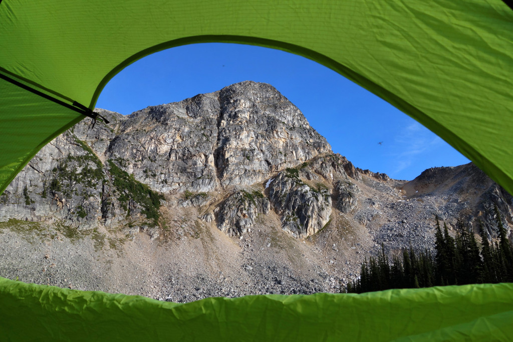
We had the lake to ourselves and chose a nice camp site just north of the outlet. Note to self: next time bring a rod; we saw lots of trout jumping around.

We settled into an evening at camp, much of which was spent in the tent due to the overwhelming number of mosquitoes and black flies. Two other parties of overnighters arrived, but given the area, we still had a lot of solitude.


The next day, we hiked up to Blowdown Pass and summited Gotcha Peak. Ryan decided not to drive his XTerra up to the Pass, since he didn’t know the current road conditions and was concerned about a lack of turnaround spots if it was impassable. As it turned out, the last stretch of the road to the pass is fairly easily drivable. There is one narrow spot between two large boulders that would require careful driving and one large rock in the middle of the road to climb over, but other than that, this stretch should be easily doable for any cars able to make it up to the lake. It was a quick hike to the pass.


The pass was beautiful. We spent some time taking pictures of the valley on the other side, where the road continued to the old Silver Queen mine area. The pass marks the start of the Stein and motorized vehicles are prohibited any further. We had a quick discussion about ridge-walking the gorgeous looking Gott Peak, but settled on our original plan of Gotcha.


We left the Blowdown road at the the last switchback and picked up an indistinct trail heading up the slope. There were occasional cairns to follow, but the approach was generally obvious – boulder hop up and trend to climbers left of some steeper cliffs near the summit plateau. The higher we climbed, the more beautiful the views of the surrounding mountains.

Part way up the climb, I felt my blood sugars dropping. We ended up taking an extended break for 35-40 minutes, to wait for my sugar levels to rise. If I had to wait much longer, we likely would have turned back and saved the summit for another day. This was my first hike using the Animas Vibe insulin pump and integrated Dexcom CGM, this system helped us decide to keep going (vs turn back) because I was able to determine how my blood sugars were ‘trending’. Once I picked up a stable trend, where my blood sugar levels stopped rising and/or falling, we were able to continue to the summit, while still keeping an eye on my levels. For more details, please read the ‘Diabetes Management’ section below.
Our extended break had some of the most beautiful views of the day. I don’t mind tending to blood sugars if the views are like this more often!

After a little while, I felt ok enough to continue on. A quick and easy scramble up block-shaped rocks got us past the steeper cliffs and onto the summit plateau. We continued to follow the occasional cairns until we topped out on the break-taking summit.

The true summit itself was not obvious and there were 3 ‘high points’ across the plateau. We spent quite a bit of time up there, wandering from one end to the other. We took many pictures and tried to identify the various snow-capped peaks off in the distance.


On our way down, we made quick work of the boulders and scree and we were back down to the truck in no time. The 4WD back down to the ‘branch 6’ junction was a bit easier than the way up. The rest of the drive out, to the Duffy Lake road, passed without incident and we headed back to Vancouver via Pemberton (assuming traffic wouldn’t be too bad). As it turned out, traffic was virtually non-existant and Alice Cooper was on stage as we drove by.
Diabetes Management

Part way up the climb, I felt my blood sugars dropping. This weekend, I used the Animas Vibe insulin pump and integrated Dexcom CGM (continuous glucose monitoring) system. A quick breakdown for those who aren’t familiar with the CGM, it is a sensor that reads my blood sugars every 5 minutes and displays the readings on a chart to show blood sugar trends over a specific amount of time.
It is my second time using a CGM system and I absolutely love the way it works.
I won’t get into too much detail re: the low. In summary, during our ascent, my sugars fell to 3.2mmol. It took some time for us to raise the sugars up to a comfortable level (between 10 and 12mmol) without dropping again. I’m 90% sure the reason for the low was due to a lack of calories in my breakfast. Normally, before hiking, I have a ‘balanced’ breakfast (carbs, fat, protein) with a minimum of 500 calories. This number seems to work for me in terms of controlling my sugars during moderate to difficult hikes. This morning, I only ate 1 shotblok.
To manage the low, we sat down on a boulder and I ate many shotblocks/gu gels until we noticed a stable & upward trend in my sugars. Surprisingly, my blood sugars did rise, but did not spike after all the gels. I did not rely on the CGM initially, as there is a bit of lag in the readings. After 20 minutes or so when my CGM graph and manual finger pokes were matching each other, I assumed my sugars were stabilizing and we continued on the hike, slowly.
After the the low, we summited and returned within 4 hours. I kept an eye out for rebound lows and kept my basal rate at 50% for a while during the drive back.
Pack List (+ the Essentials)
- Overnight gear (tent, sleeping bag, sleeping pad)
- Stove + meals
- Camera + tripod
- Warm layers (toque, down sweater, wool shirt)
- Hiking boots
- Fishing rod
Thanks for reading! This area is definitely worth checking out, if you haven’t before. We were able to eye-out a handful of future objectives from Gotcha Peak, we will be back here shortly.
I hope everyone is enjoying the summer :).
– Ash
Lovely photos – we’ve wanted to visit the Kidney Lakes ever since we saw them from Gotcha.
It’s funny – the first time I visited Blowdown Pass I wasn’t as impressed as I thought I would be. But I’ve liked it more and more every time I’ve been back since. We’ve been up both Gott and Gotcha and like them both. Gott is more hiking than boulder-hopping too. If you catch it right, the area is a riot of glacier lilies 🙂
Hi Andy, I thought the area was great our first time there haha. Kidney Lakes is well worth a visit if you’re looking for an easier hike, it’s a beautiful area! Hope you’re enjoying the summer.
Hi Ashi and Ryan. Beautiful pics as usual with a gorgeous area. Thx for sharing. Are you guys still up for Weart ? I’m planning to do it this August so let me know if you guys are still interested. I still have Ryan’s GPS lol. I wasn’t on for a long time since i was busy with my wife’s pregnancy and giving birth. Now its all over and i have more time. All the best,
Vic
Hi Vic, long time! I’m in NZ visiting family until the end of August. I’ll let Ryan know to contact you if he’s interested in getting out on a hike :). Congrats to you and your wife and welcome back!
I enjoyed your trip report. Looks like a beautiful area to explore.
I’ve been using a carbohydrate called Highly Branched Cyclic Dextrin (HBCD) which provides a slower rise in glucose and insulin and thus prevents hypoglycemia that glucose would otherwise do. It is not meant to increase blood glucose levels rapidly but provide a sustained source of energy without the ‘crash’ that you get from ingesting simple carbs.
Tip: If you do ingest a fast acting carb before hiking, take it immediately befor or 10 minutes after starting out to prevent insulin induced hypoglycemia before the onset of exercise.
Ron
Ron, as always your advice is greatly appreciated. I normally have a proper breakfast, atleast half an hour before hiking. I’ll give HBCD a try, any suggestions on where to pick it up? Or anything similar I can get my hands on locally? Thanks again.