Ashika Morasiewicz
Outdoor Adventurer from the North Shore, BC
Into the Shulaps: September Long Weekend 2014
I read a while back you might learn more from climbing the same mountain 50 times than you would from climbing 50 different mountains. I can’t vouch for climbing, but I know hiking trails are much the same.
I’ve visited the Shulaps range via the same access a handful of times and each trip has been different from the last. For as long as I’ve observed, I’ve found different views, weather, lighting, colors and a different state of mind. Have you ever spent time on a mountain or in a range that makes your heart ache during the decent because you don’t want to leave? That’s how I feel here.
The Shulaps range isn’t like our local mountains. The tree line is accessible by 4X4, its peaks tower to magnificent heights of 2000+ meters and the summits are connected by never-ending ridge walks; this is my happy place.
September long weekend held a few milestones, including my birthday. To celebrate, I thought I’d share one of my favourite places with Ryan; we headed to Marshall Lake in hopes to explore the Shulaps range via Jim Creek. My end-goal was to reach a sub-summit. Well, I was hoping to reach the official summit – I love that this plan didn’t work out. Being the more rational one, Ryan suggested some high ridge walks to look for a viable route up for our next trip instead.
A few highlights of this area are:
– Remnants of old mining camps along the trails.
– Pack-horse trails and spurs leading to mined outcrops.
– Heavily mined zones for jade and possibly gold, dating back to the 1950s.
– The great Canadian jade rush, which began in 1955.
Day 1: Marshall Lake via Fraser Canyon
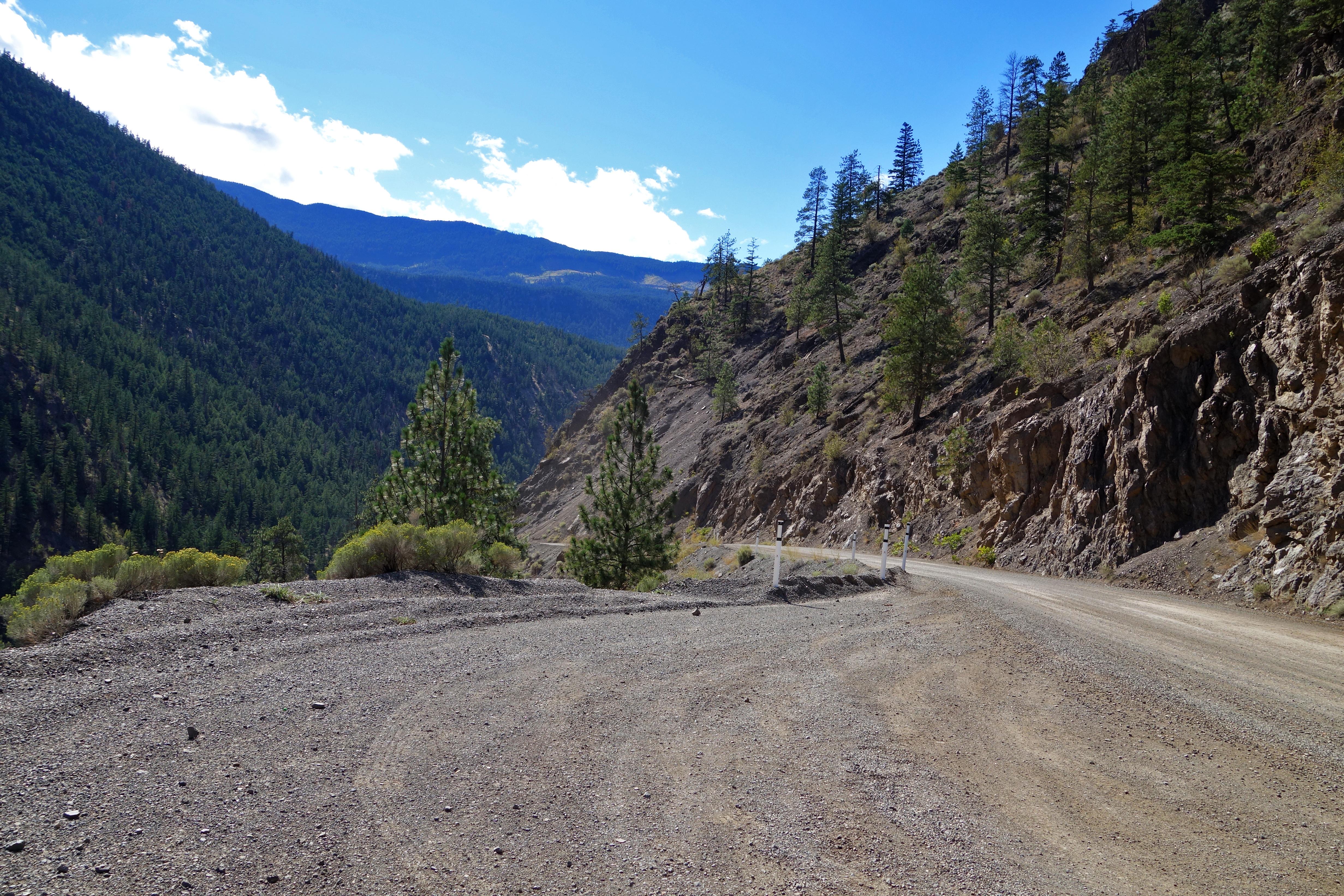
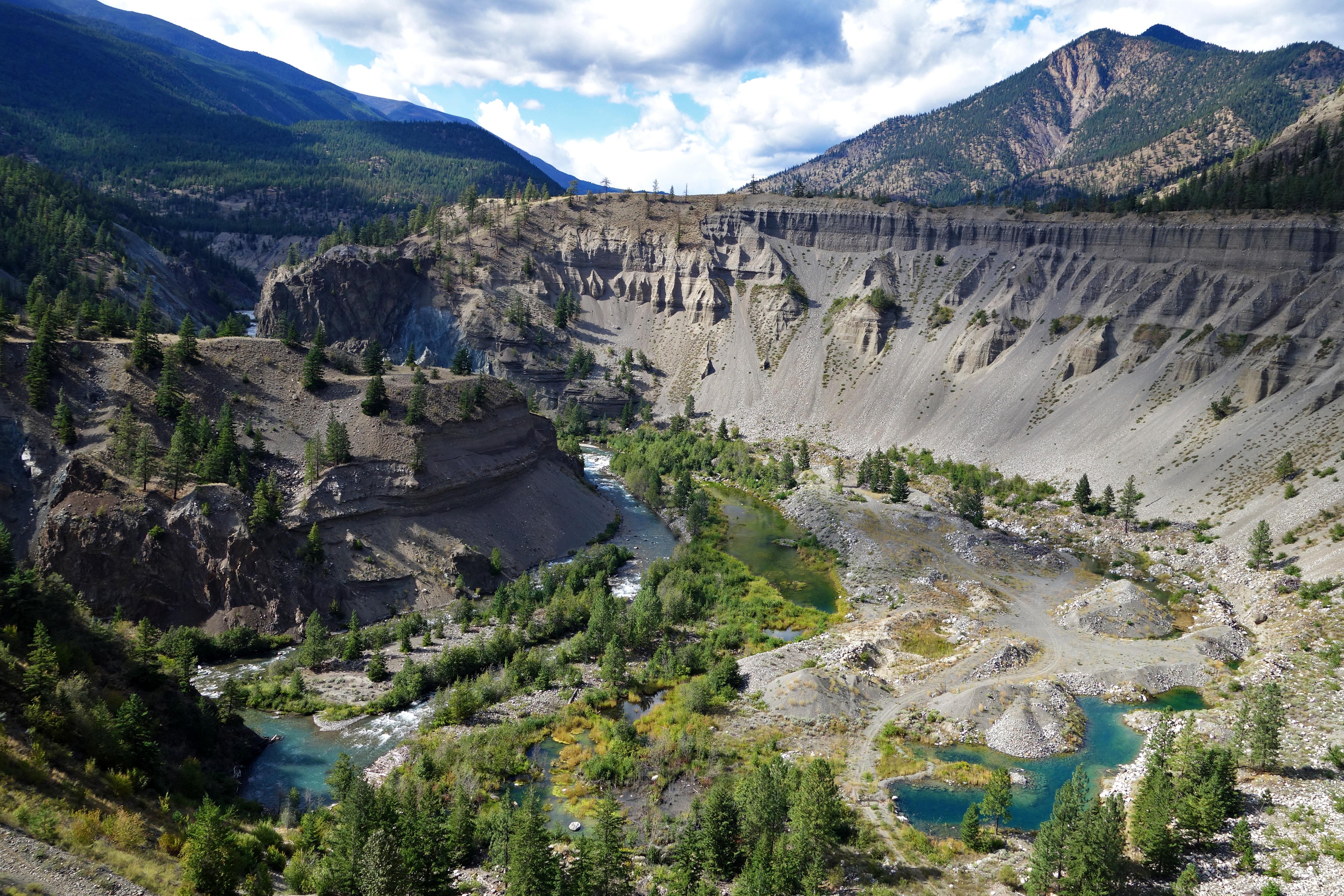
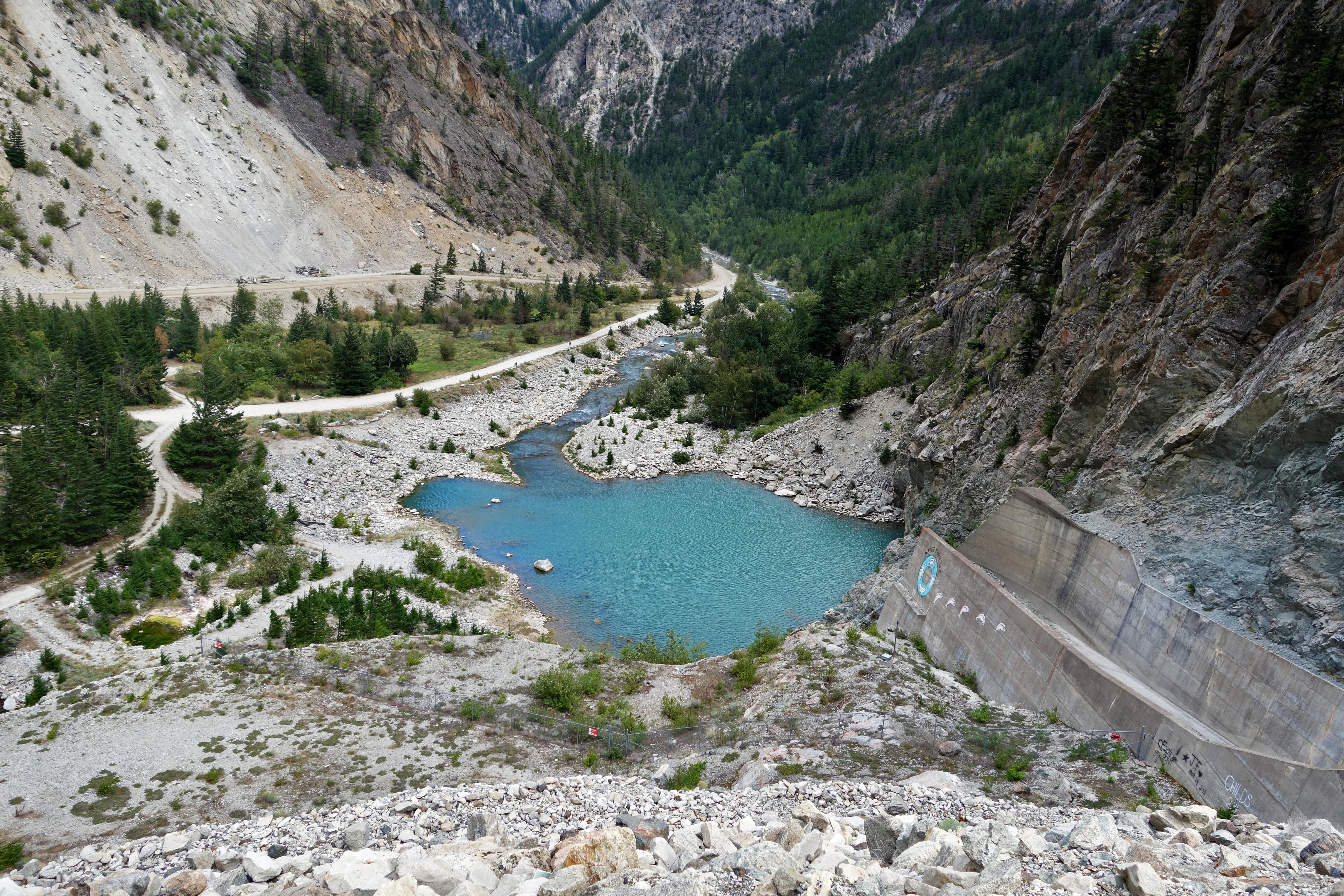
We weren’t too sure of the Hurley conditions and Ryan hadn’t driven through the Bridge River canyon before, so we opted to add a few extra kms to our trip by going through the Fraser Canyon to Marshall Lake. It was a long drive with a few stops along the way, most of which were along Carpenter Lake rd.
Views:
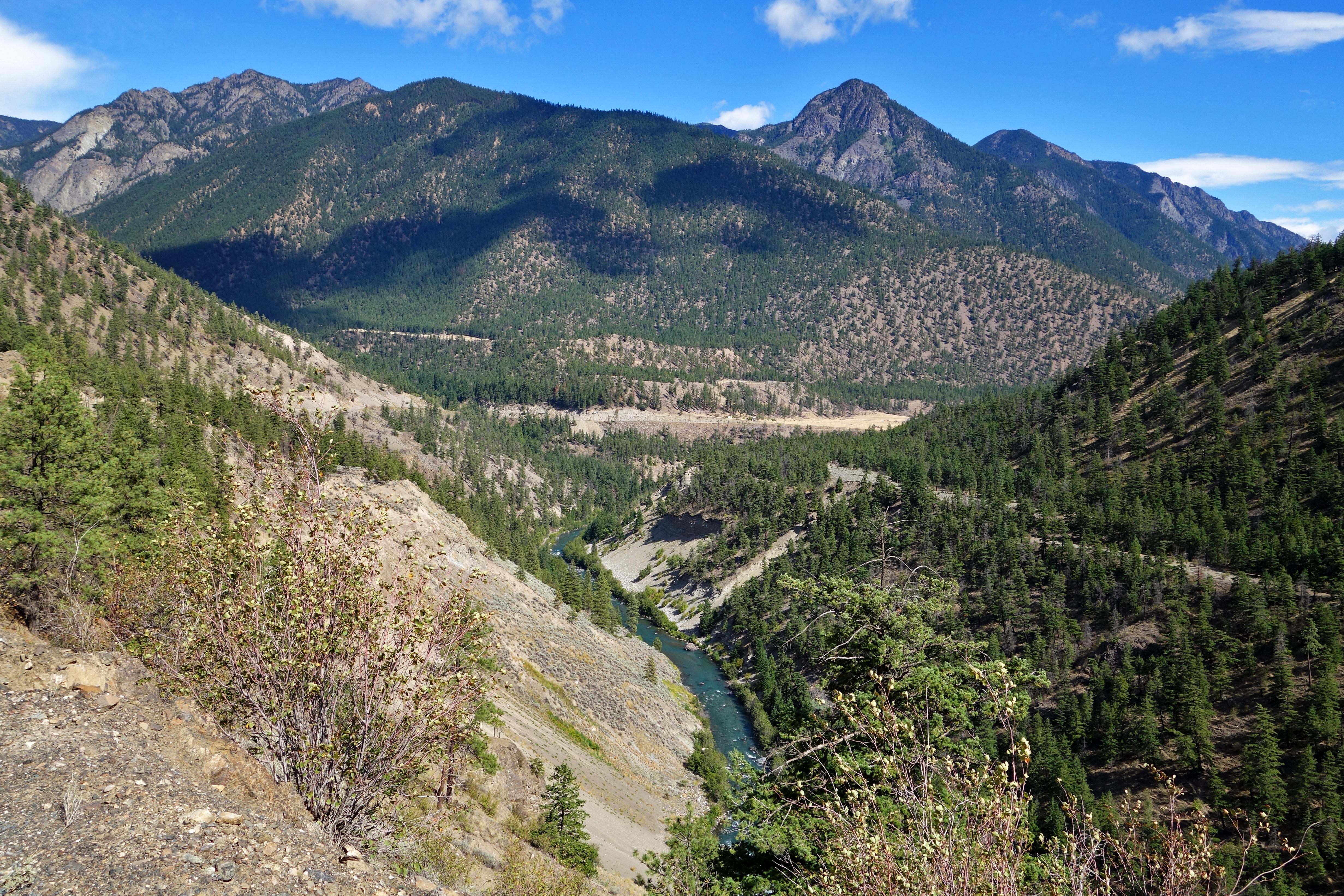
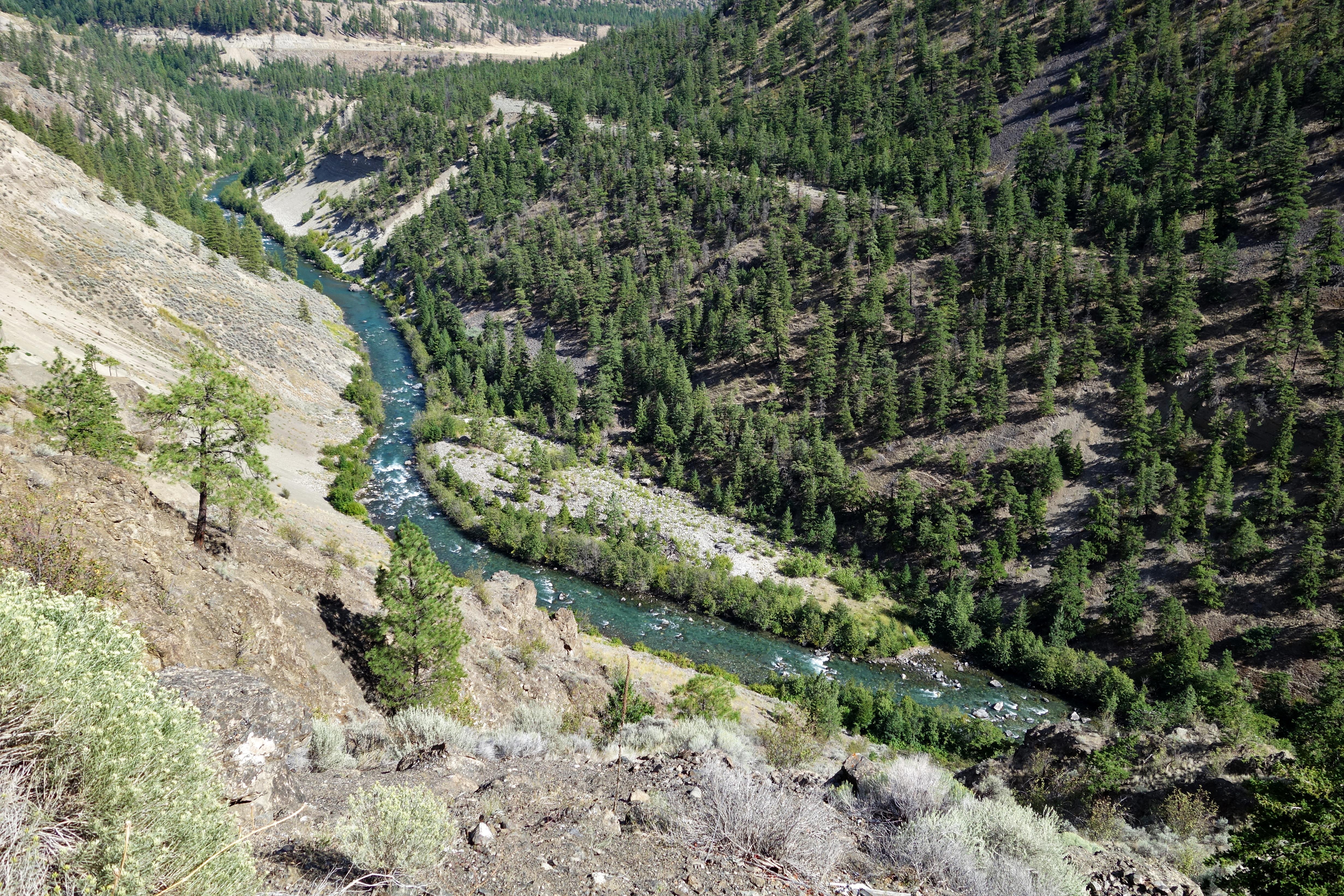
Horseshoe Bend:
Terzaghi Dam:
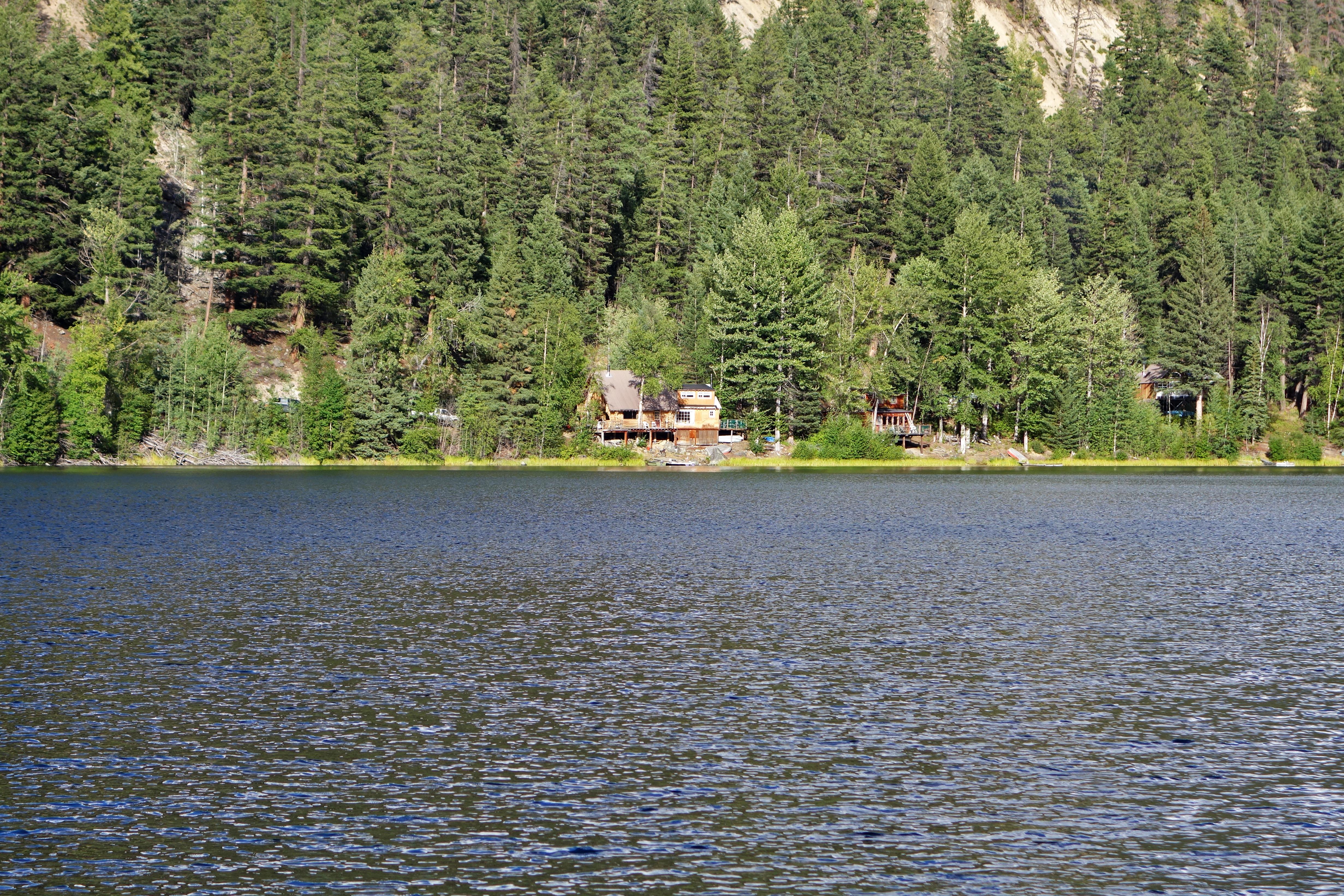
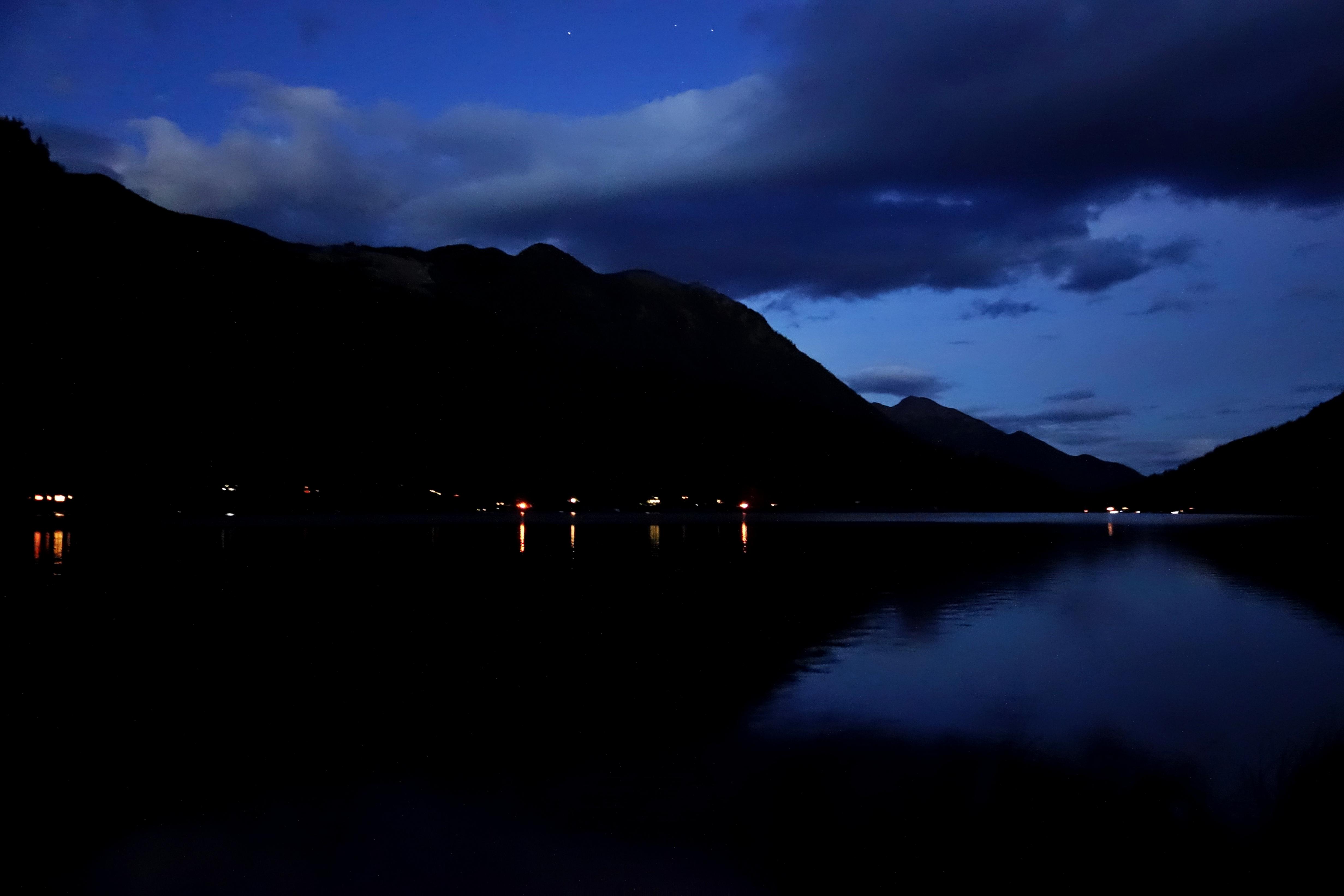
We arrived at the lake by mid afternoon. I was surprised to see very few campers on a long weekend; aside from another couple, we had the north end of the lake to ourselves.
Marshall Lake:
After setting up camp, we drove around the upper roads to figure out where we were headed the next morning.
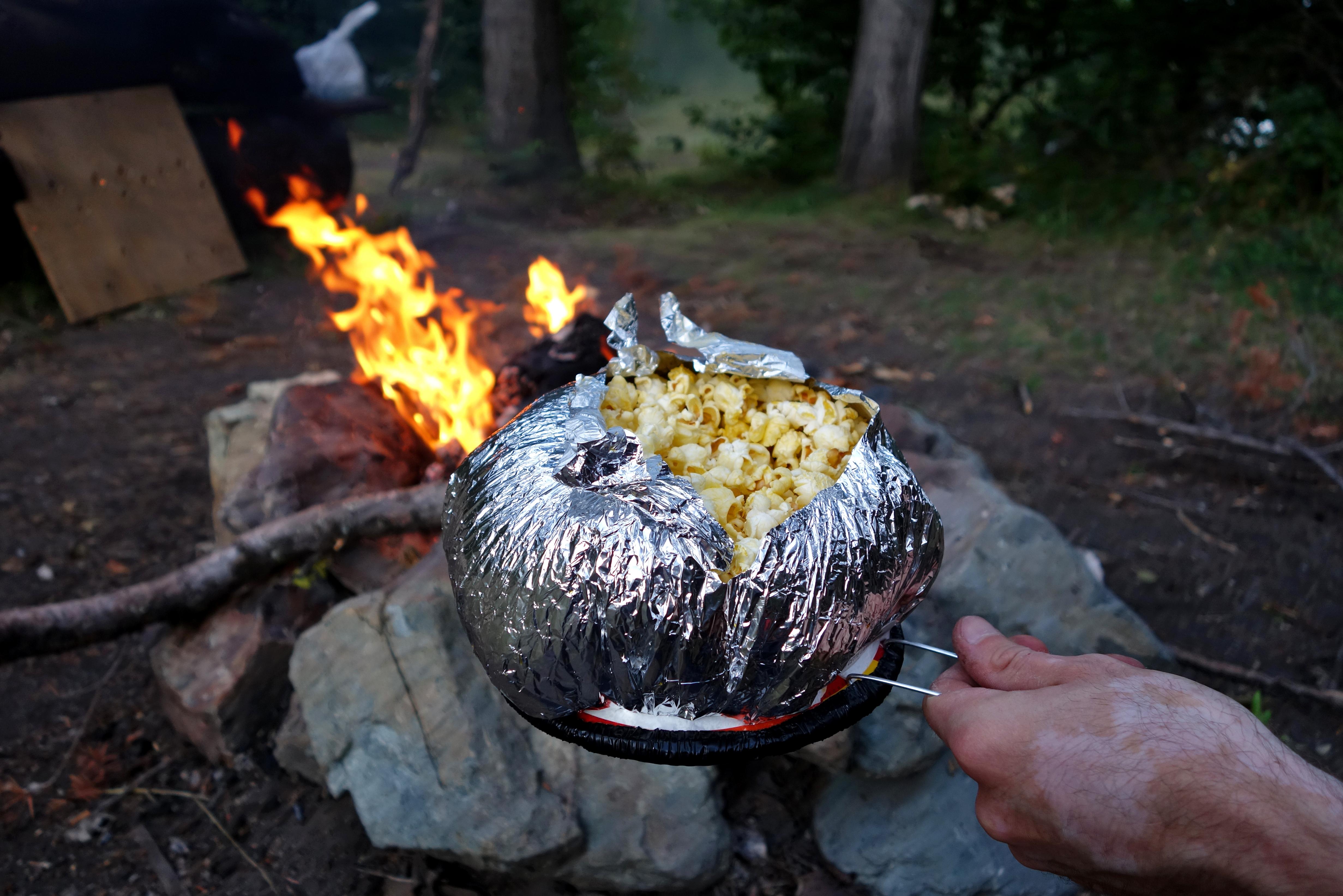
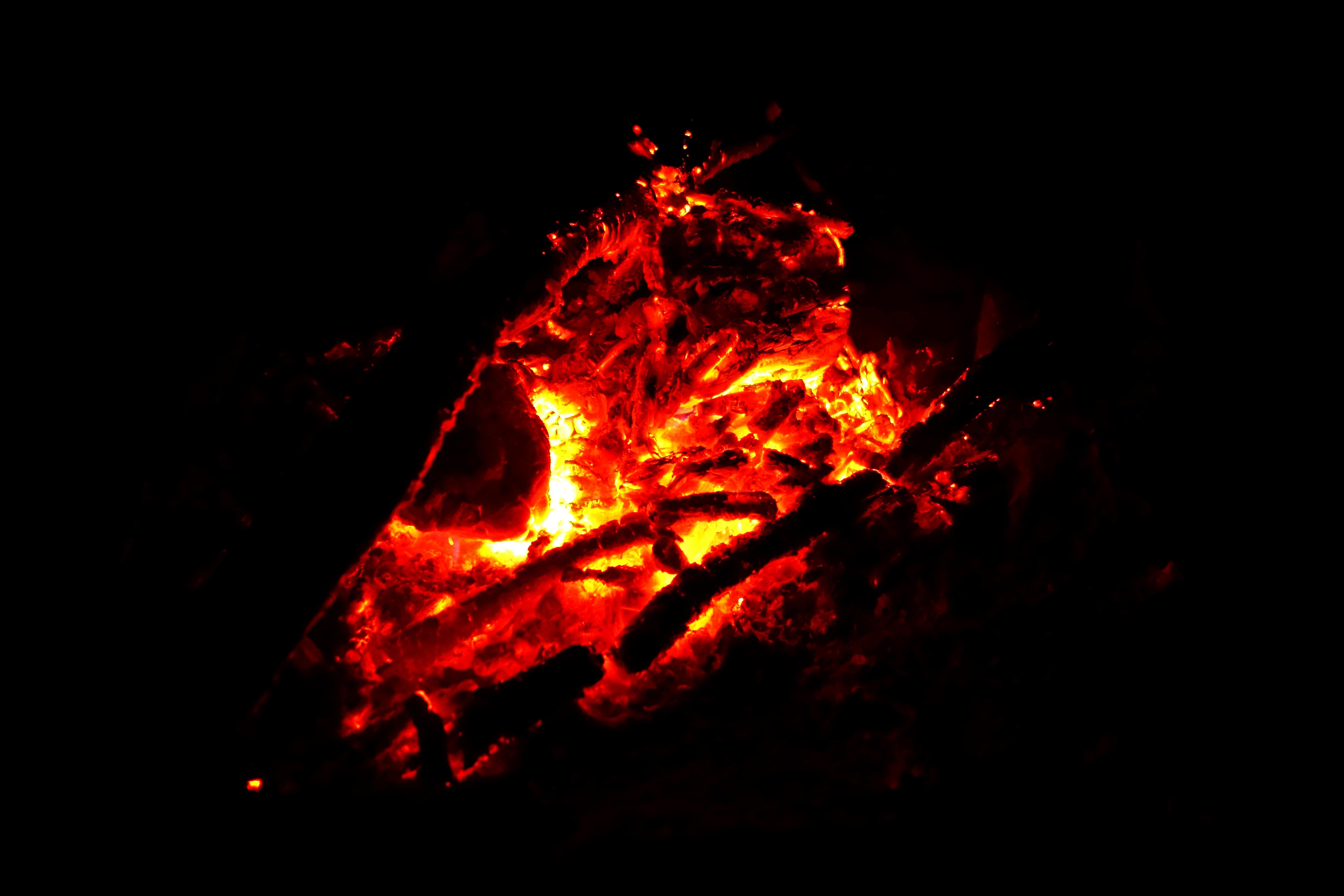
In the evening, we shared a few stories and some popcorn with our neighbours, warmed up by the fire, took a few shots by the lake, and then turned in for the night.
Day 2: Into the Shulaps
I couldn’t wait to get started!
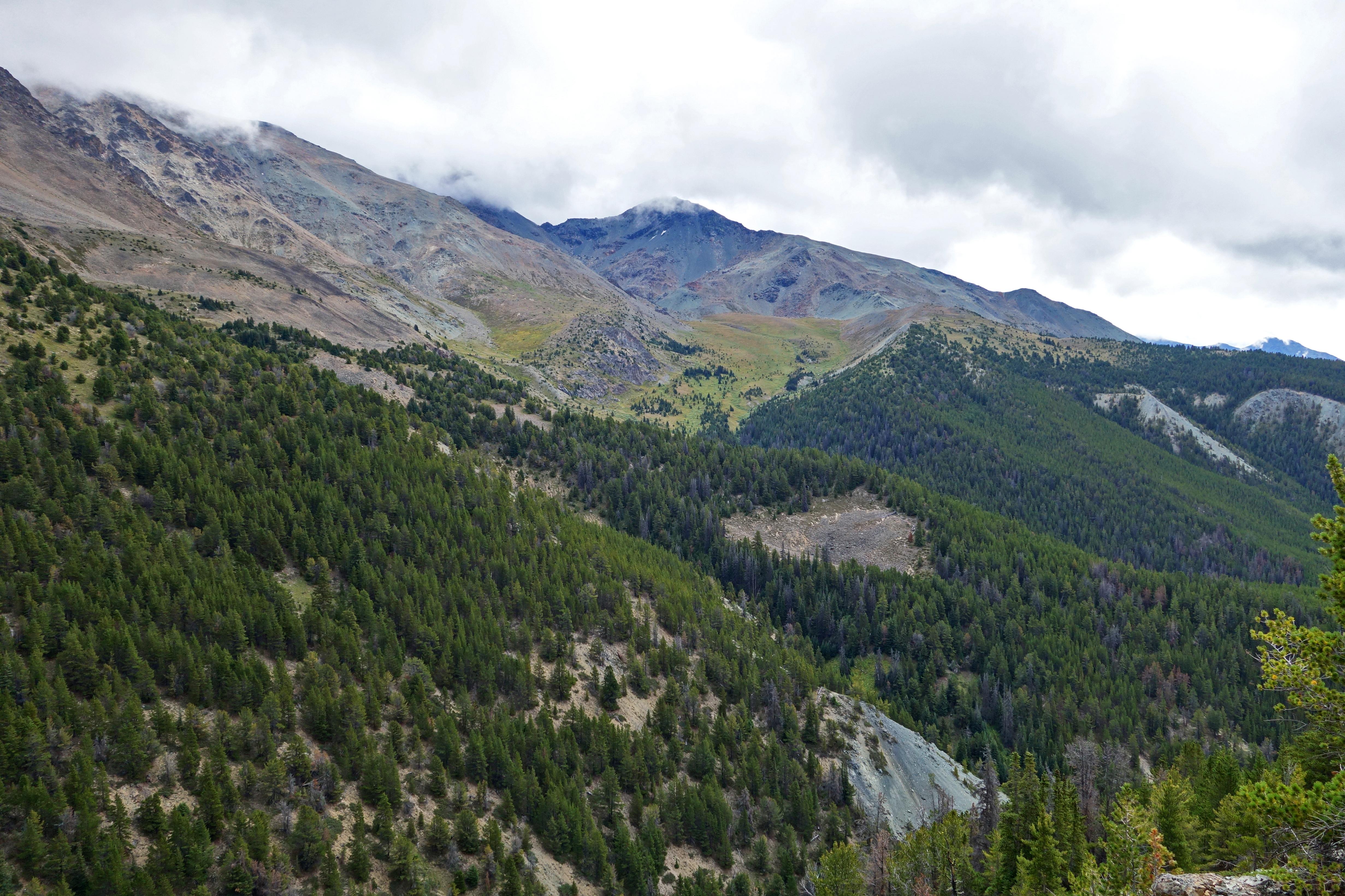
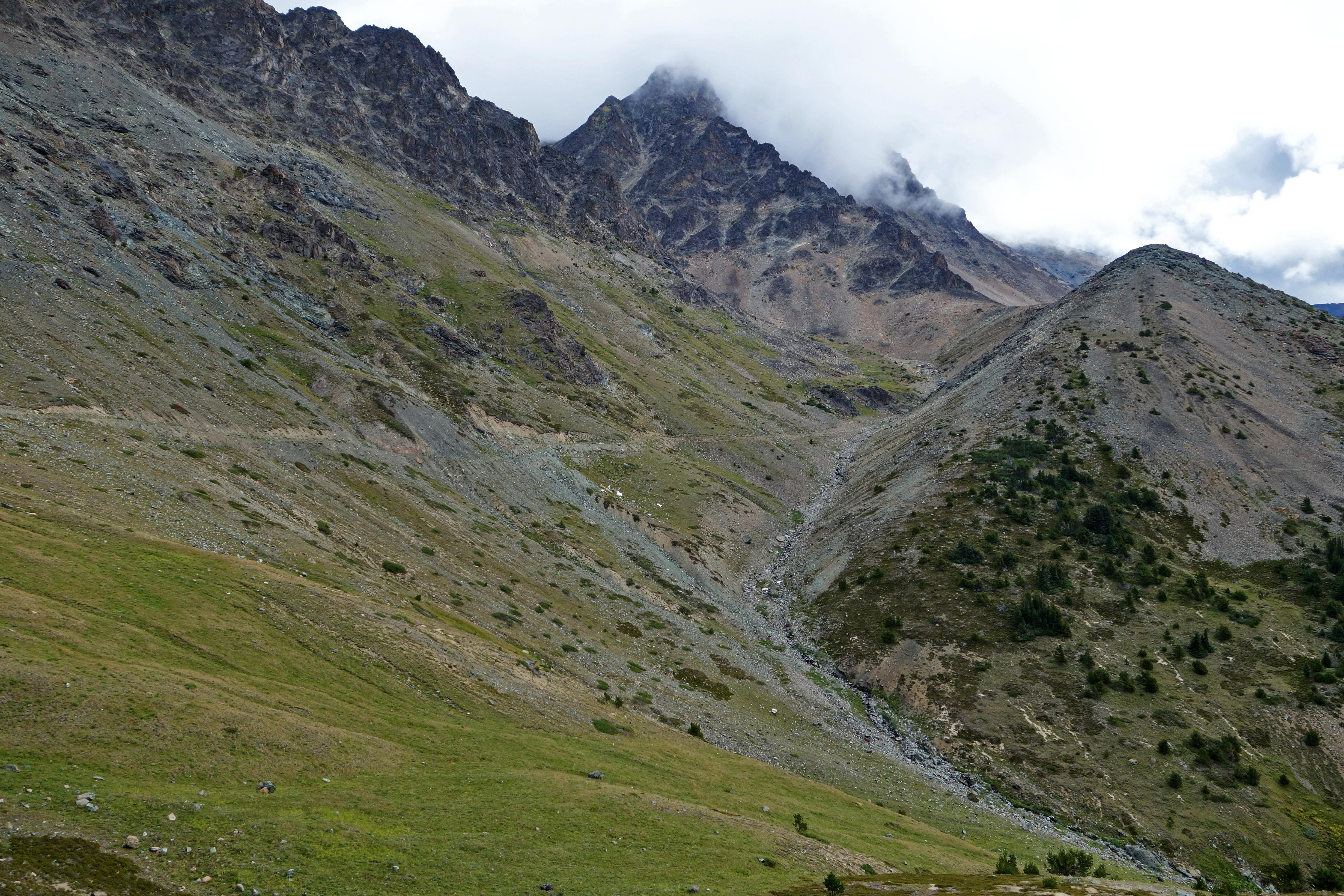
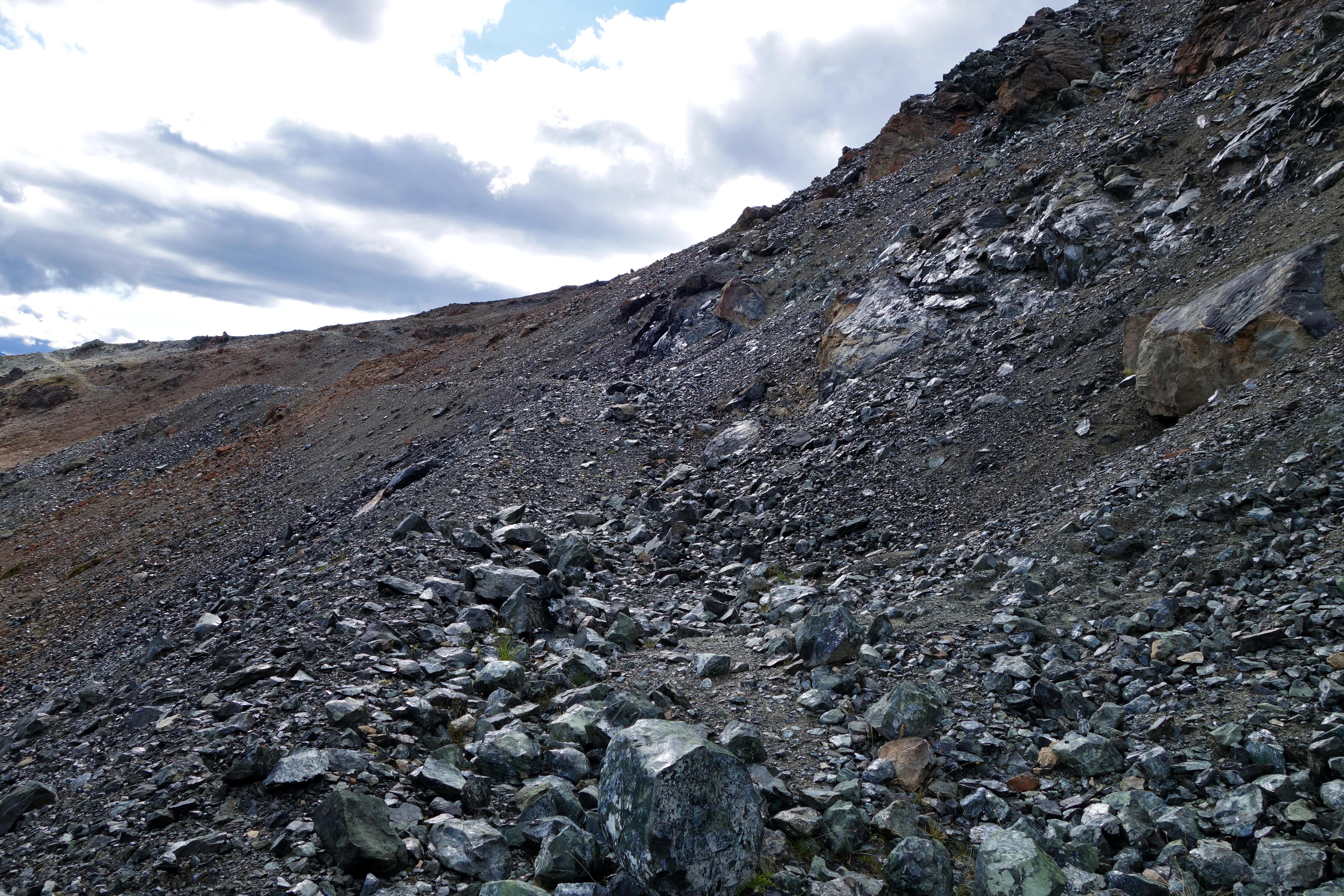
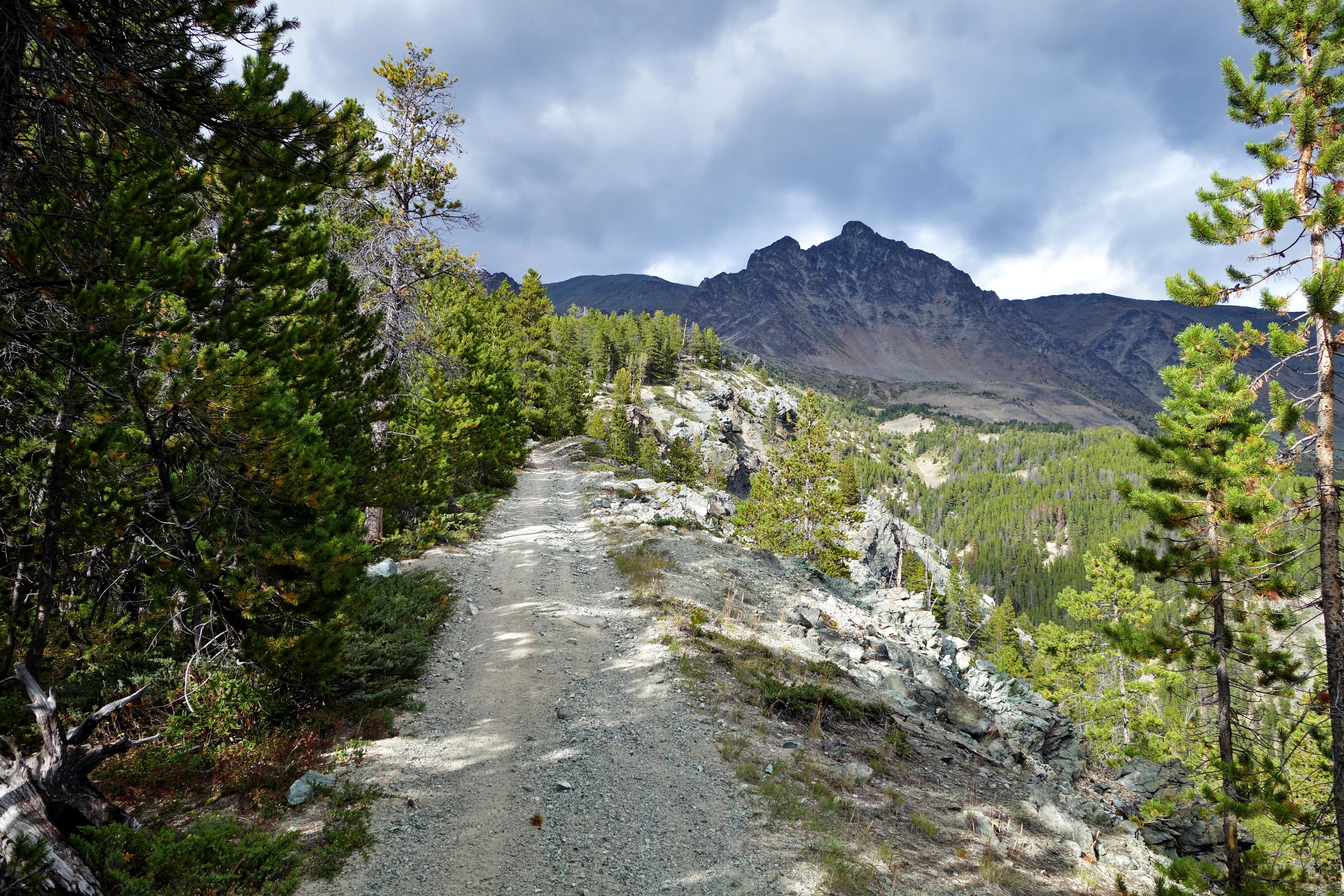
First, we followed the climbers left fork of Jim Creek up to its headwaters. From the upper road, the first 3km of the trail had an elevation gain of ~500m. After a few steep sections, we gained sight of Marshall Lake:
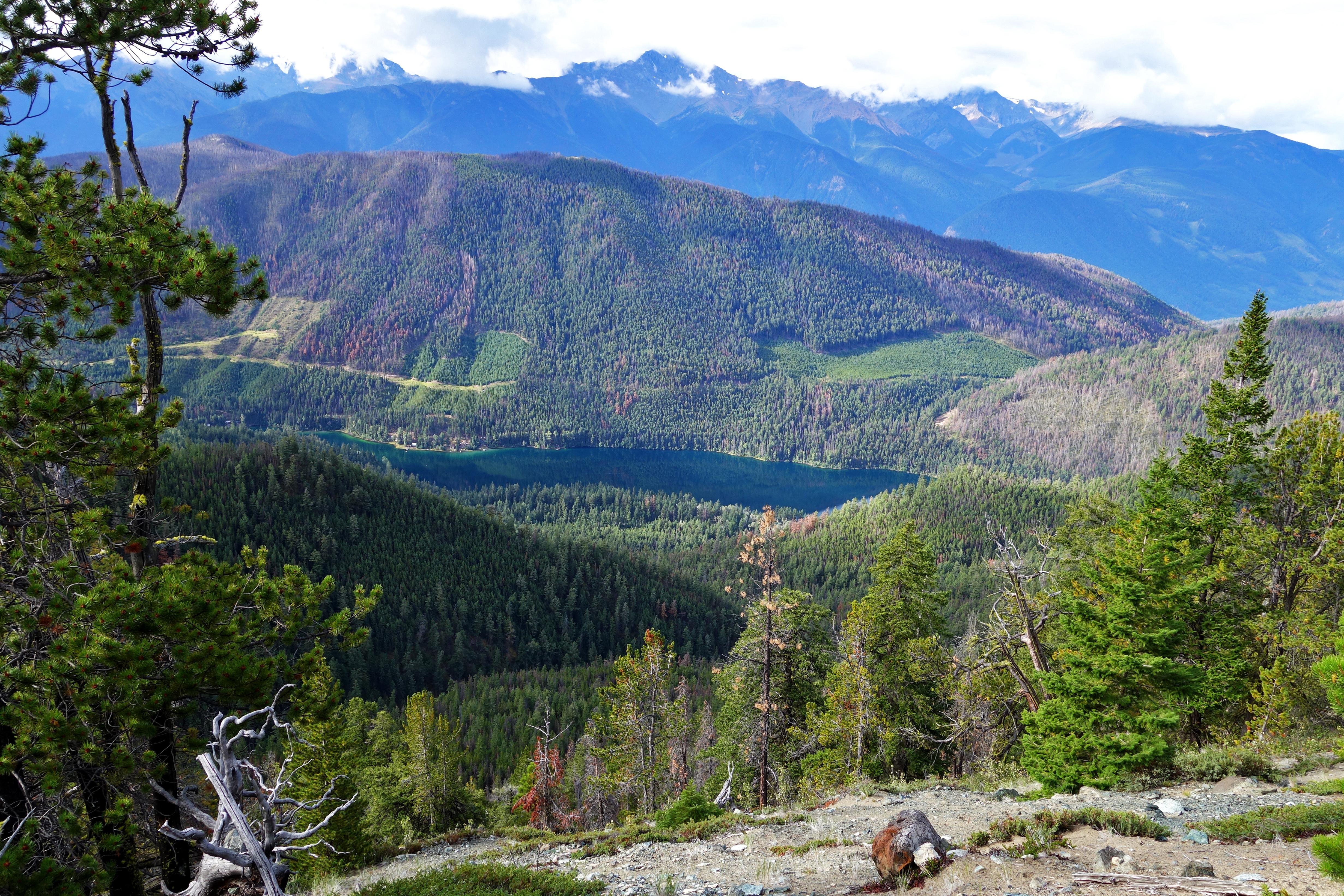
Views along the trail:
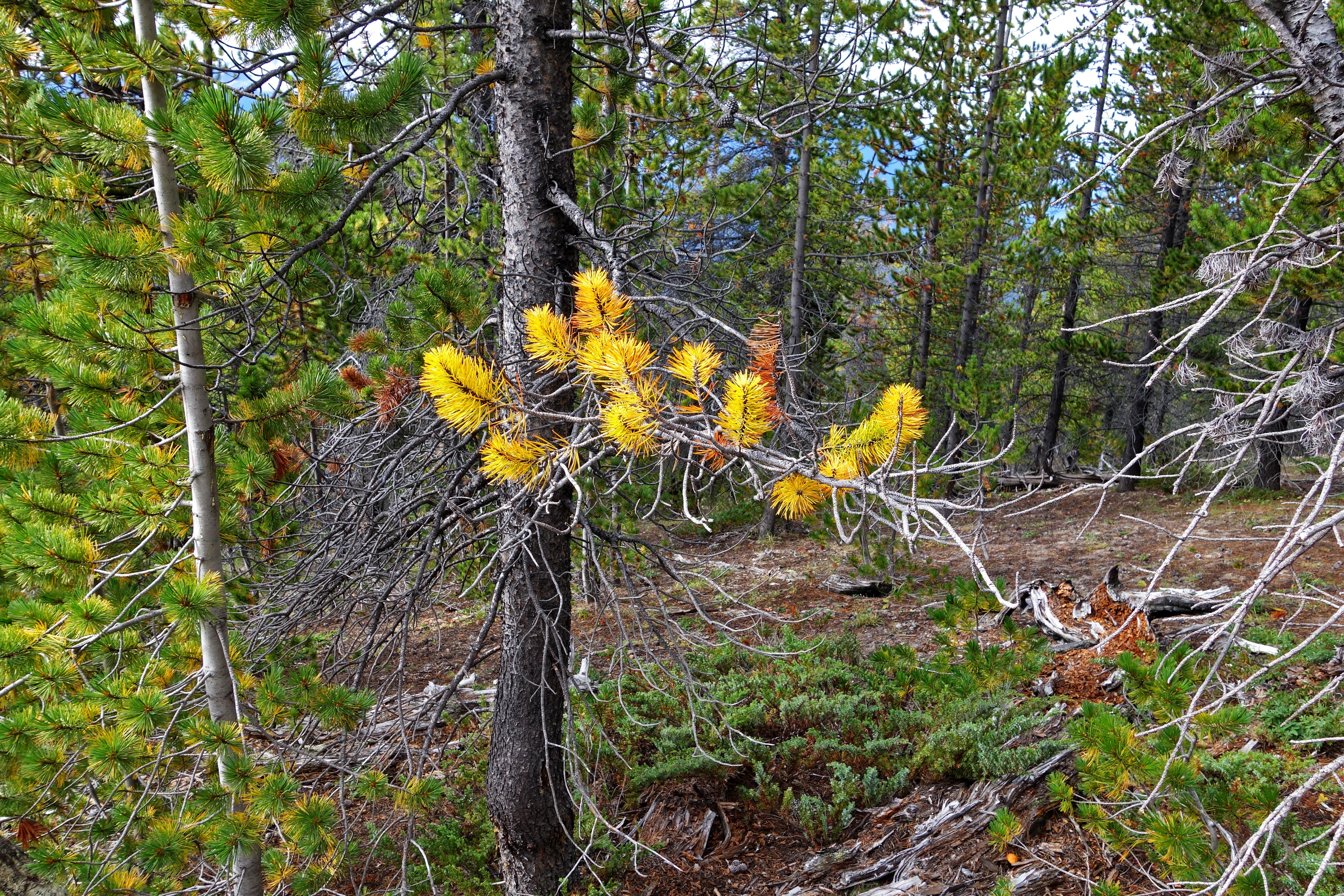
Foliage:
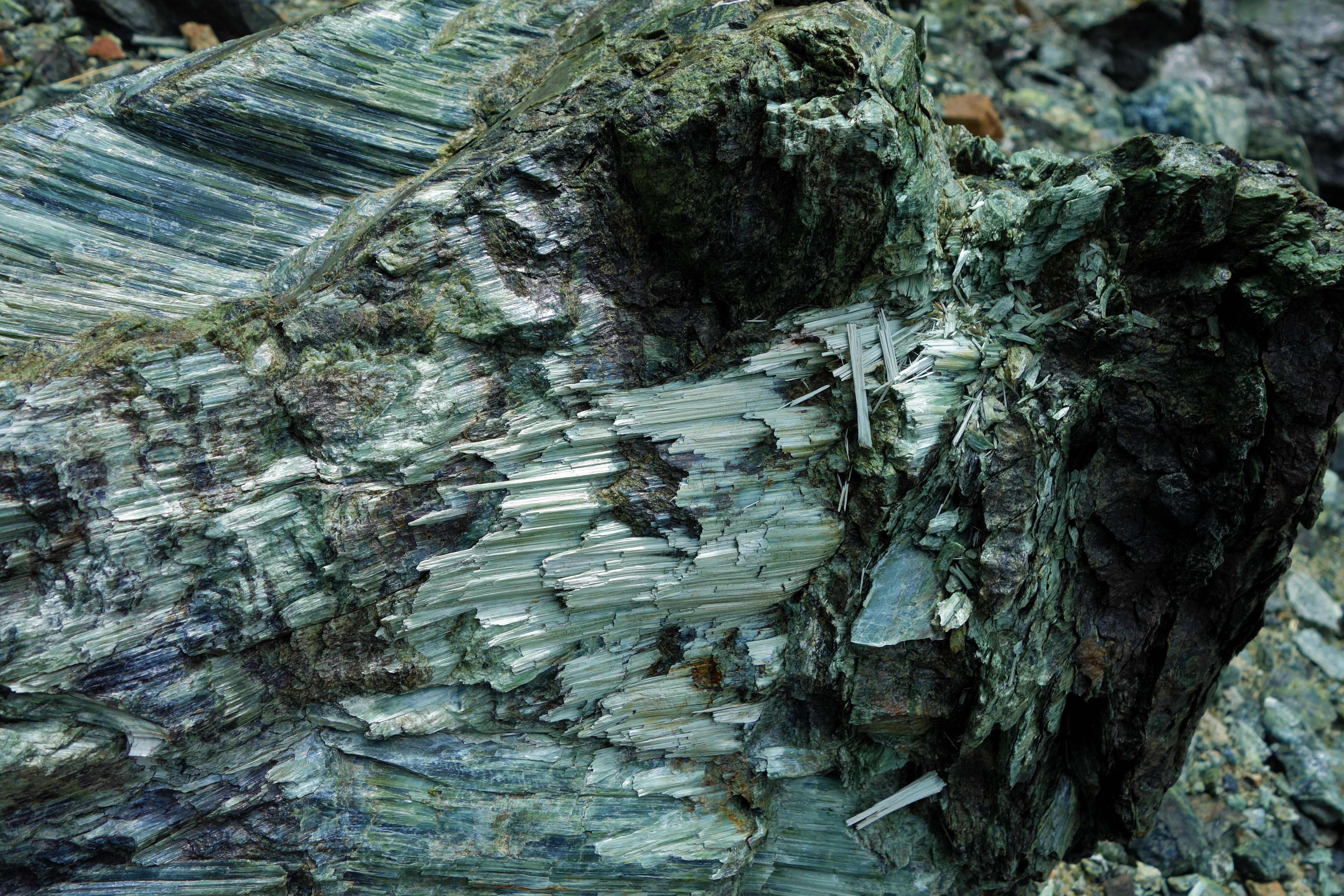
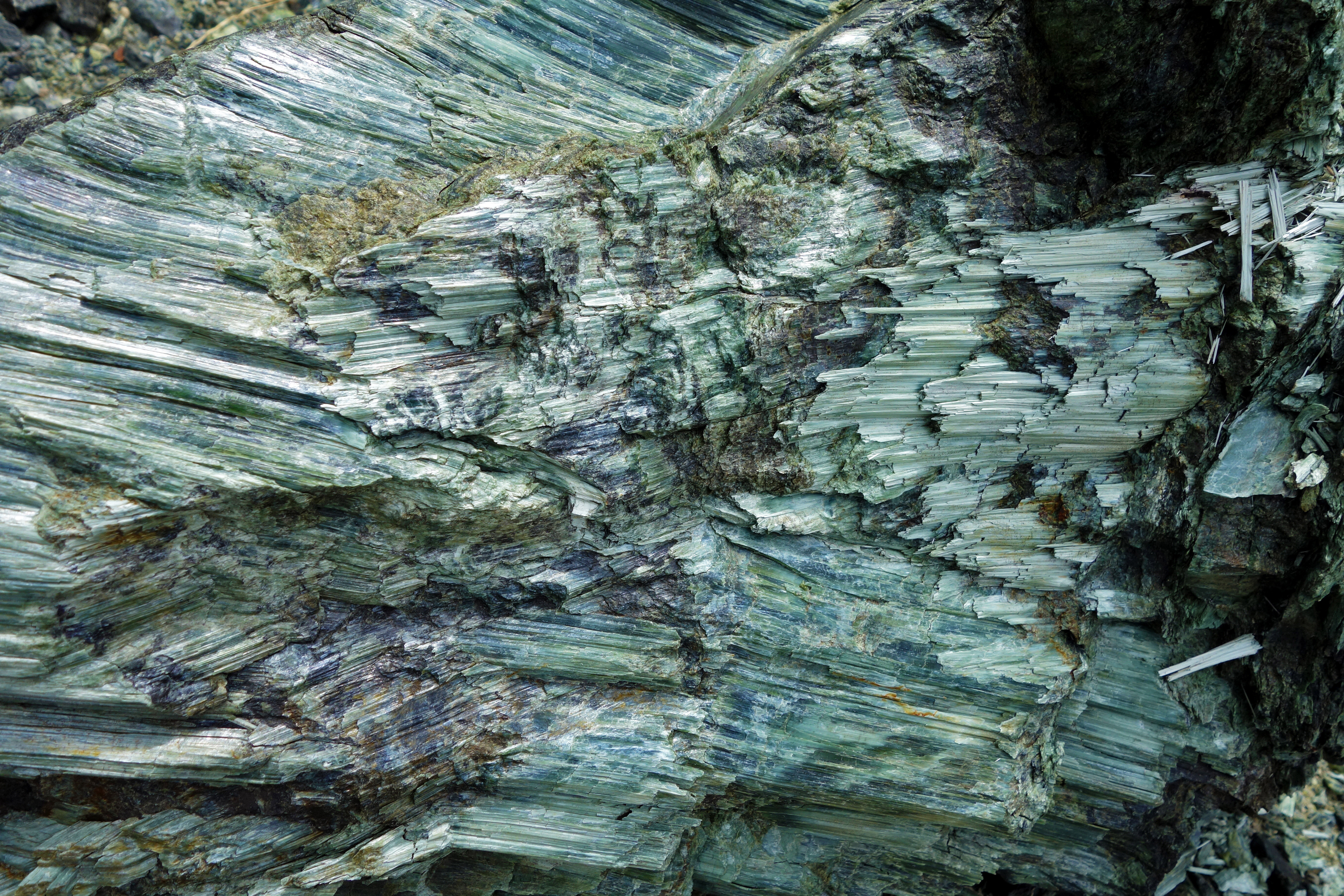
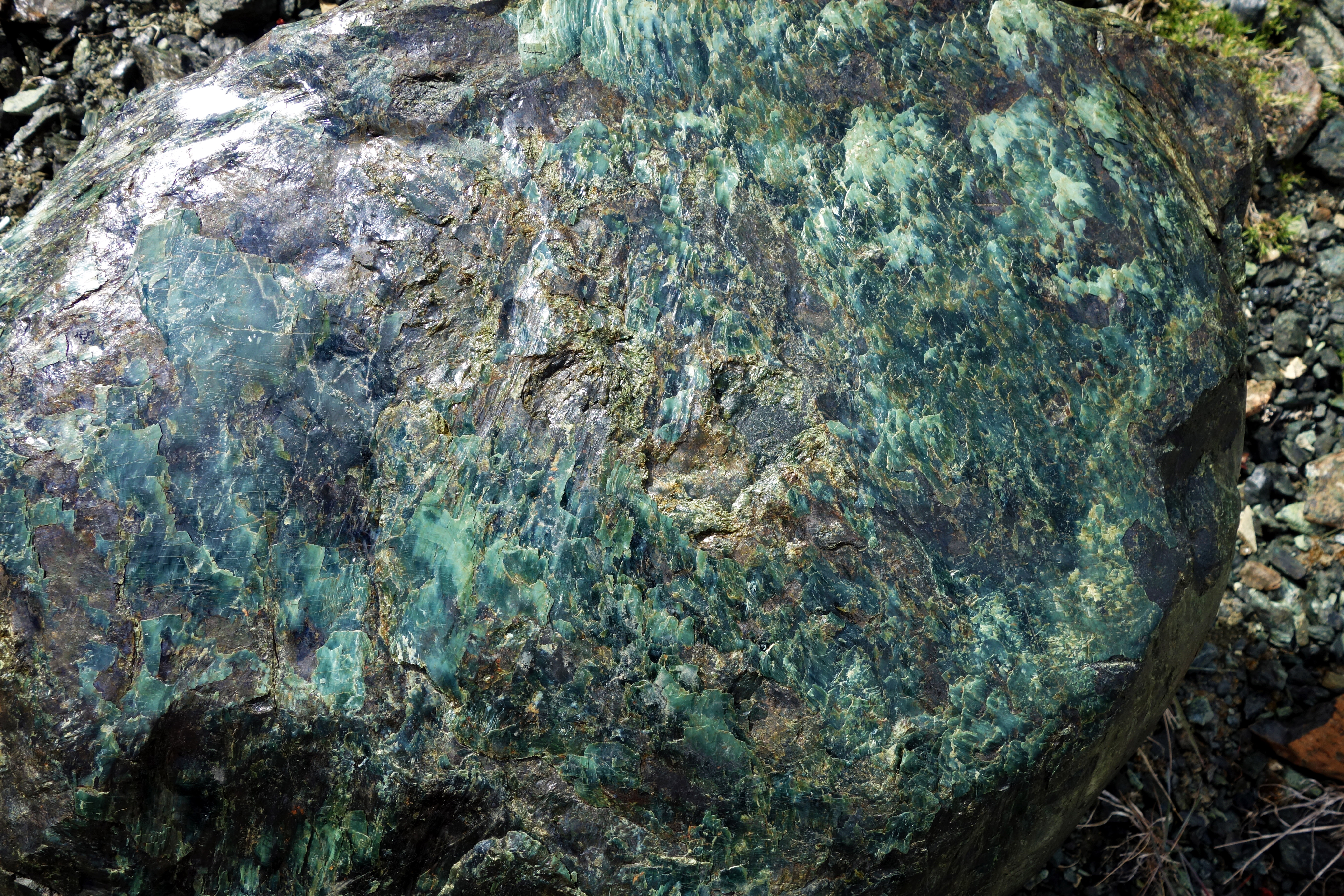
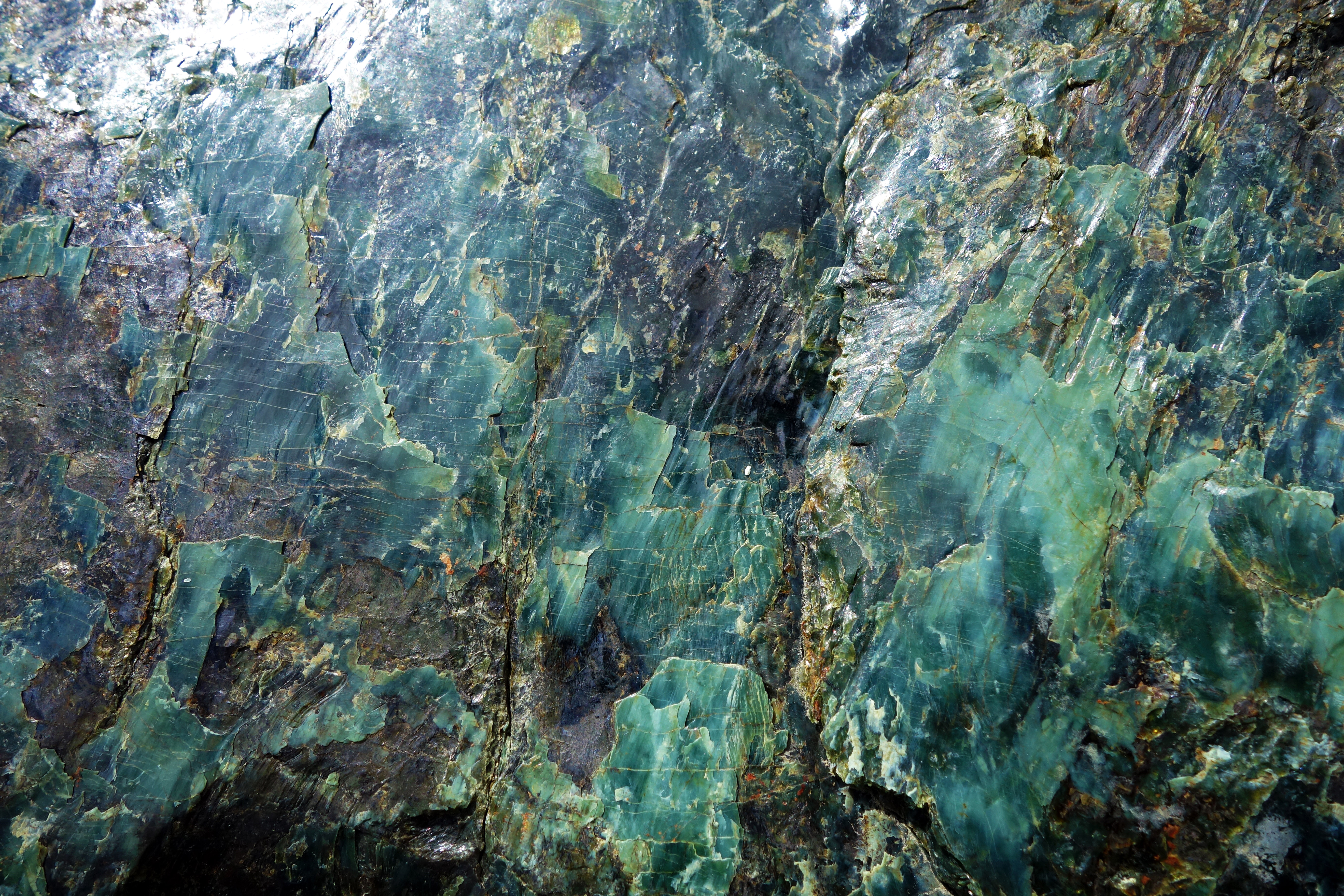
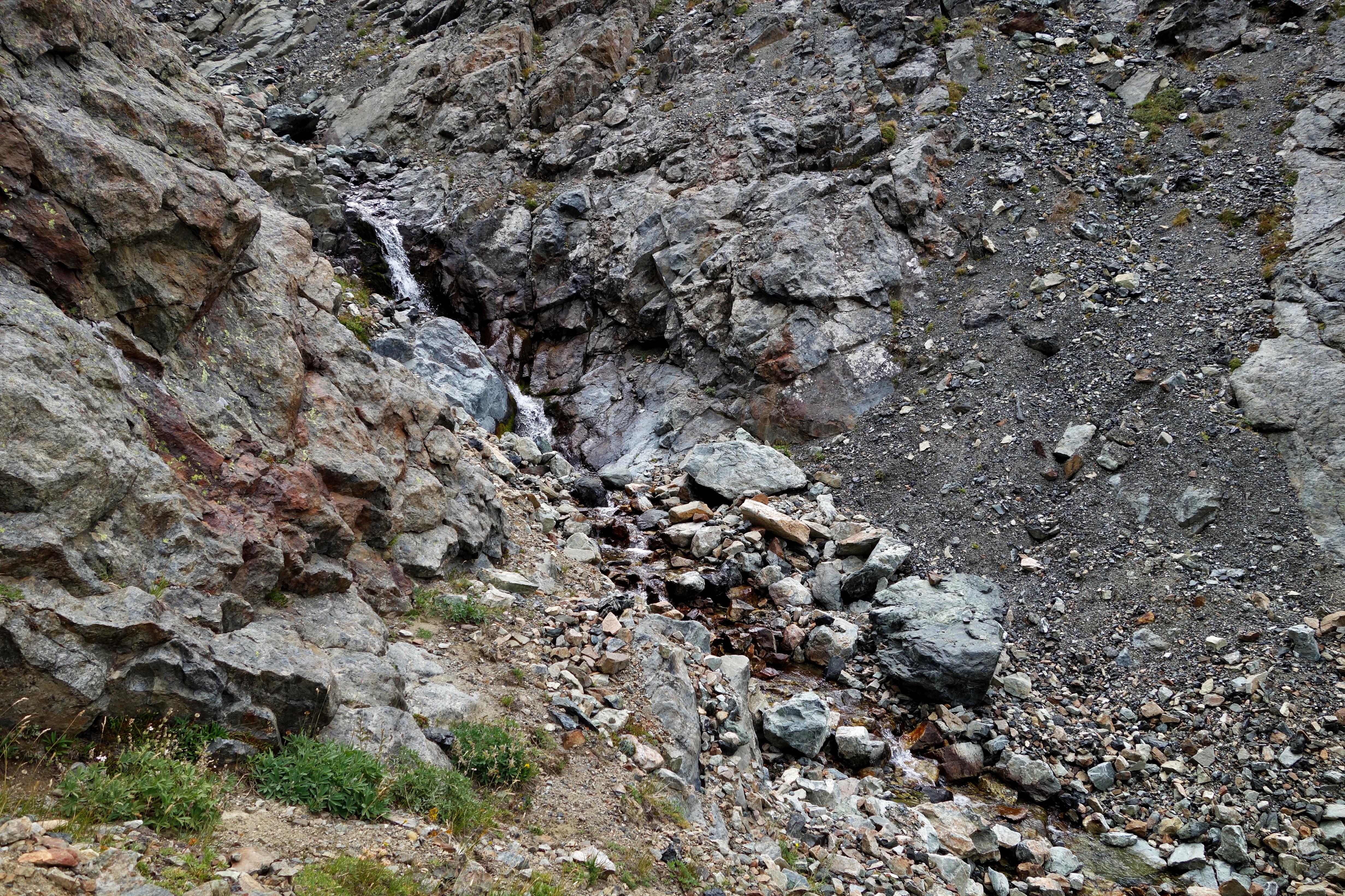
We were surprised at the amount of jade along the trail to the Jim Creek headwaters. At lower elevations, they had dull, cloudy, and unevenly textured surfaces. At higher elevations, they were intensely colored with smooth finishes and vivid root-like structures on the surfaces – likely caused by weathering:
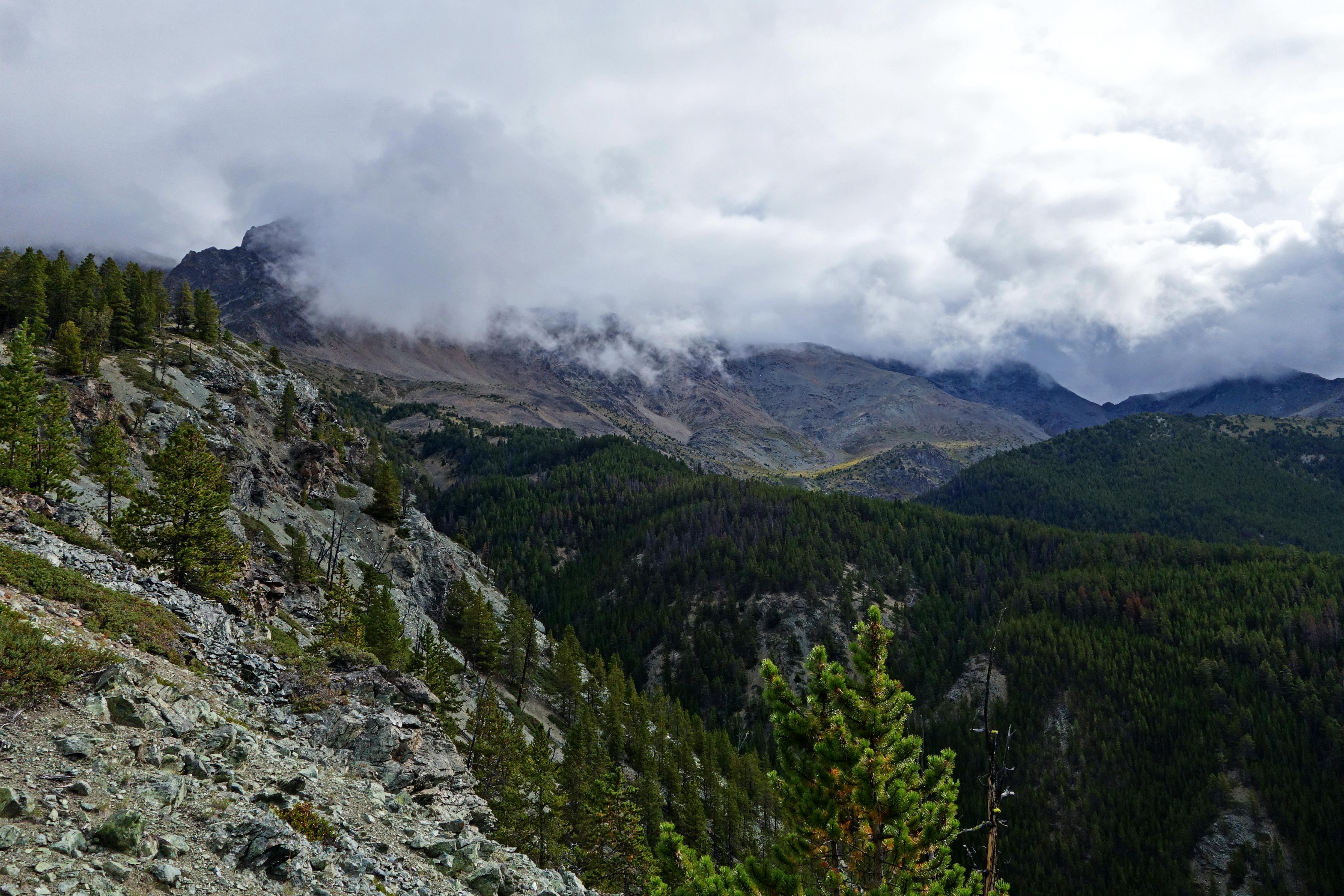
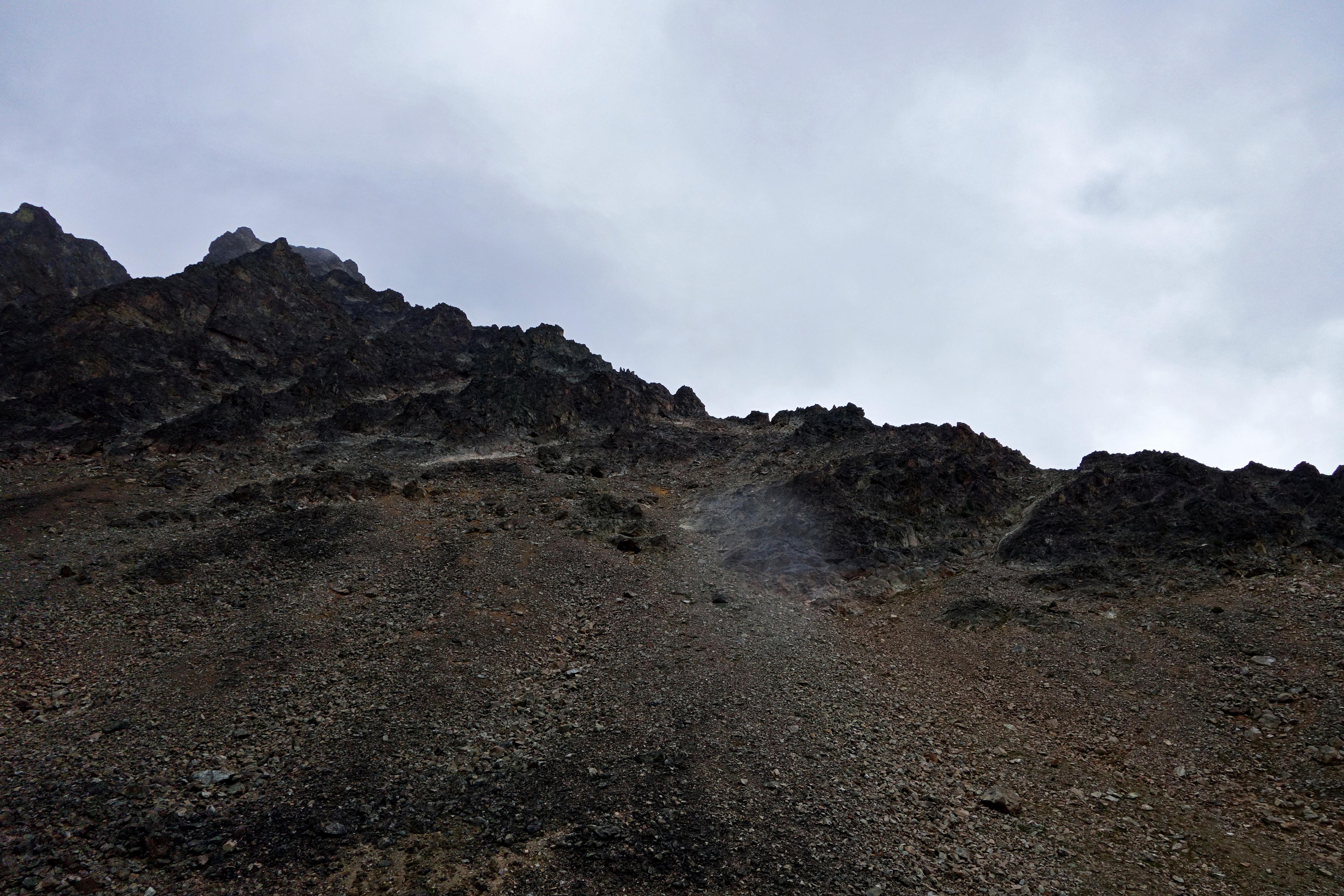
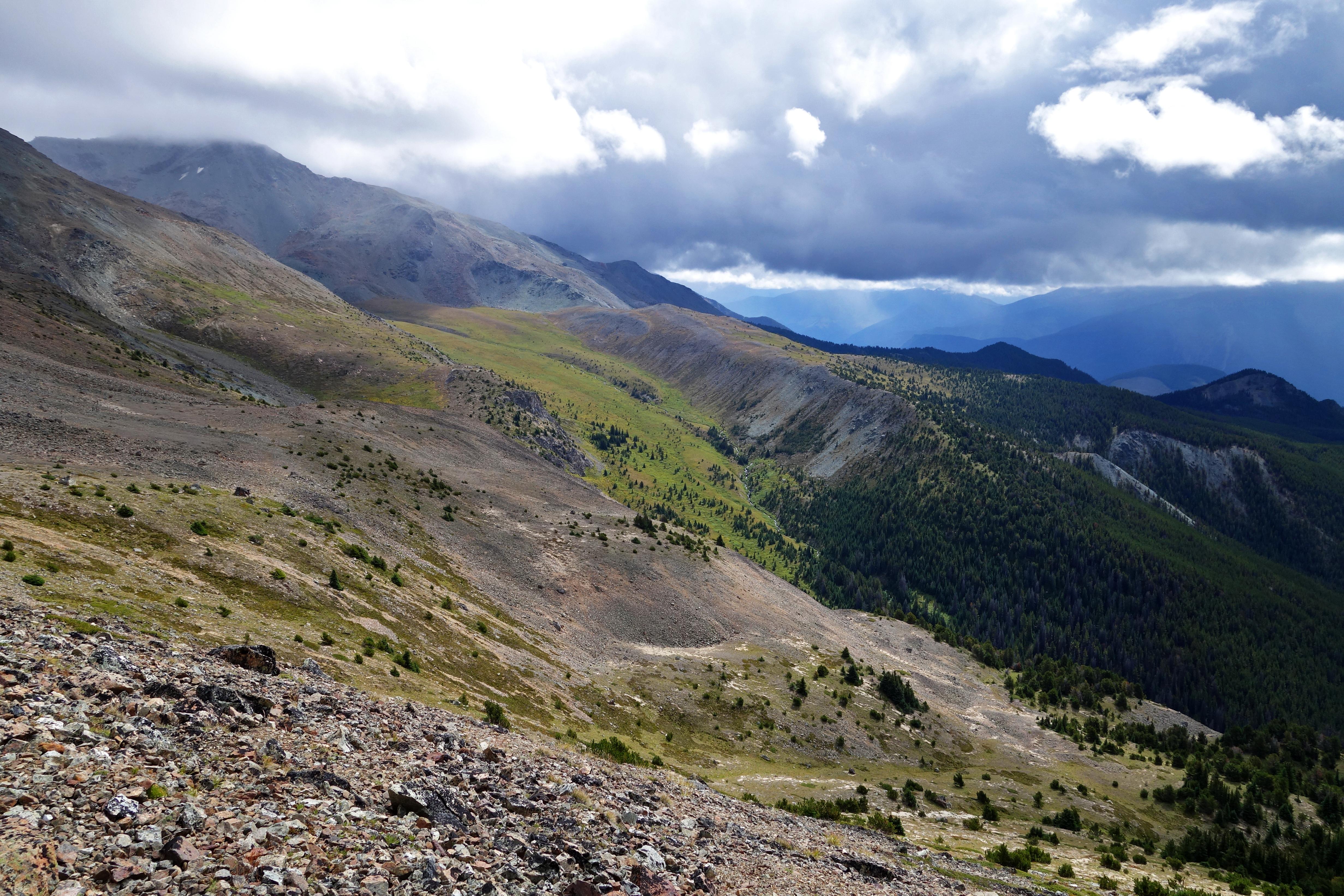
I was disappointed at the clouds and lack of views as we broke out of the trees. I was hoping they would lift so Ryan could see why I was in love with the area.
As we continued on to the headwaters, the skies started to look somewhat promising, the clouds began to lift and we caught glimpses of blue skies.

The next view became our goal for the day. The plan was to continue to the headwaters, explore around, and then double back to these switchbacks and hike up the ridge.
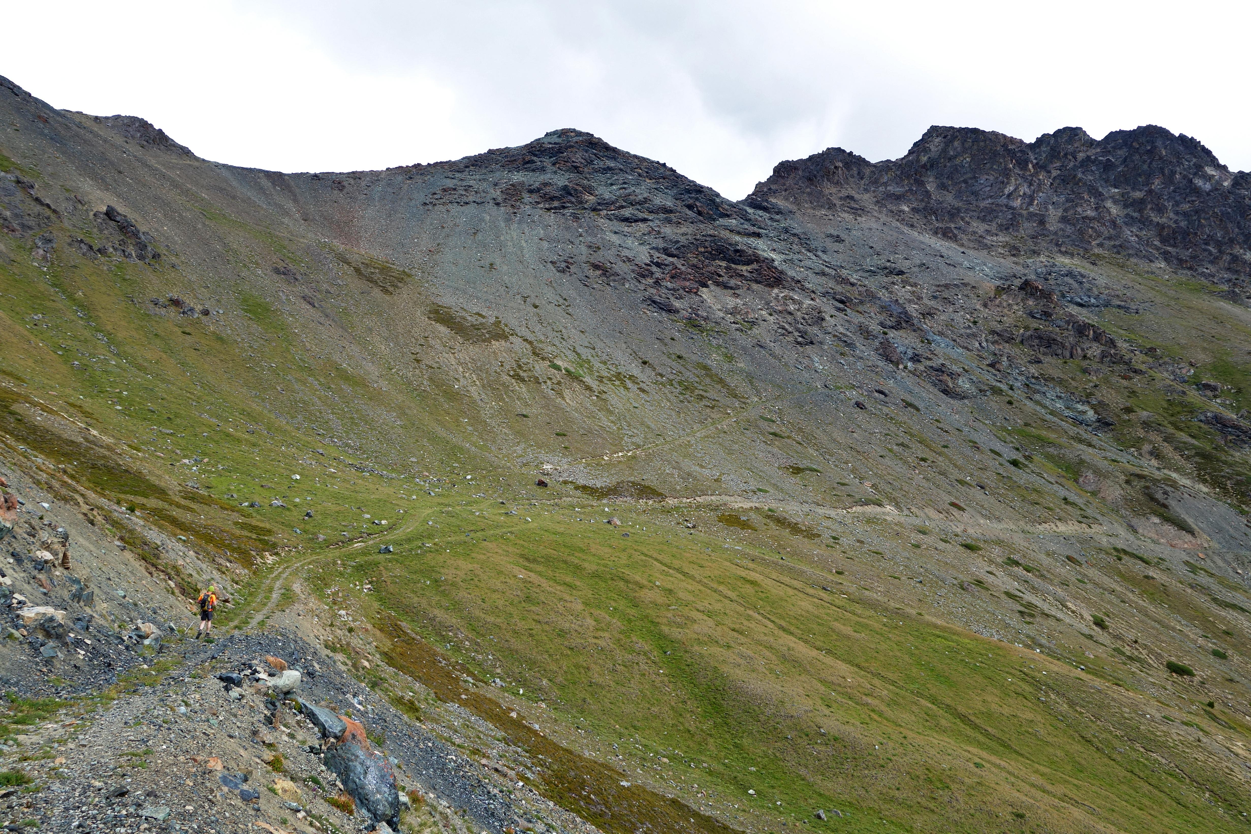
Finally, Jim Creek headwaters:
We poked around for a little bit and I noticed a trail switchbacking up to a short ridge, just east of the headwaters. Assuming it wouldn’t take long to detour for potentially good views, we headed for the trail:
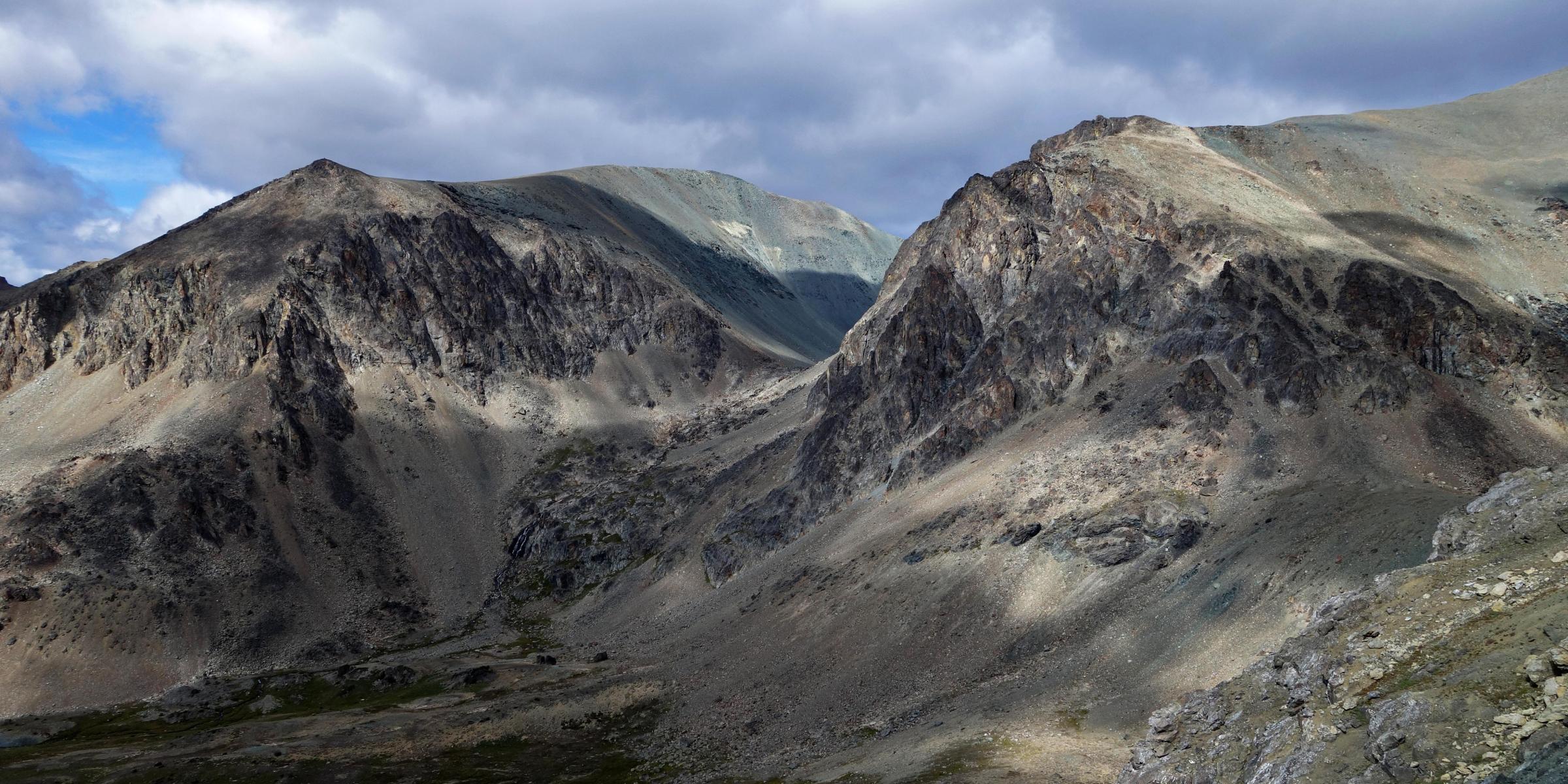
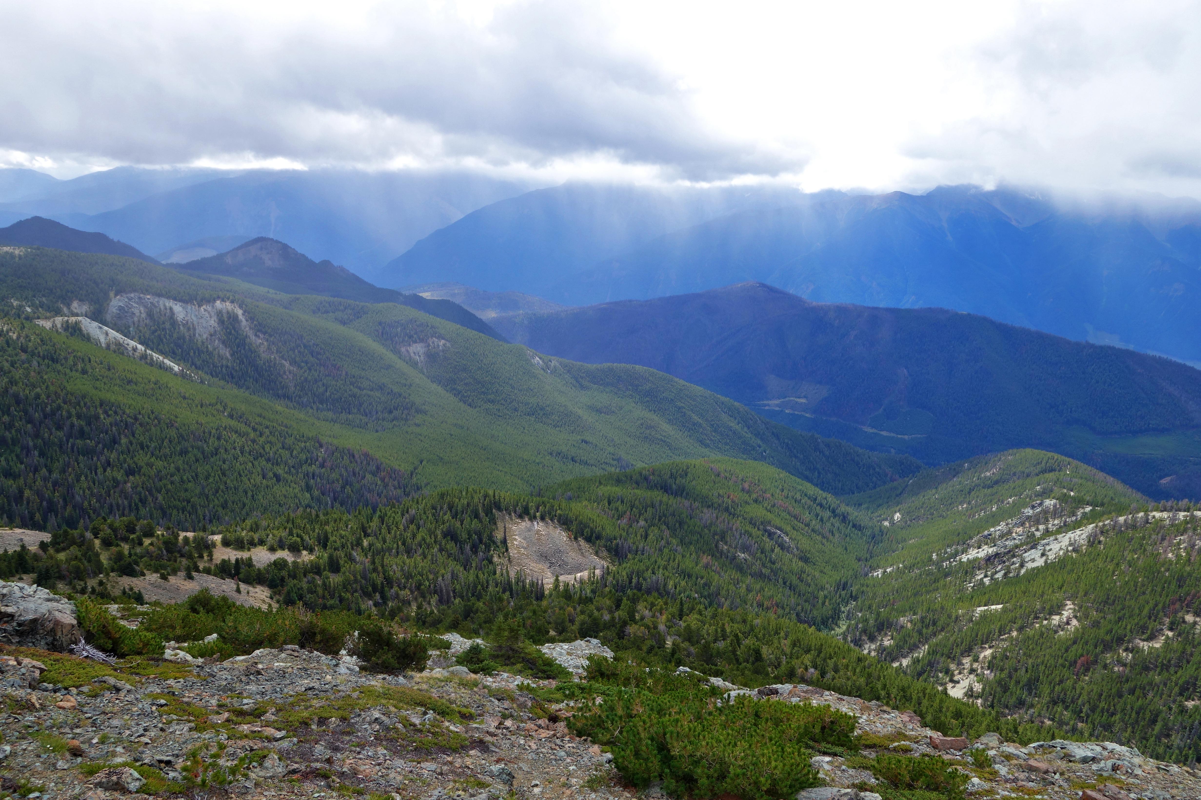
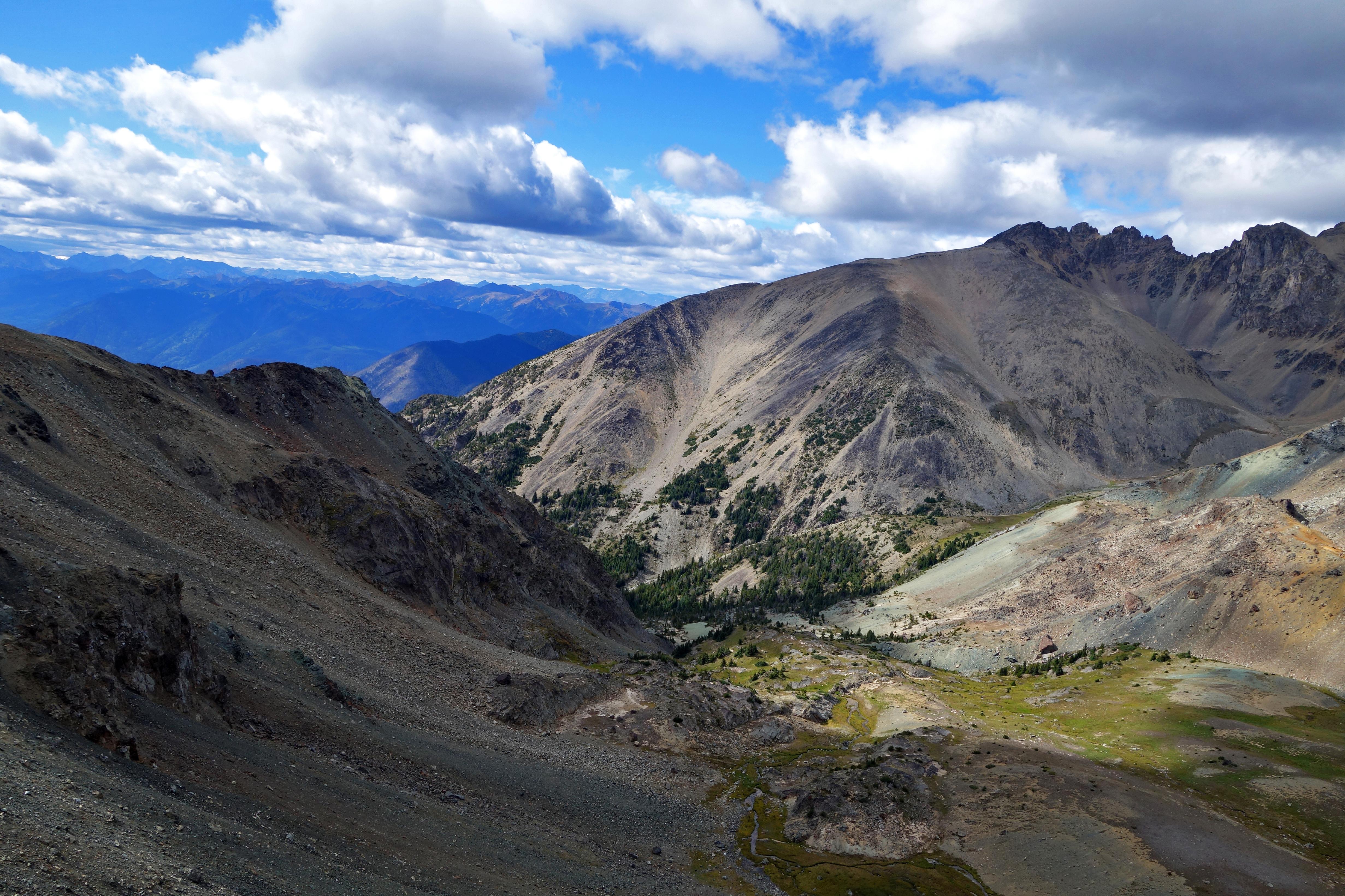
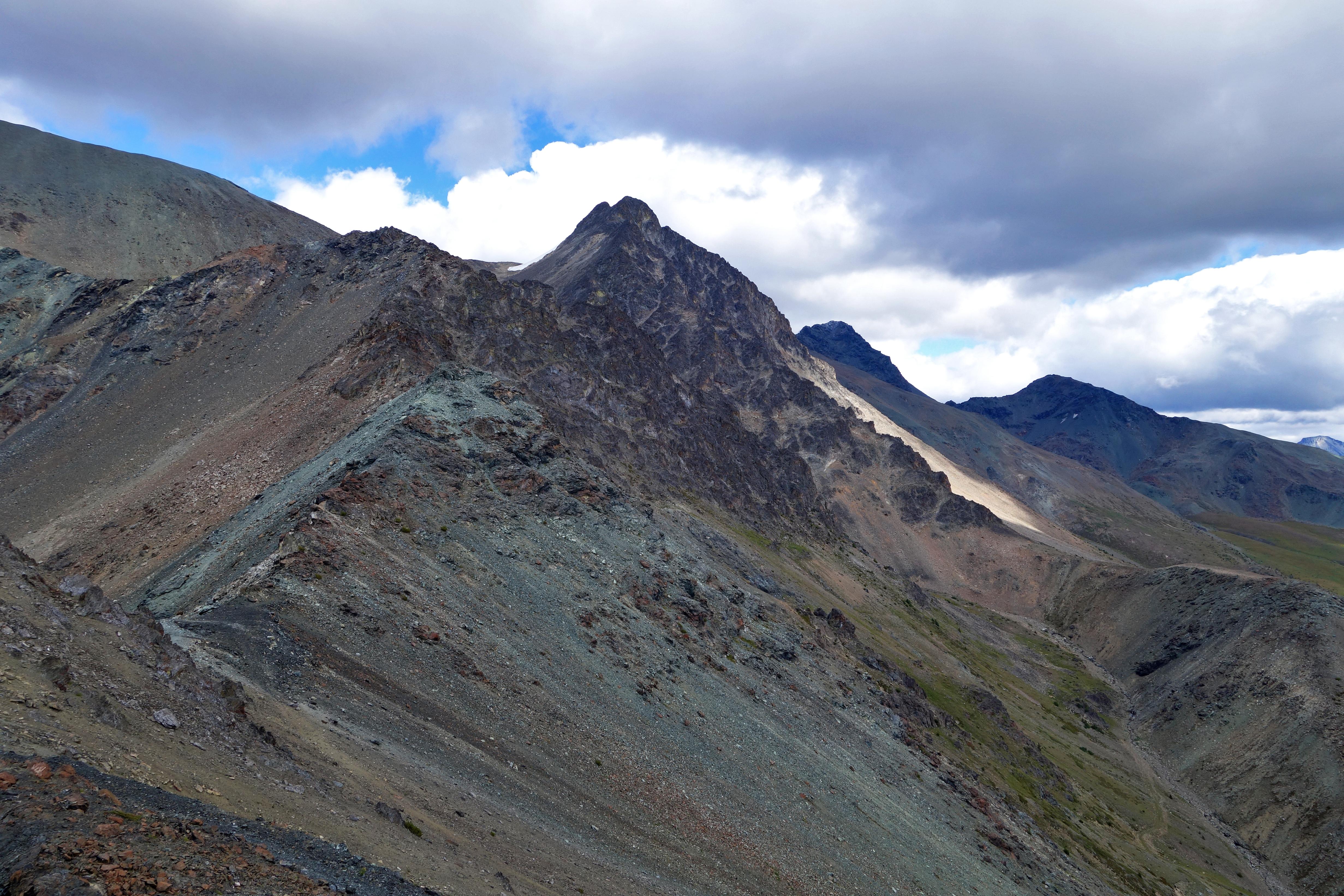
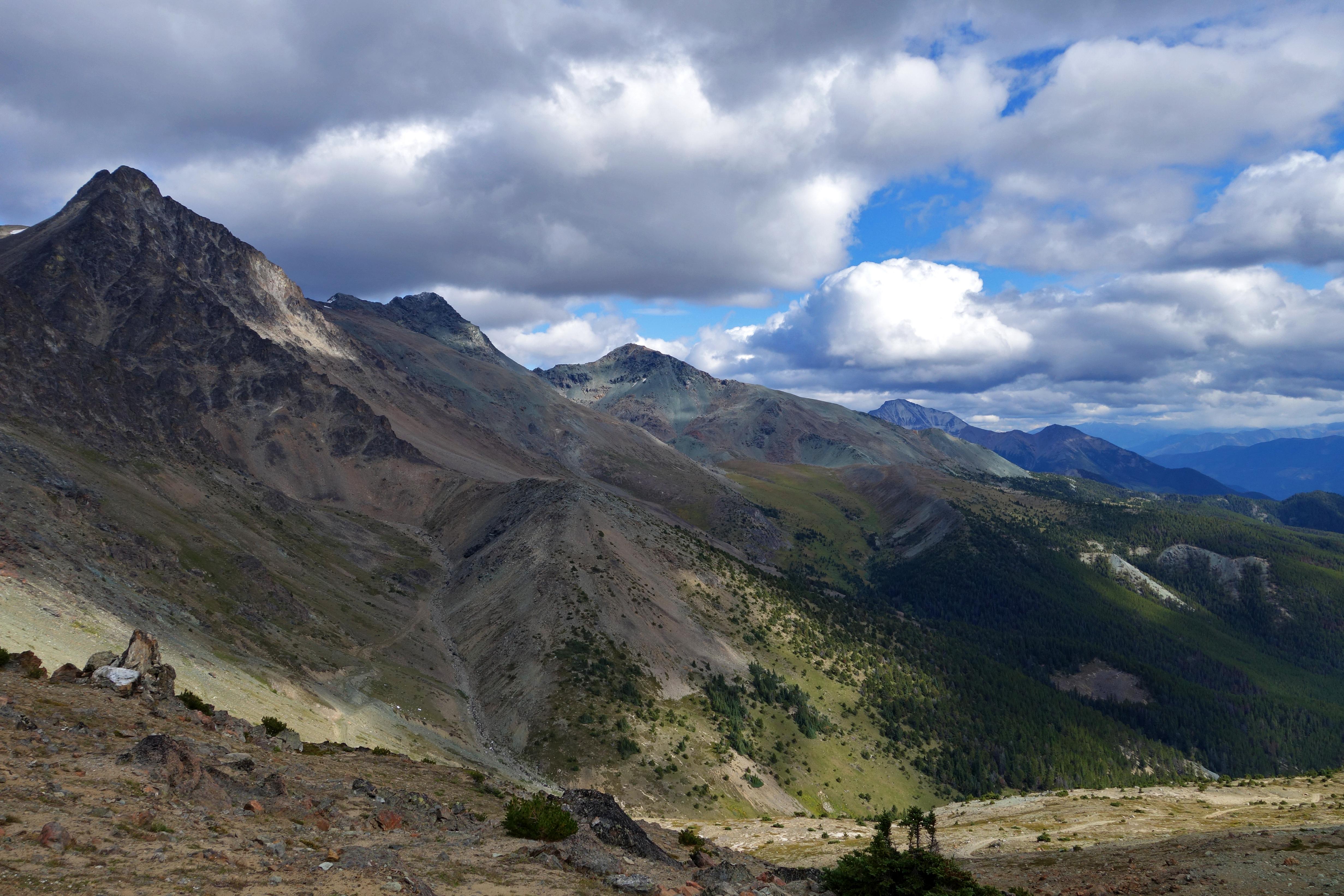
Once we reached the top, we heard what we thought were wolves in the next valley over. The views from the ridge were magnificent. The clouds somewhat lifted, letting rays of sun filter into the valley. The sun highlighted some areas while the clouds casted shadows. To complete the picture perfect view, it started to snow!
The views:
Pano:
After soaking up the views, we headed back to the junction for our original plan of ridge walking.
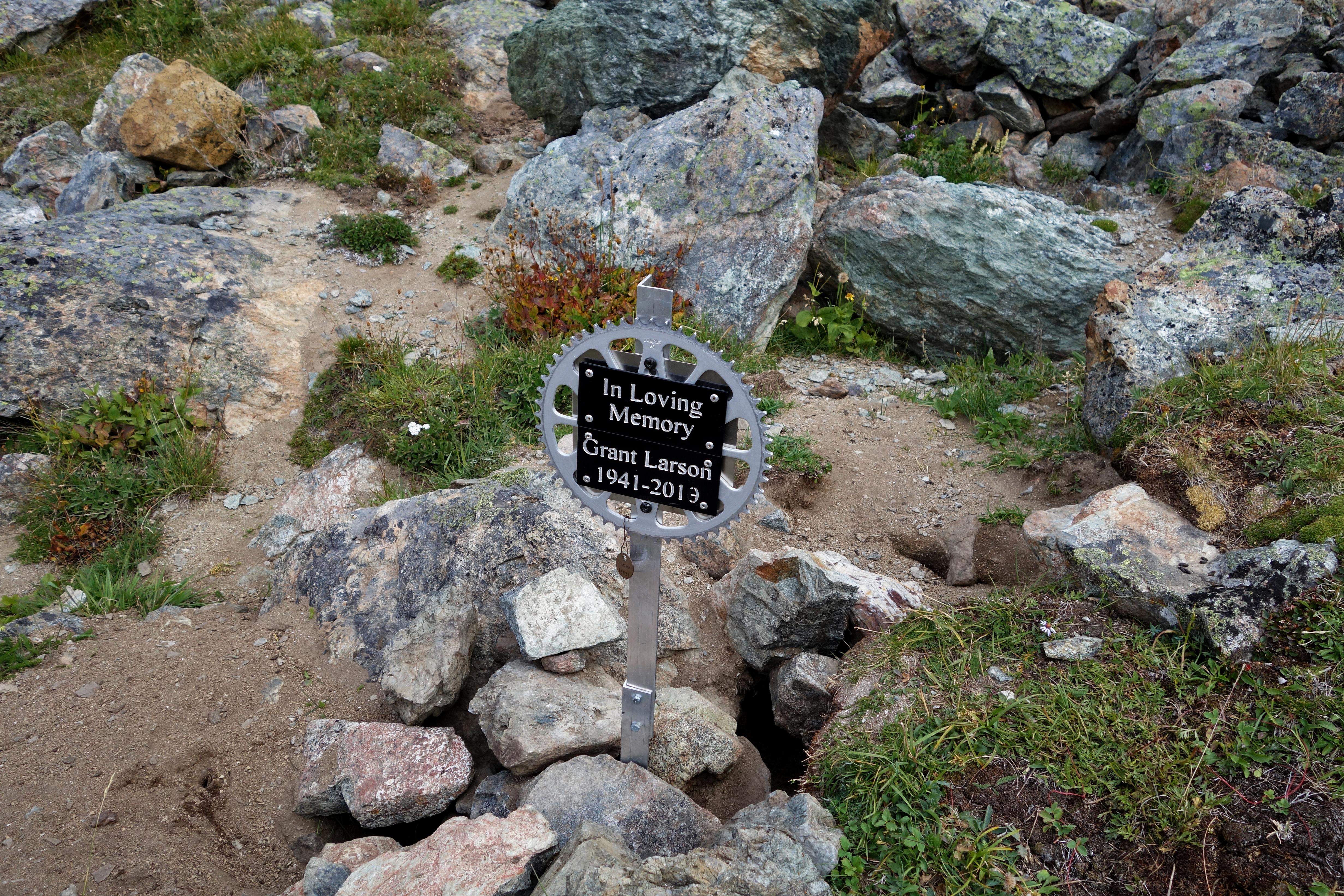
Memorial along the way:
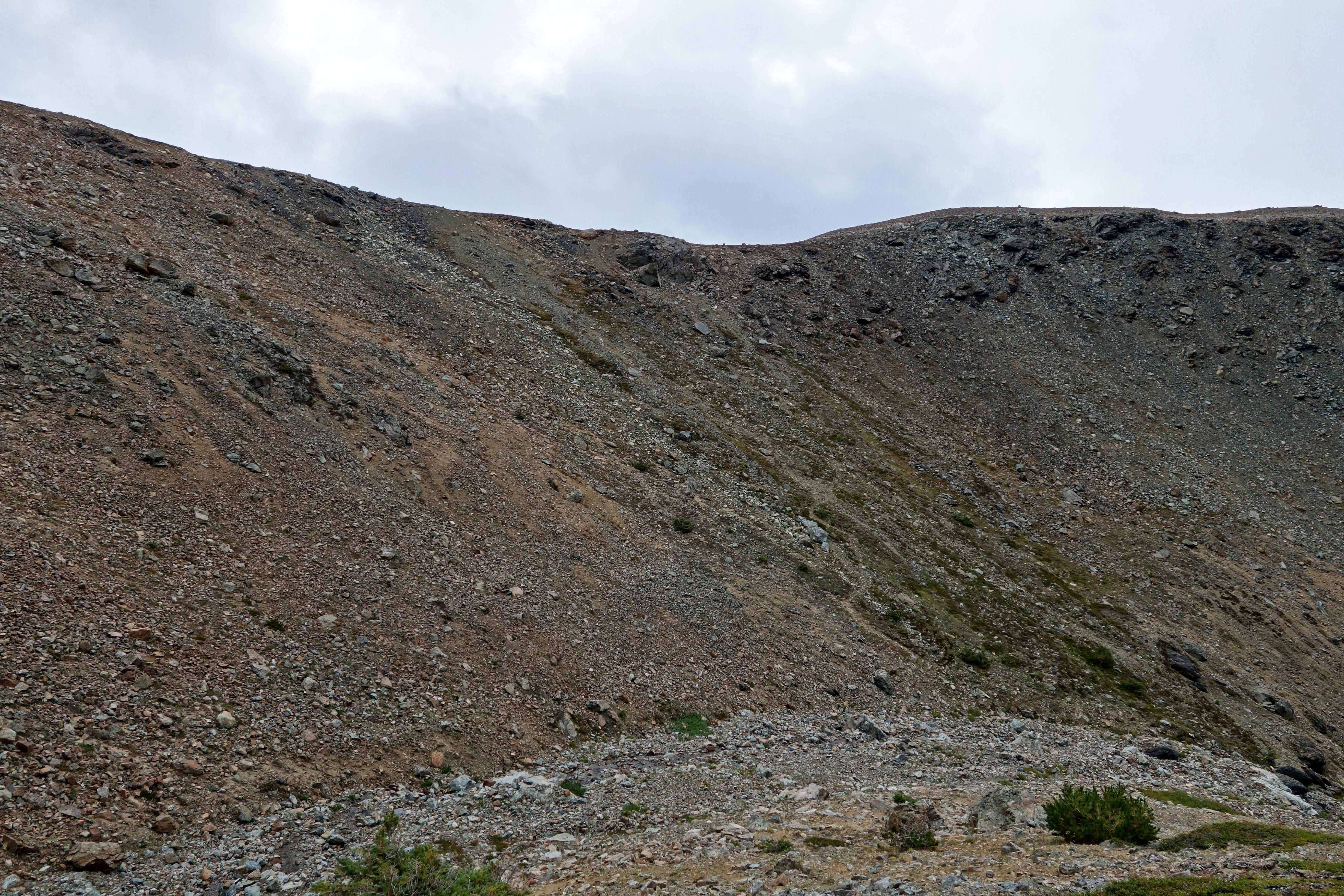
Instead of following the switchbacks, I thought it would be a good idea to go straight up. I soon realized this was a terrible idea for a few reasons: the steepness, the high altitude, the loose scree, and the fact that I was recovering from low blood sugar levels.
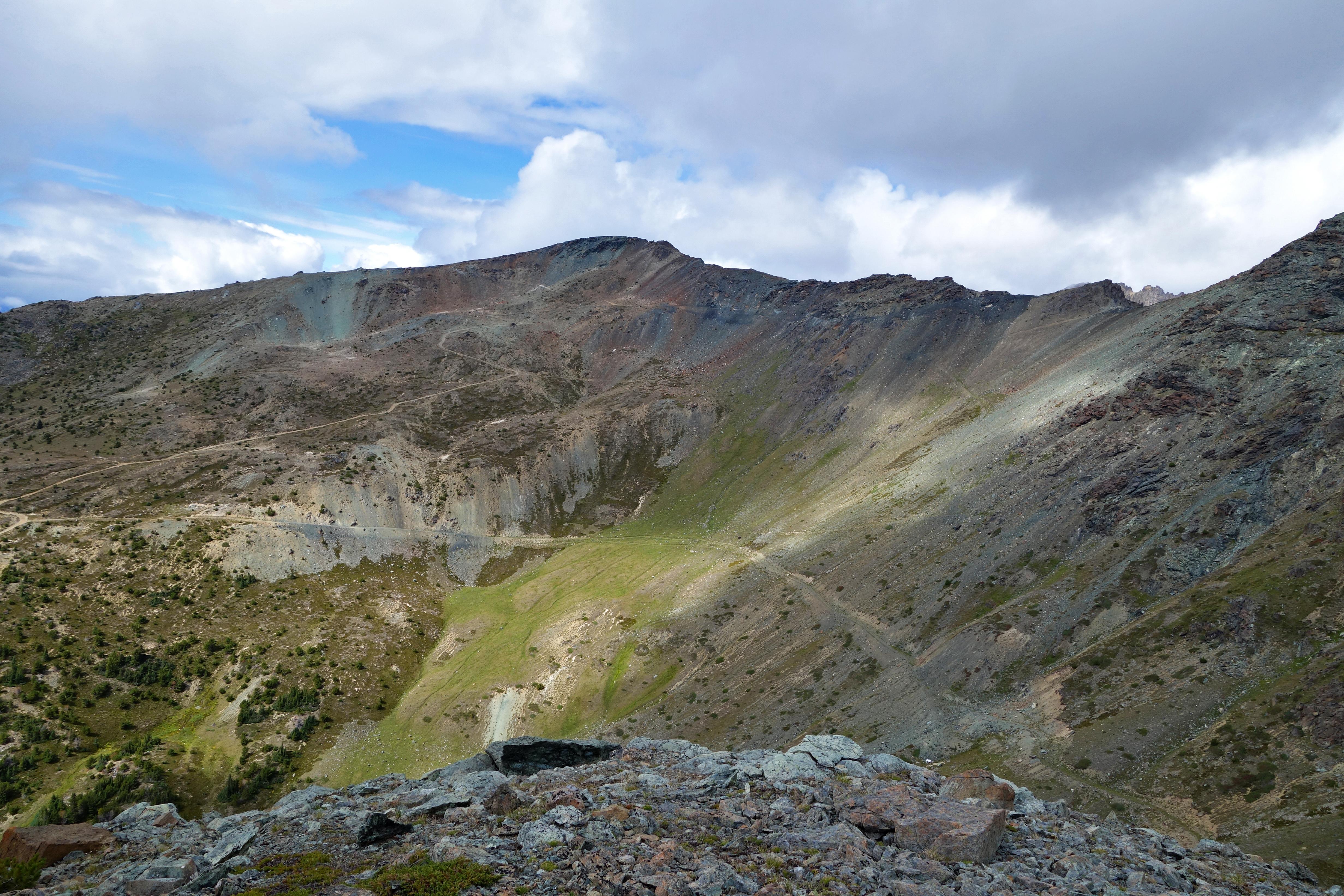
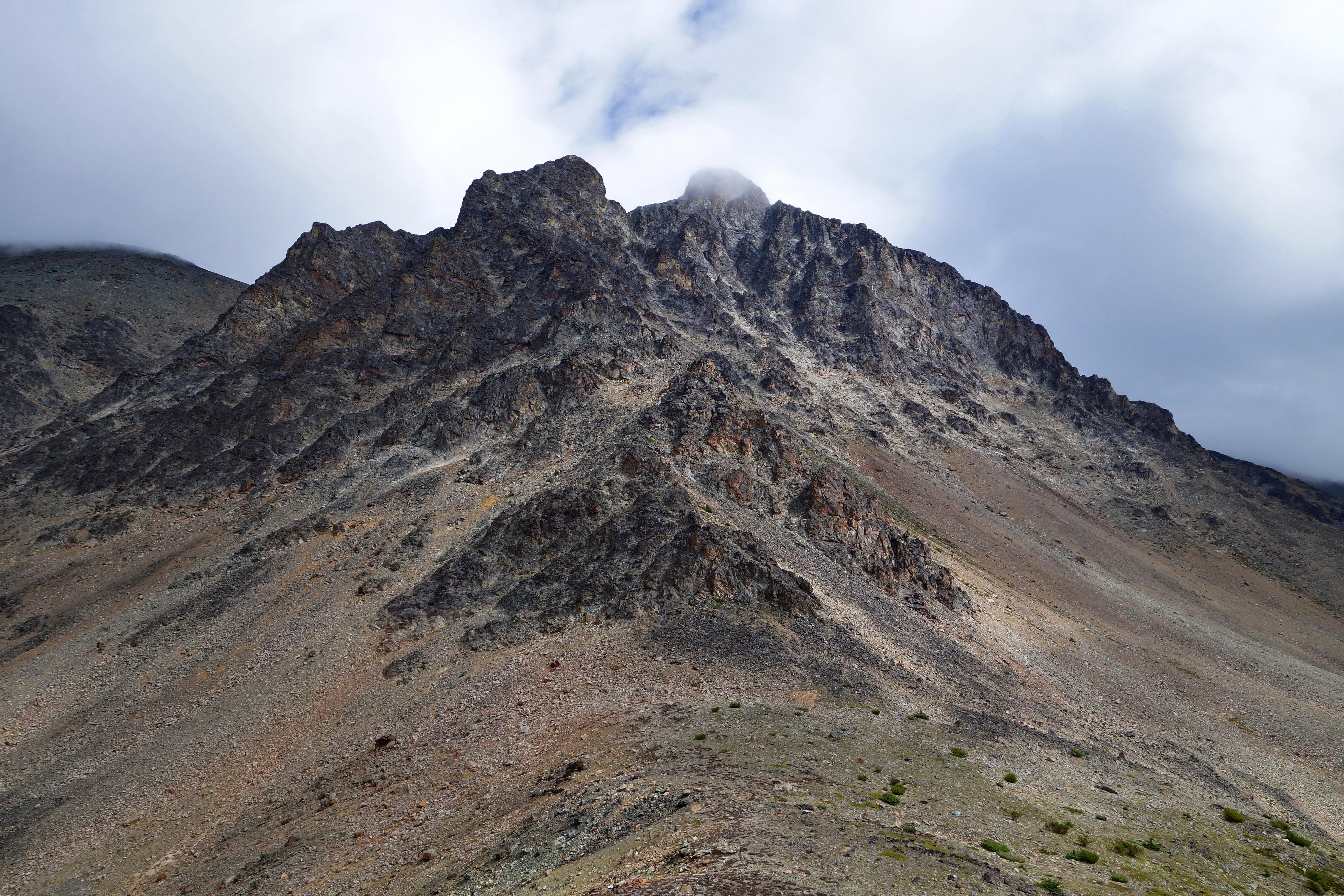
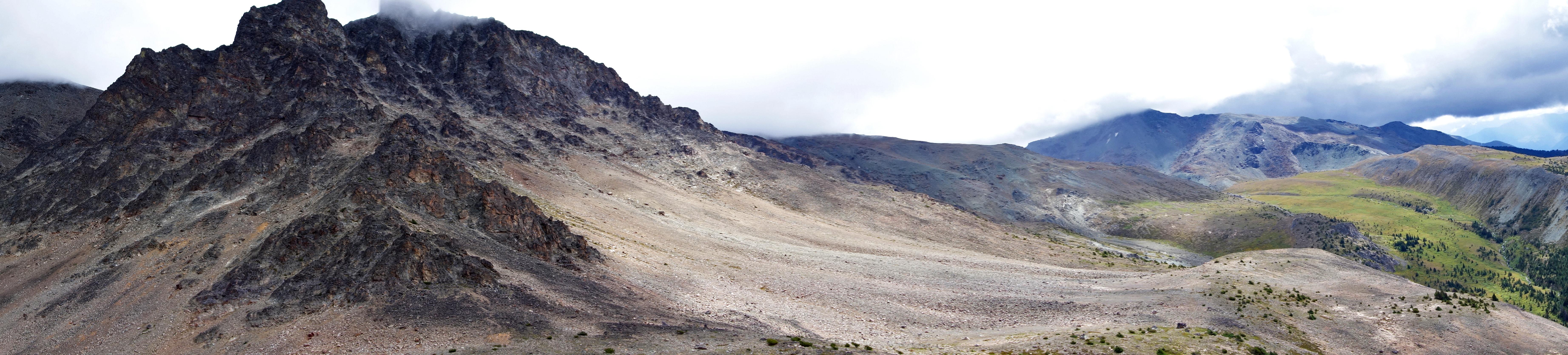
Soon enough, we made it up. As we topped out on the ridge, I looked around and realized there was no where to go, but everywhere. I was stunned by what we saw:
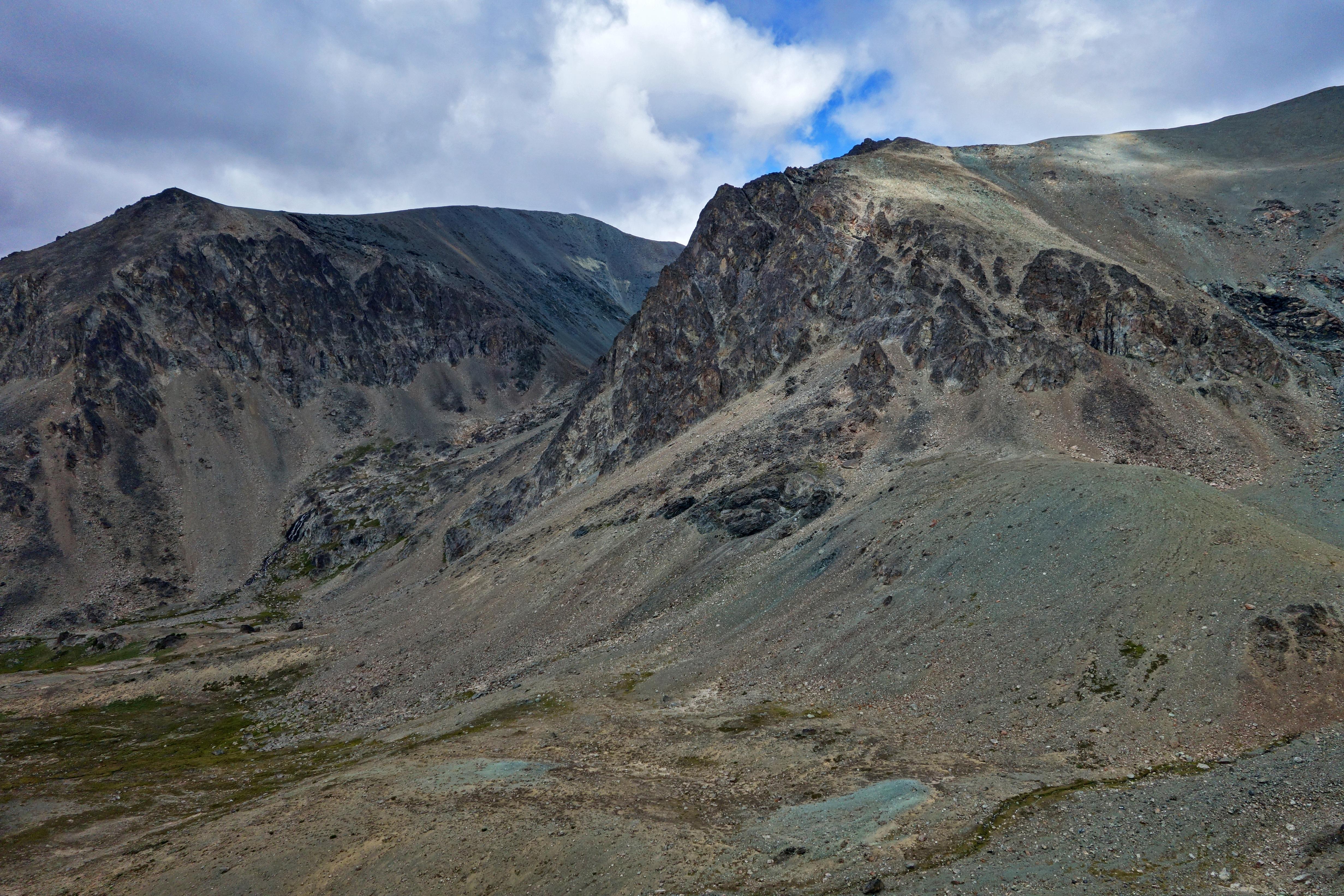
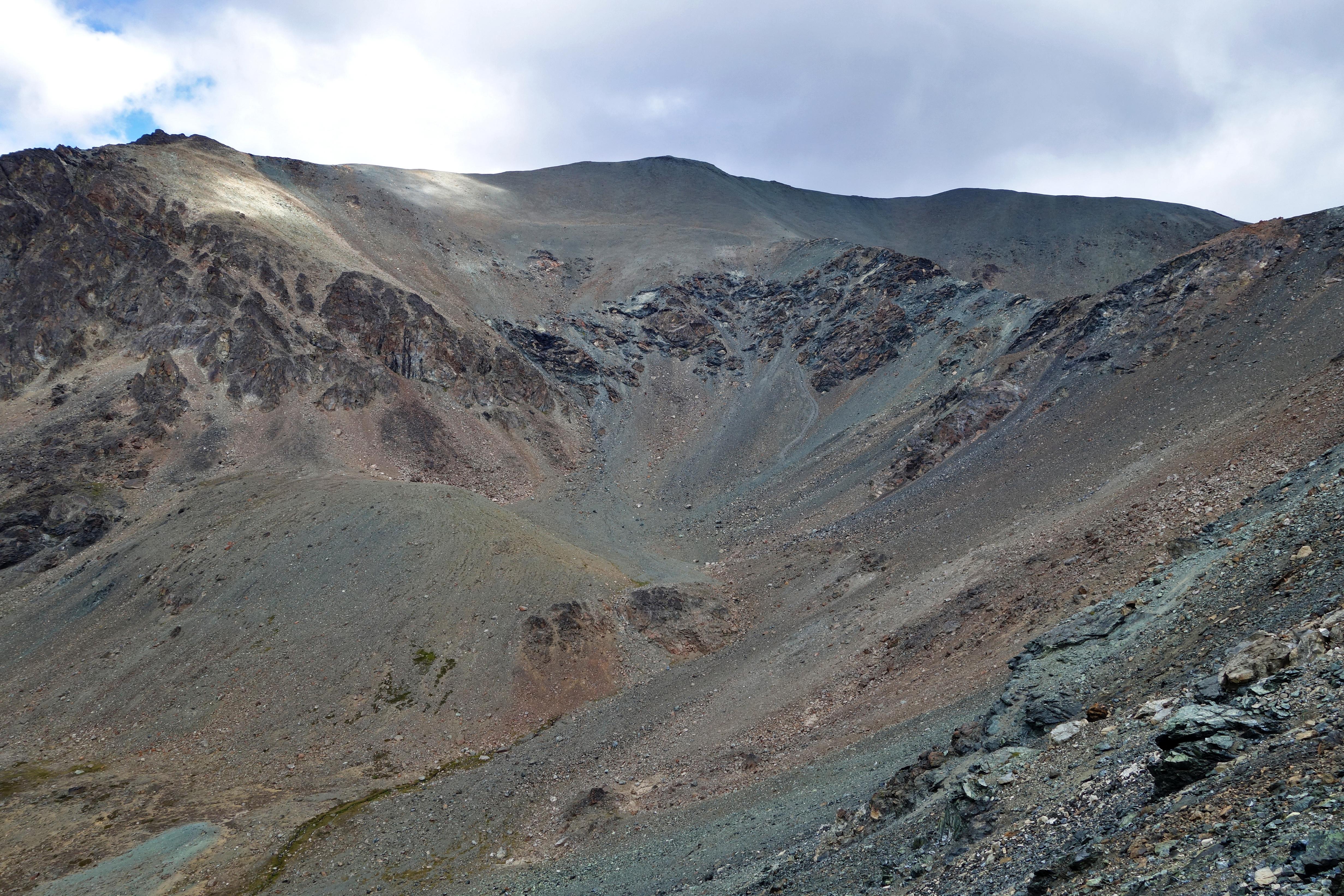
I realized Google Earth did not translate well into what I was staring at. We were a long ways away from reaching the Shulaps summit and this ridge was not a viable route. However, it opened up so many more possibilities.
Jade filled slopes:
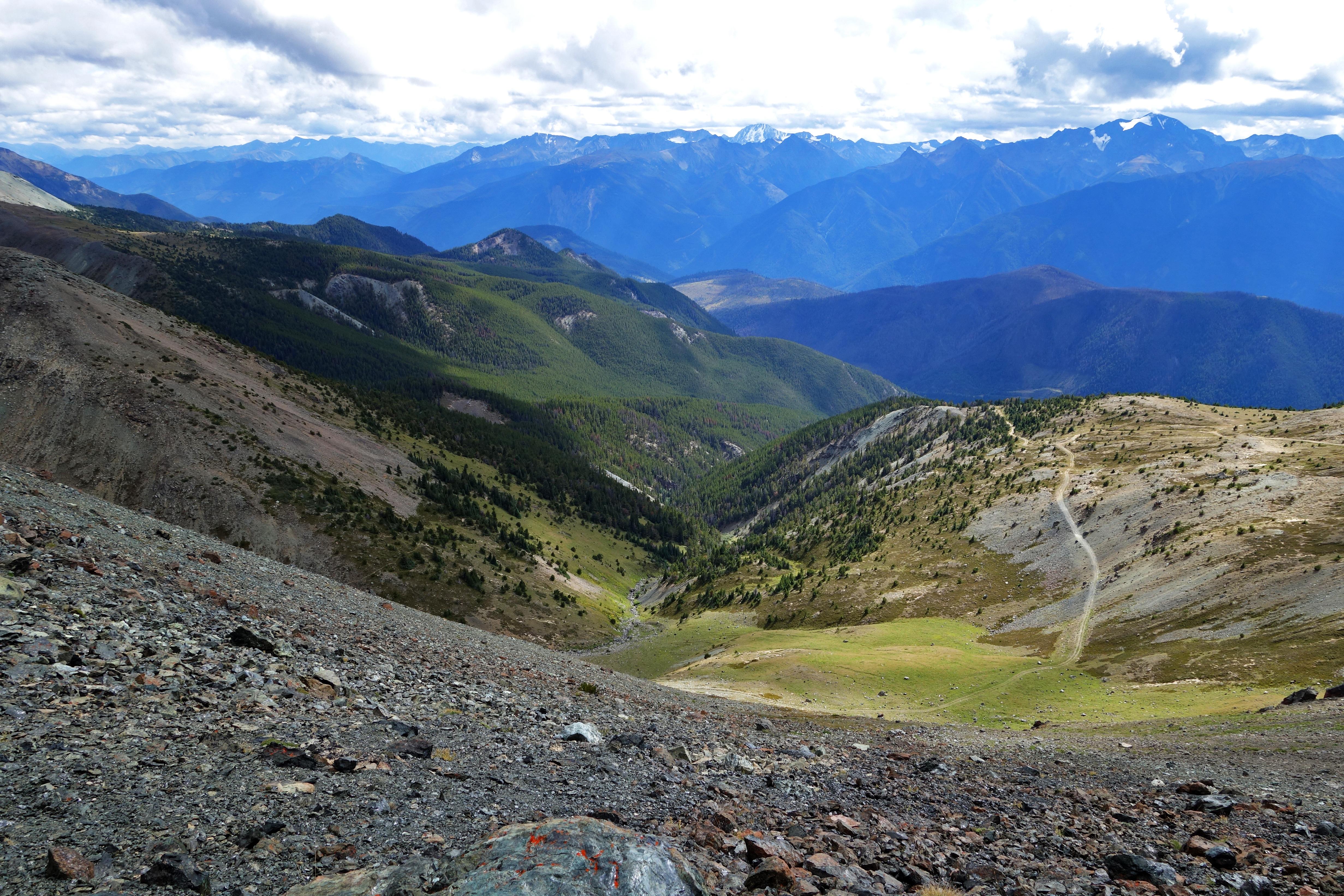
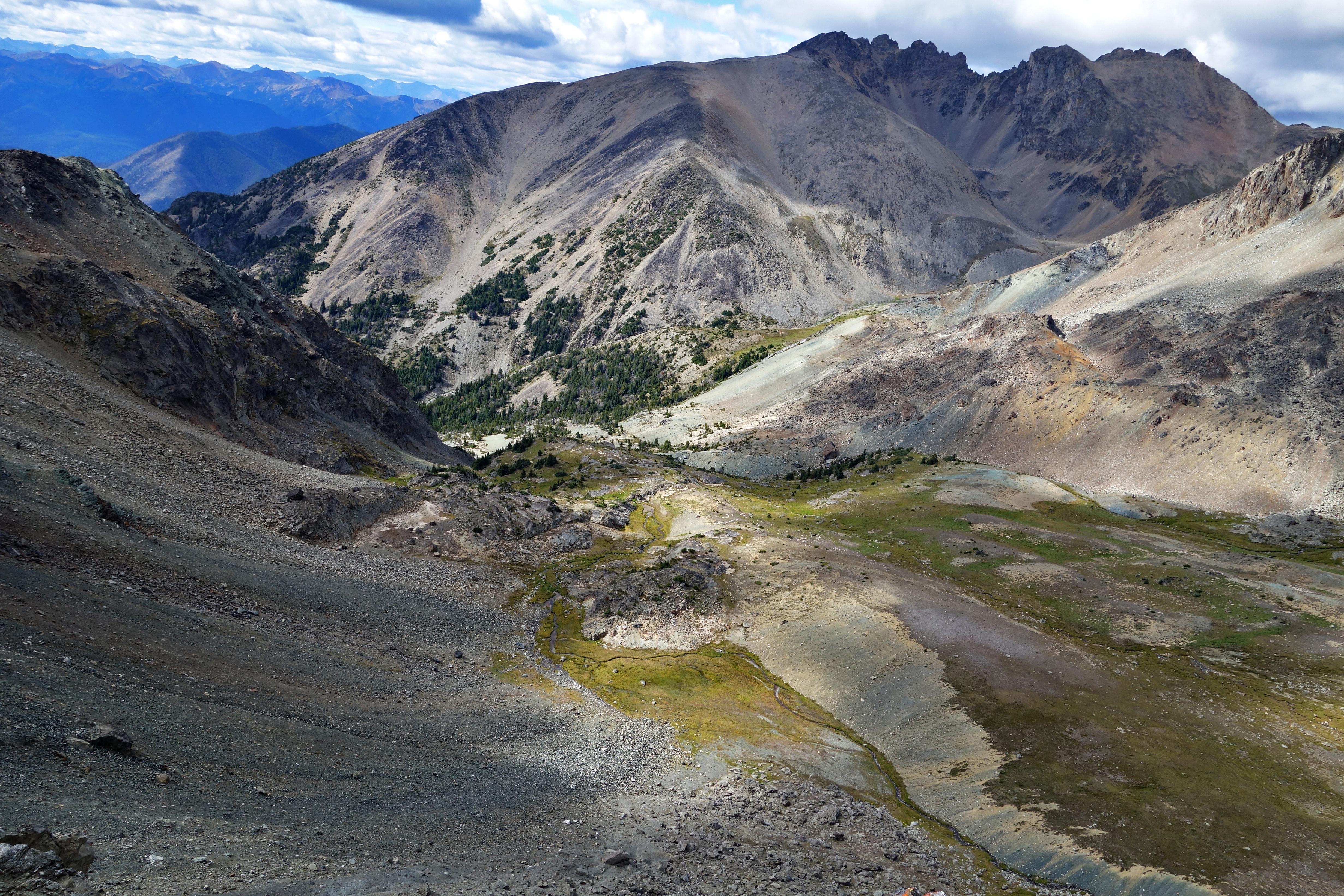
More views beyond the ridge:
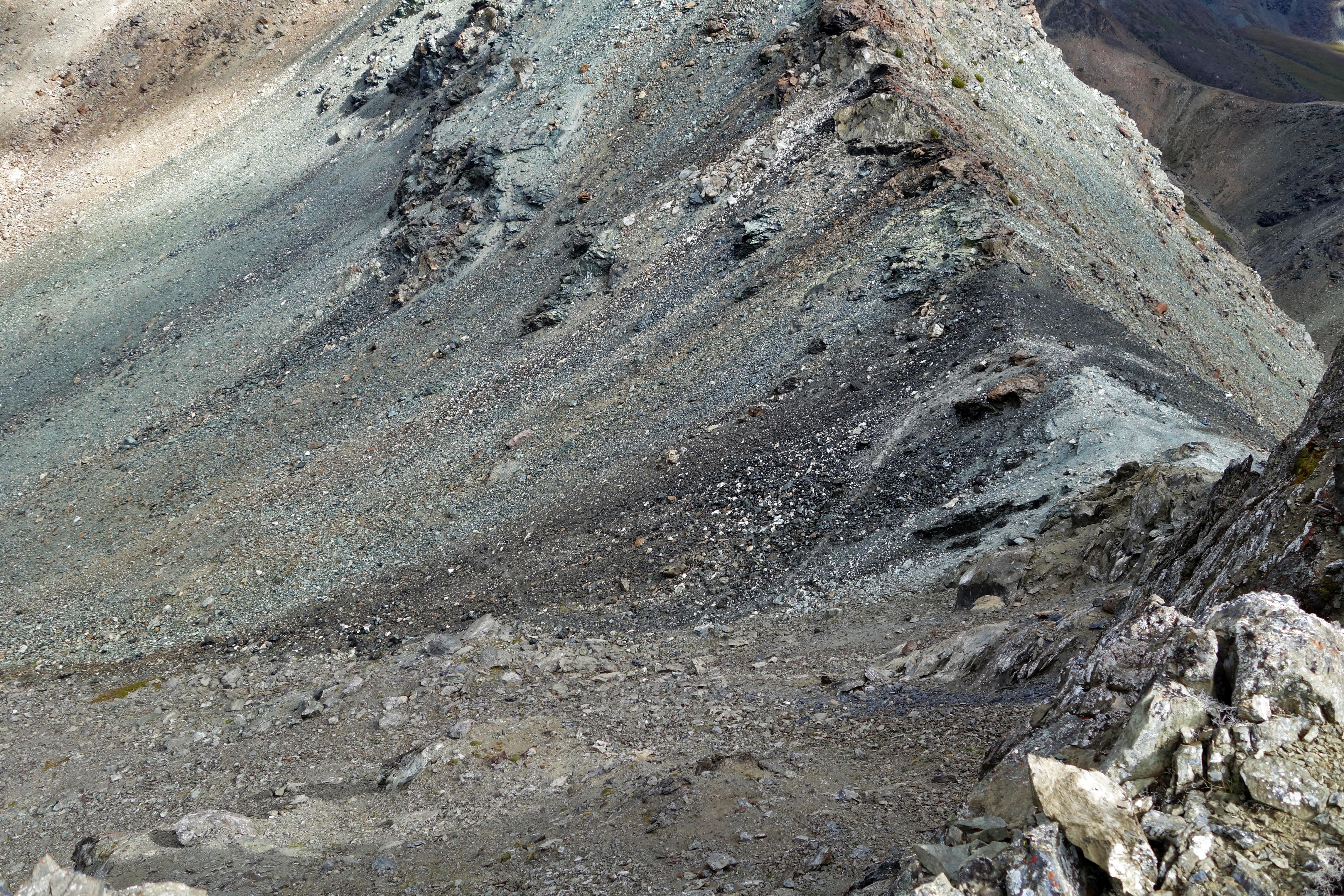
Spot the continuing trail:
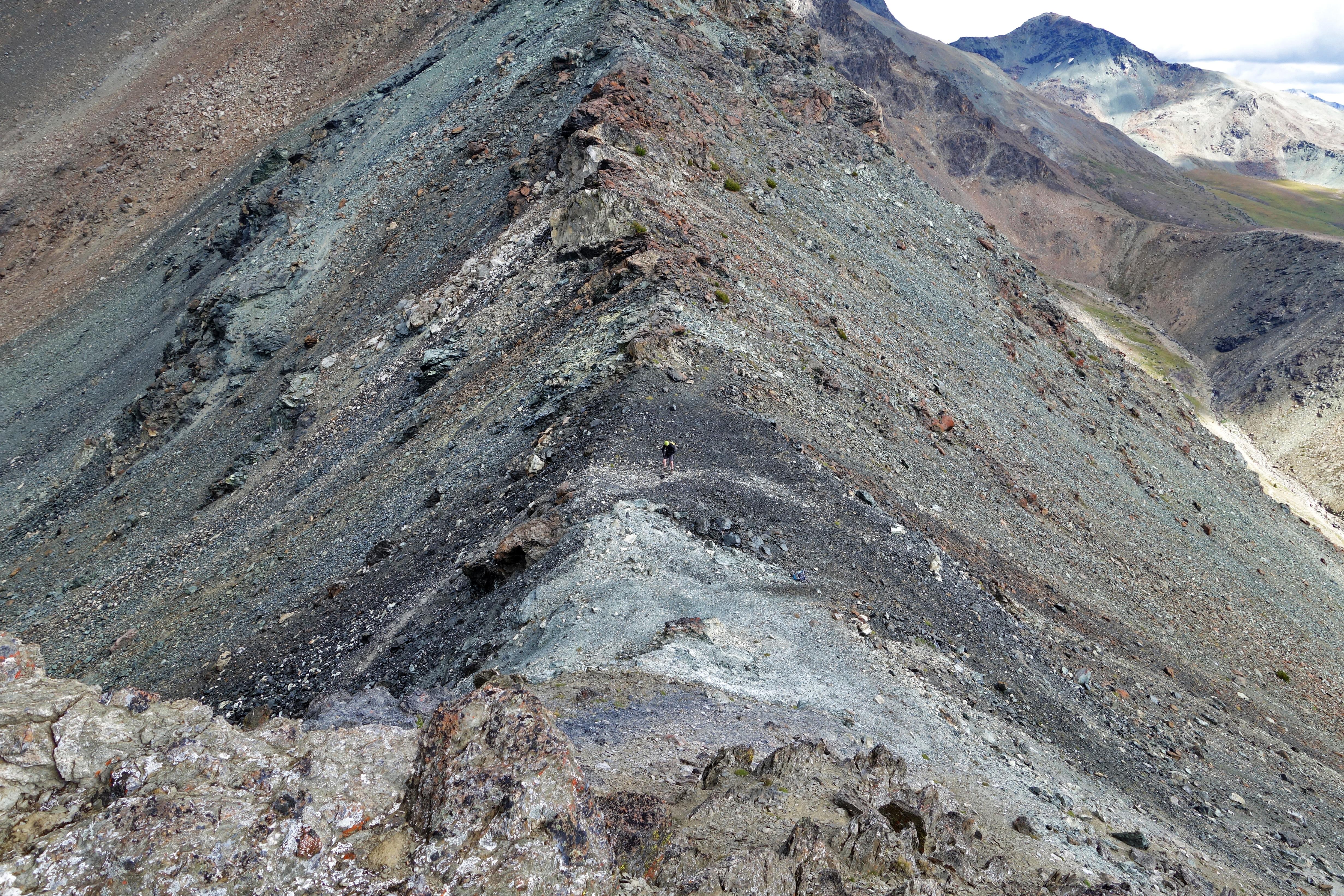
Where’s Ryan?
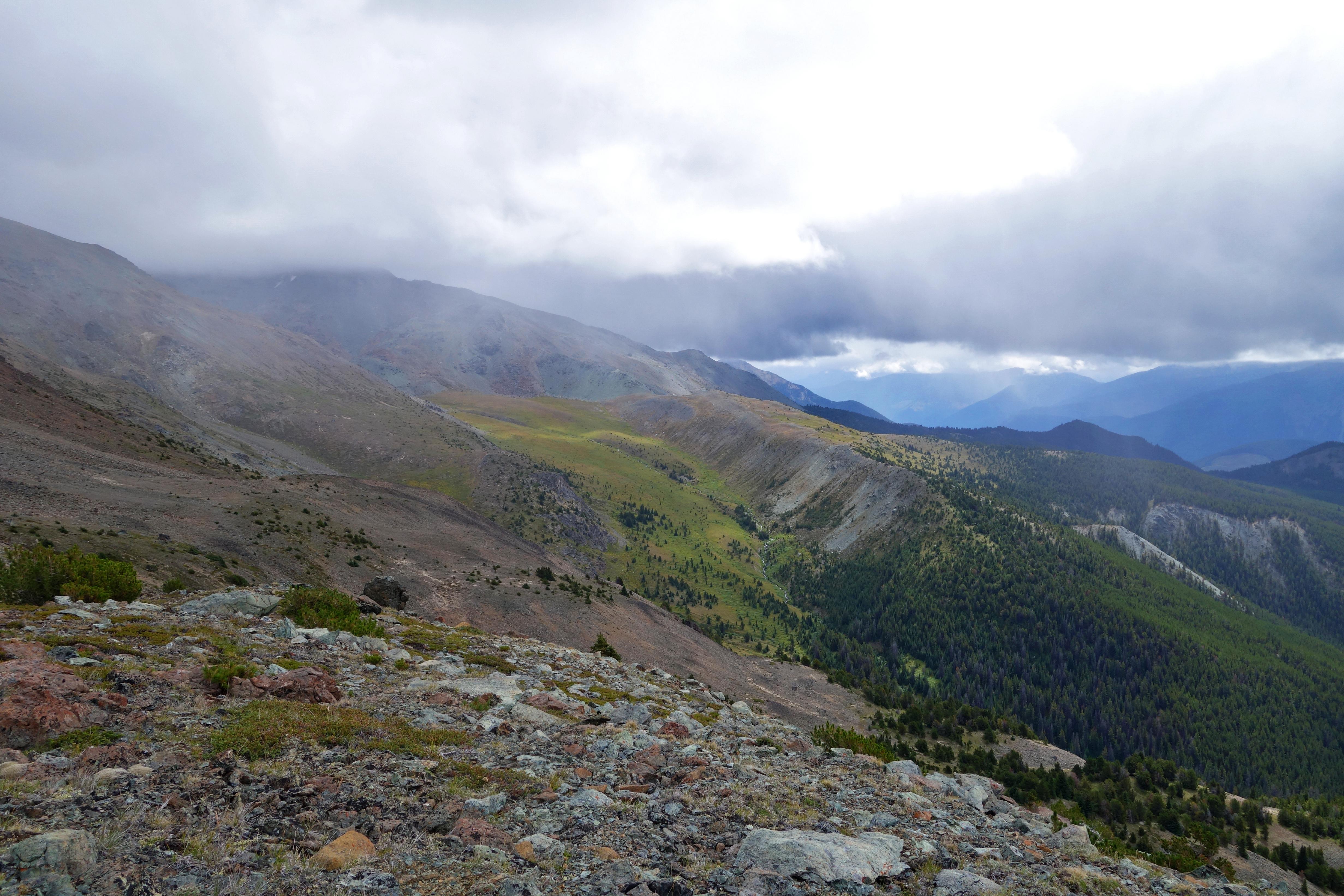
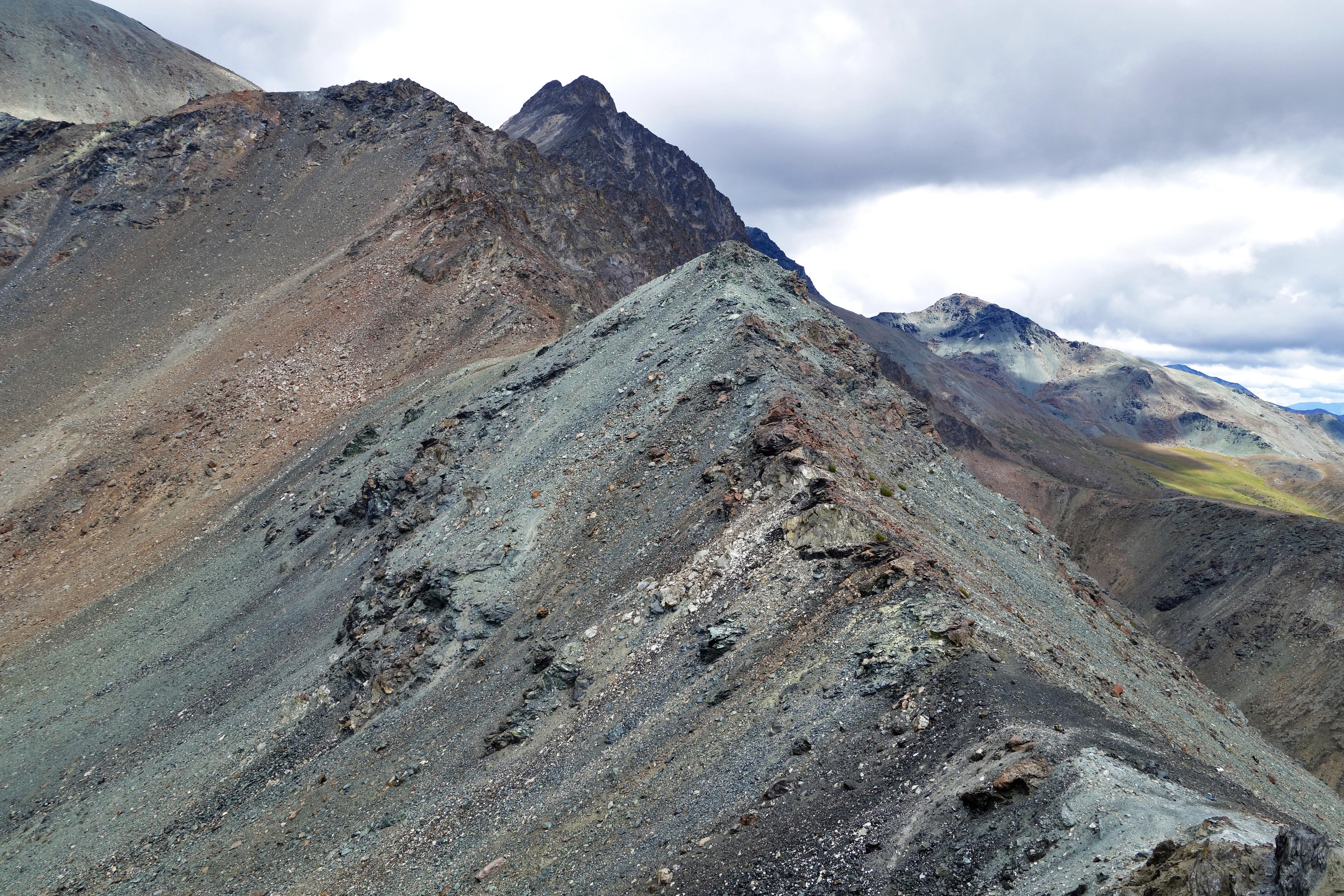
Views from the high point on the ridge:
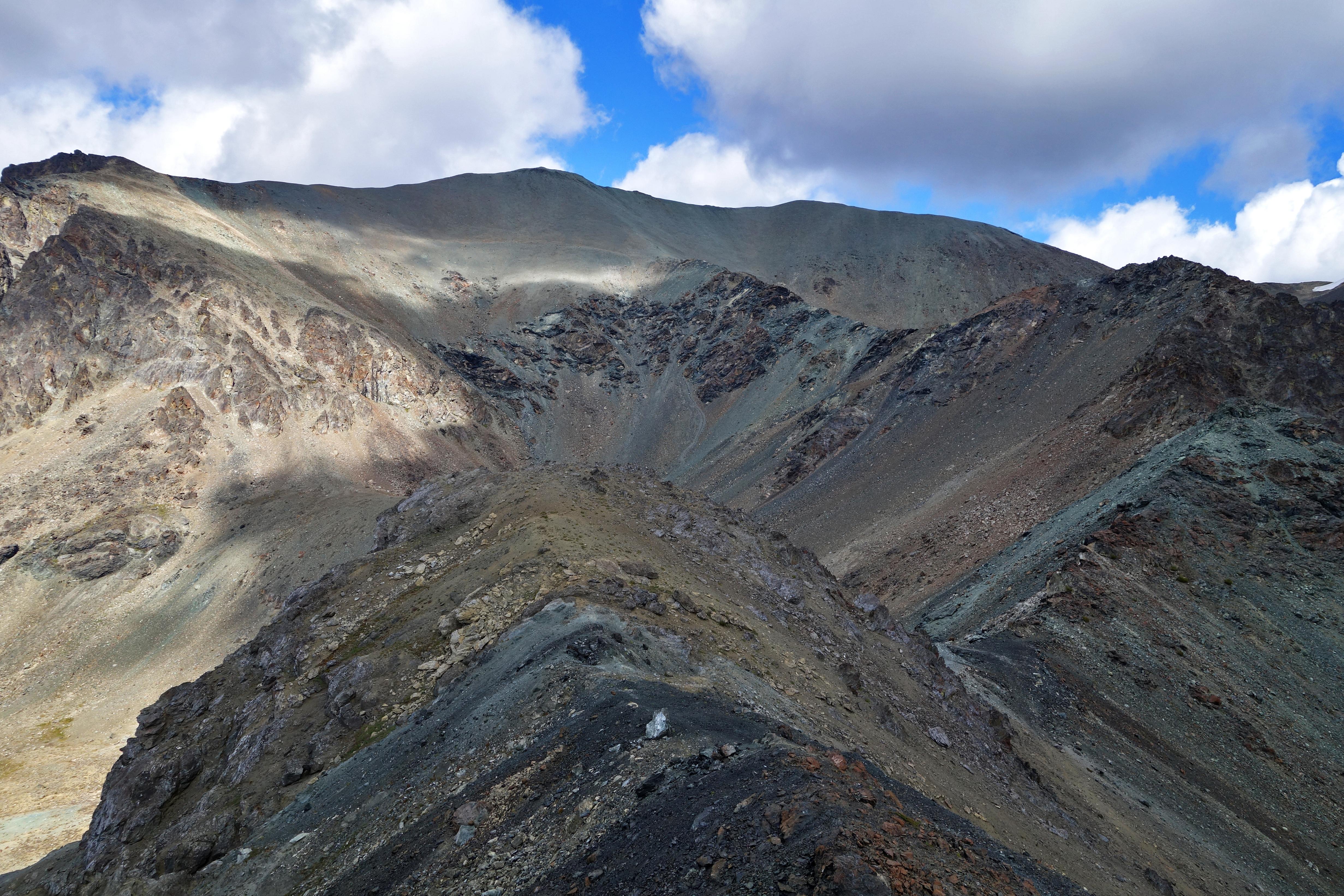
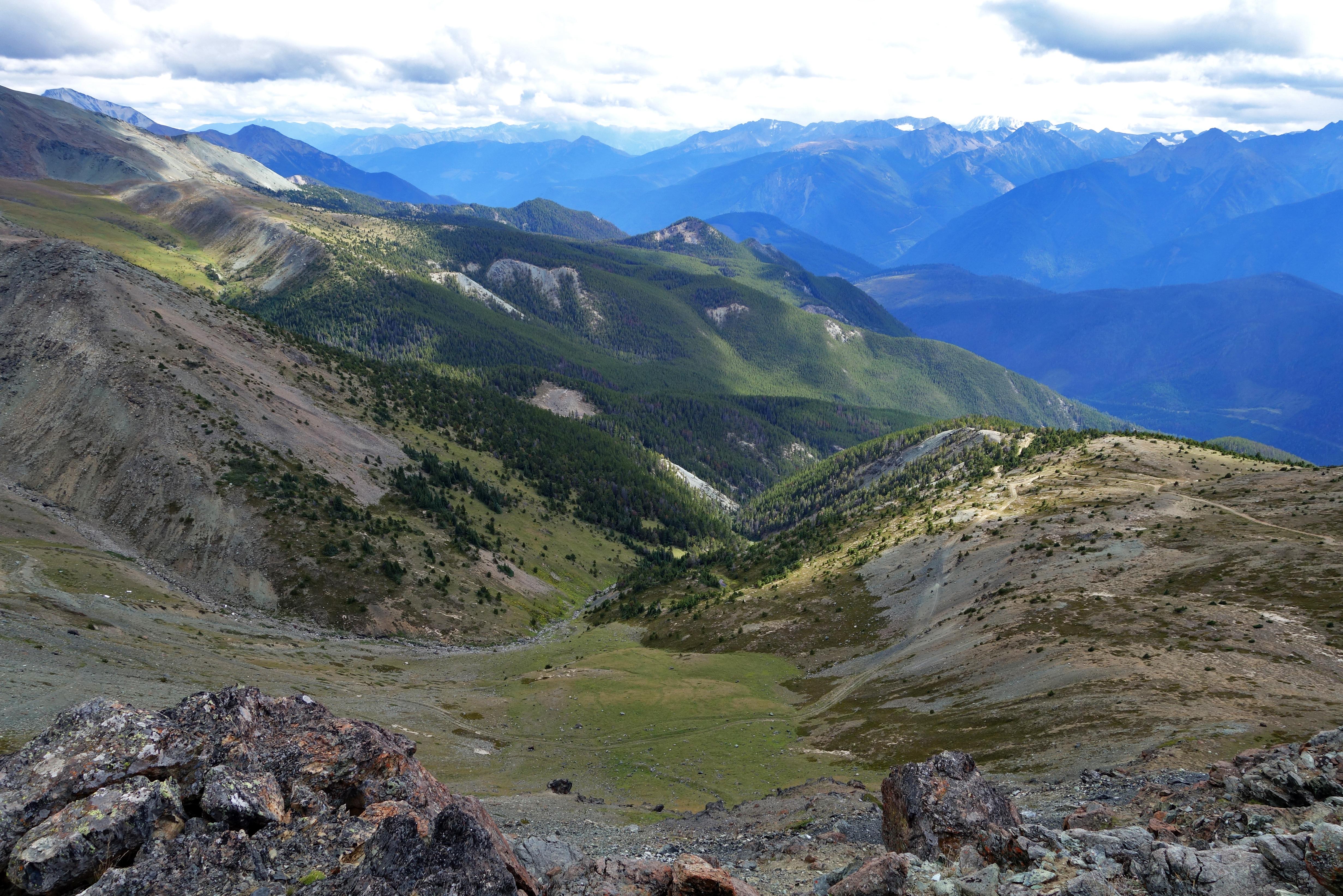
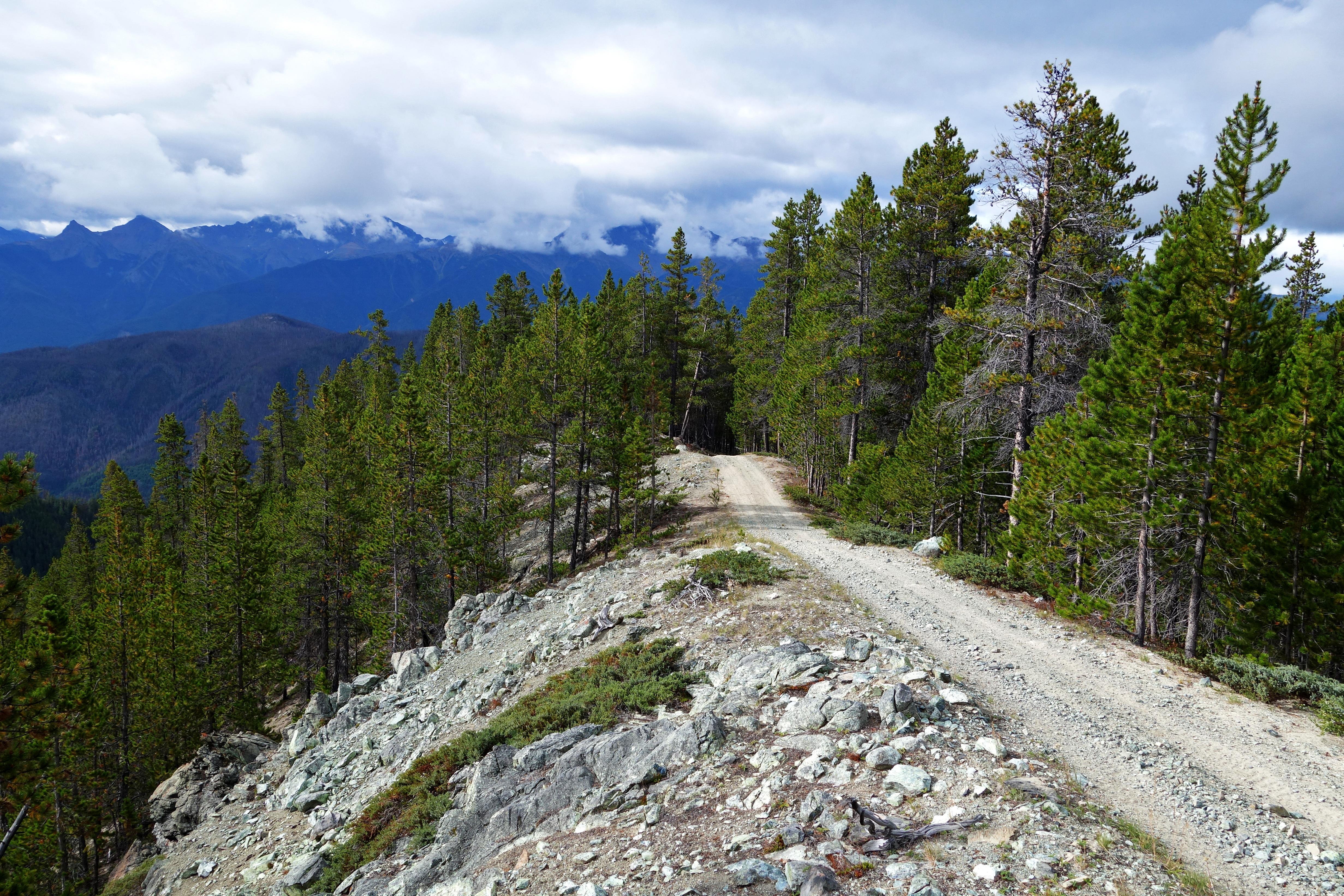
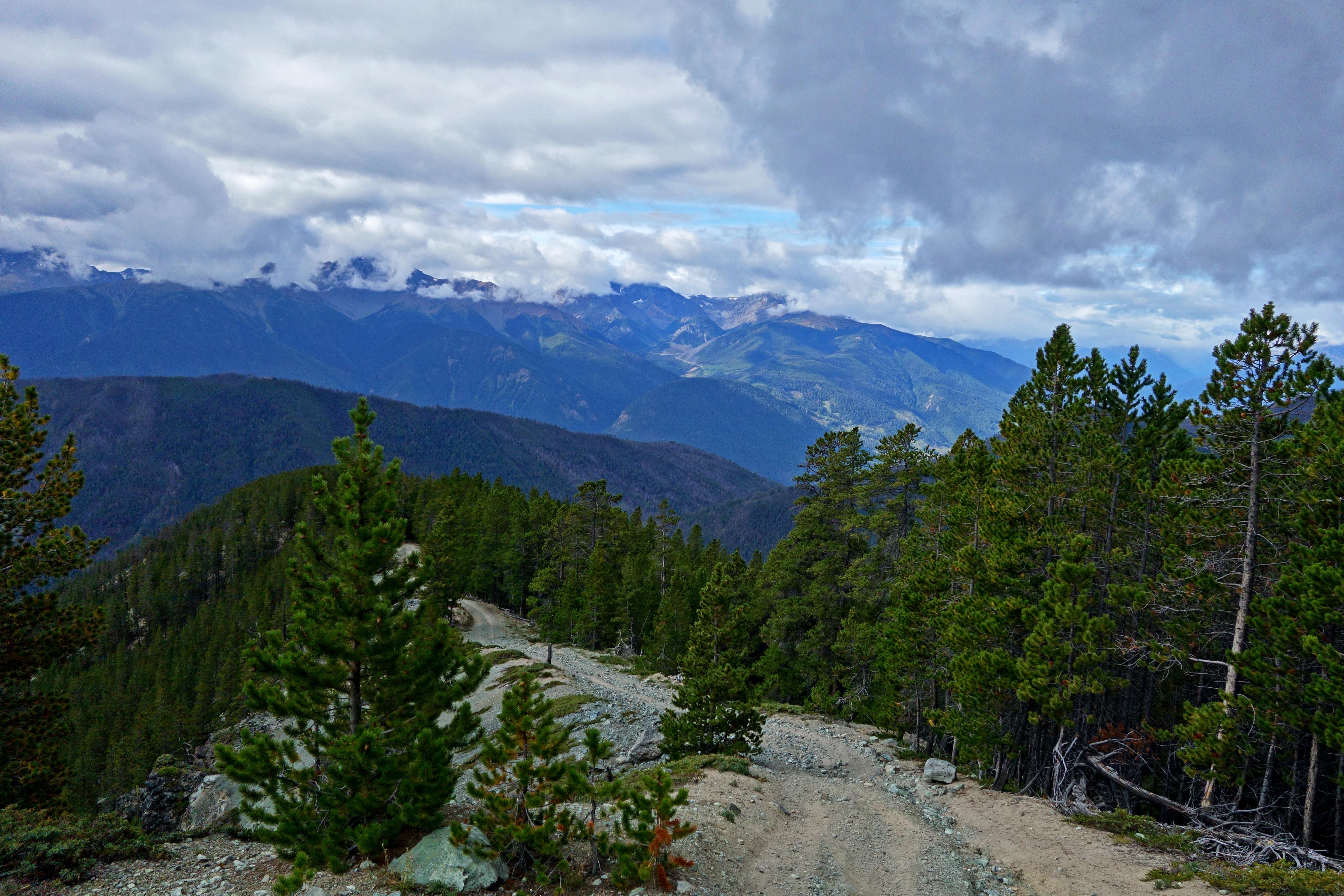
From the ridge, we dropped down to the road and made our way back. It was a sad, fulfilling, and exciting descent. I was already mapping out future trips and viable routes up the Shulaps; Fall and Winter trips, my mind was buzzing!
Jade highway:
A look back:
I reflected on the fact there are several ways up the Shulaps, most of which are easier than the one I am fixated on. Each time I come here, I discover new views and make it closer to the summit – too close not to keep at it.
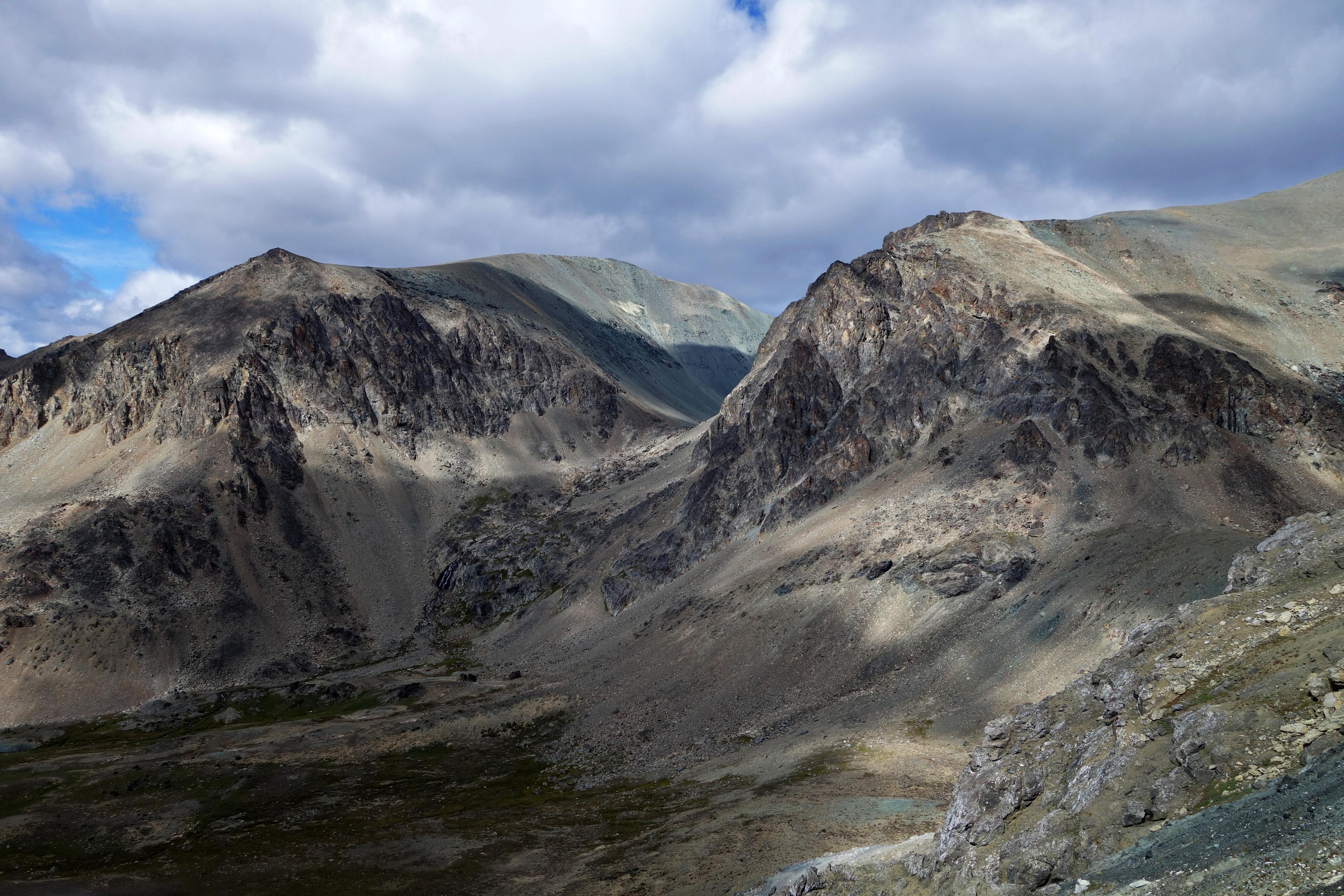
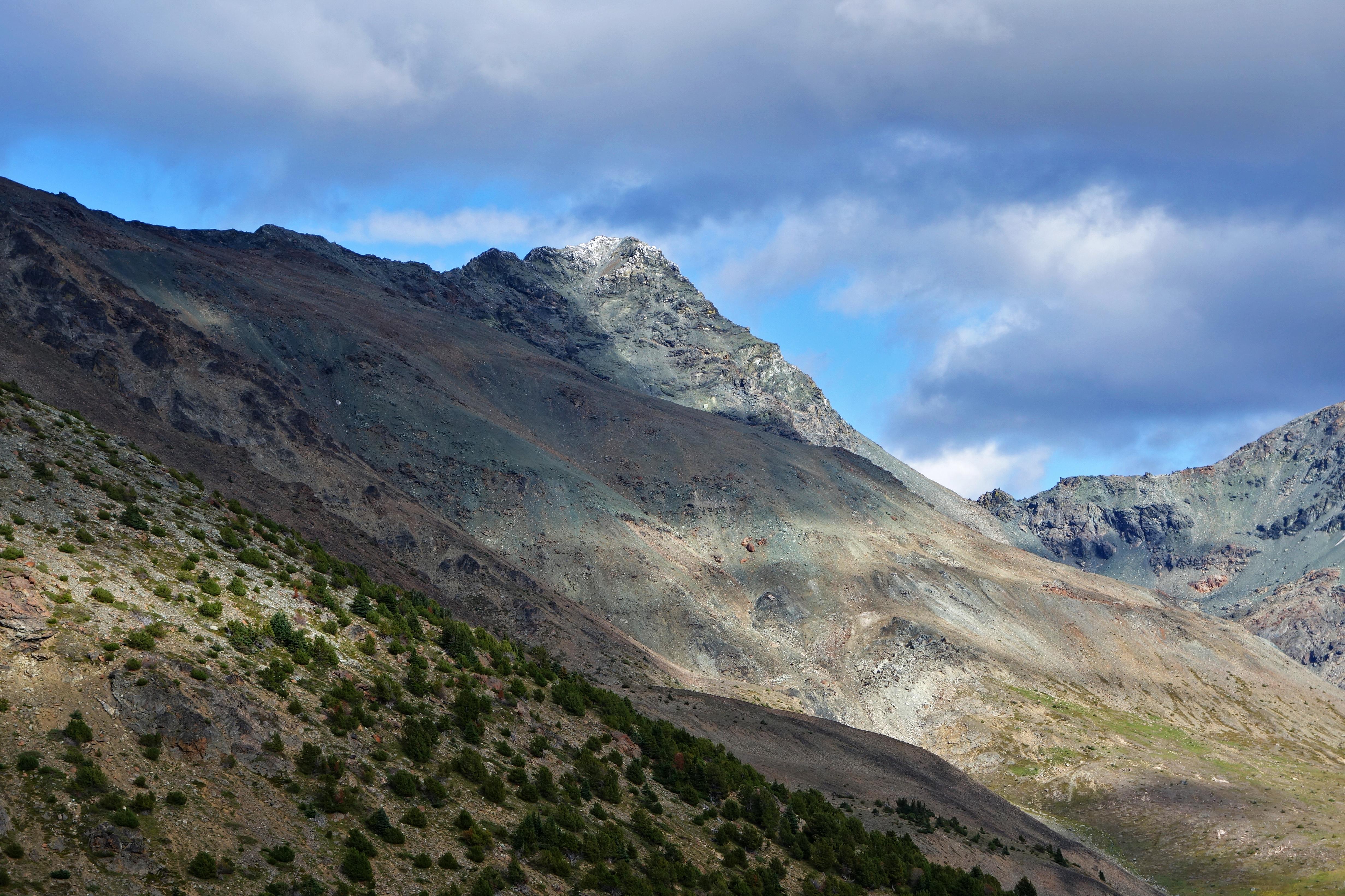
View of the official Shulaps summit with a fresh dusting of snow:
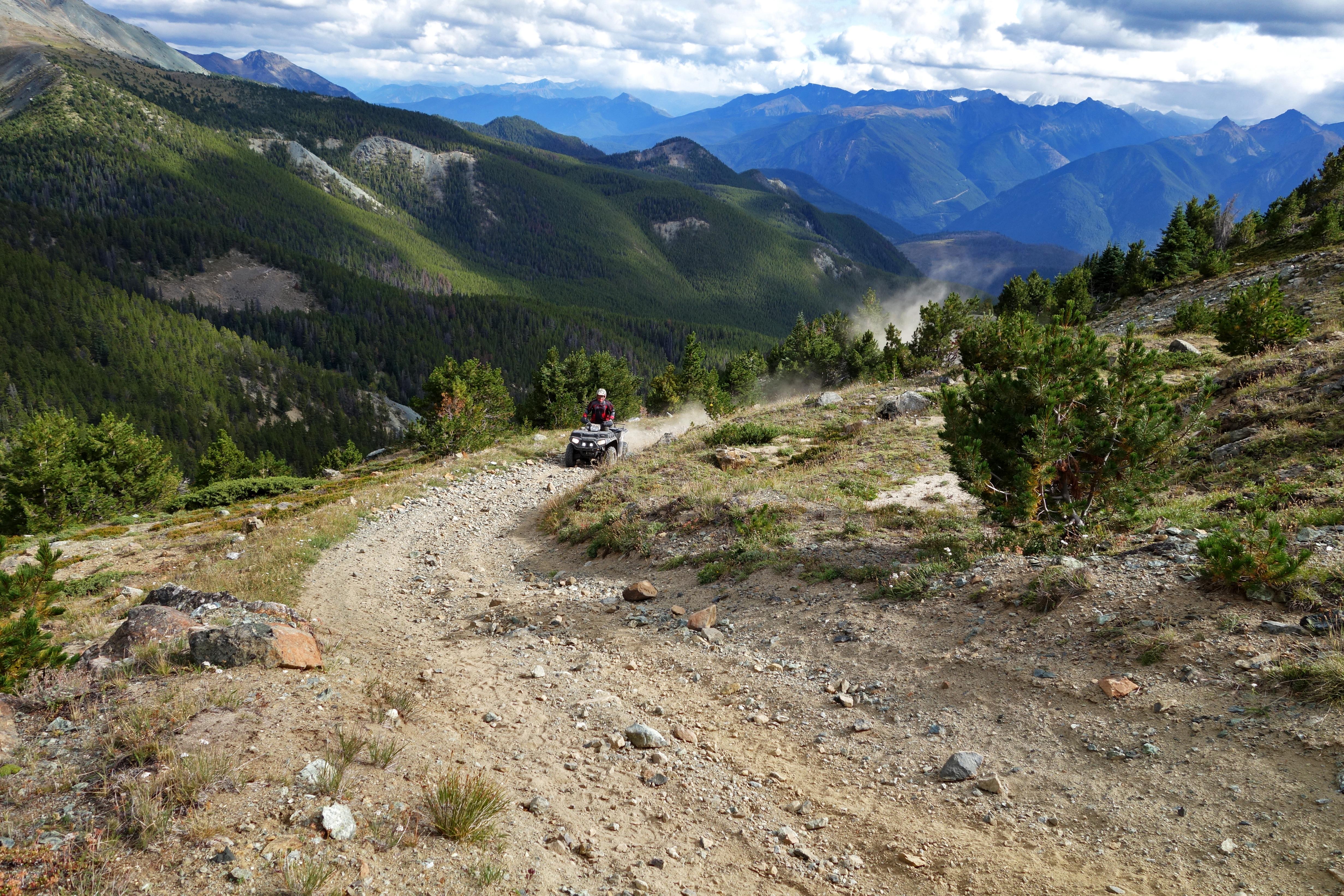
As we dropped out of the valley, we heard ATVers coming up the road. After a long day of ascending and descending the valley and its ridges, this was quite possibly the worst view of the day. [Un]fortunately, they didn’t make it past a nearby washout:
Another look back:
I forgot to mention, throughout the day, Ryan was lagging here and there and it took a little while for me to figure out why. Apparently he was more impressed with the jade than I was. His rock collection:
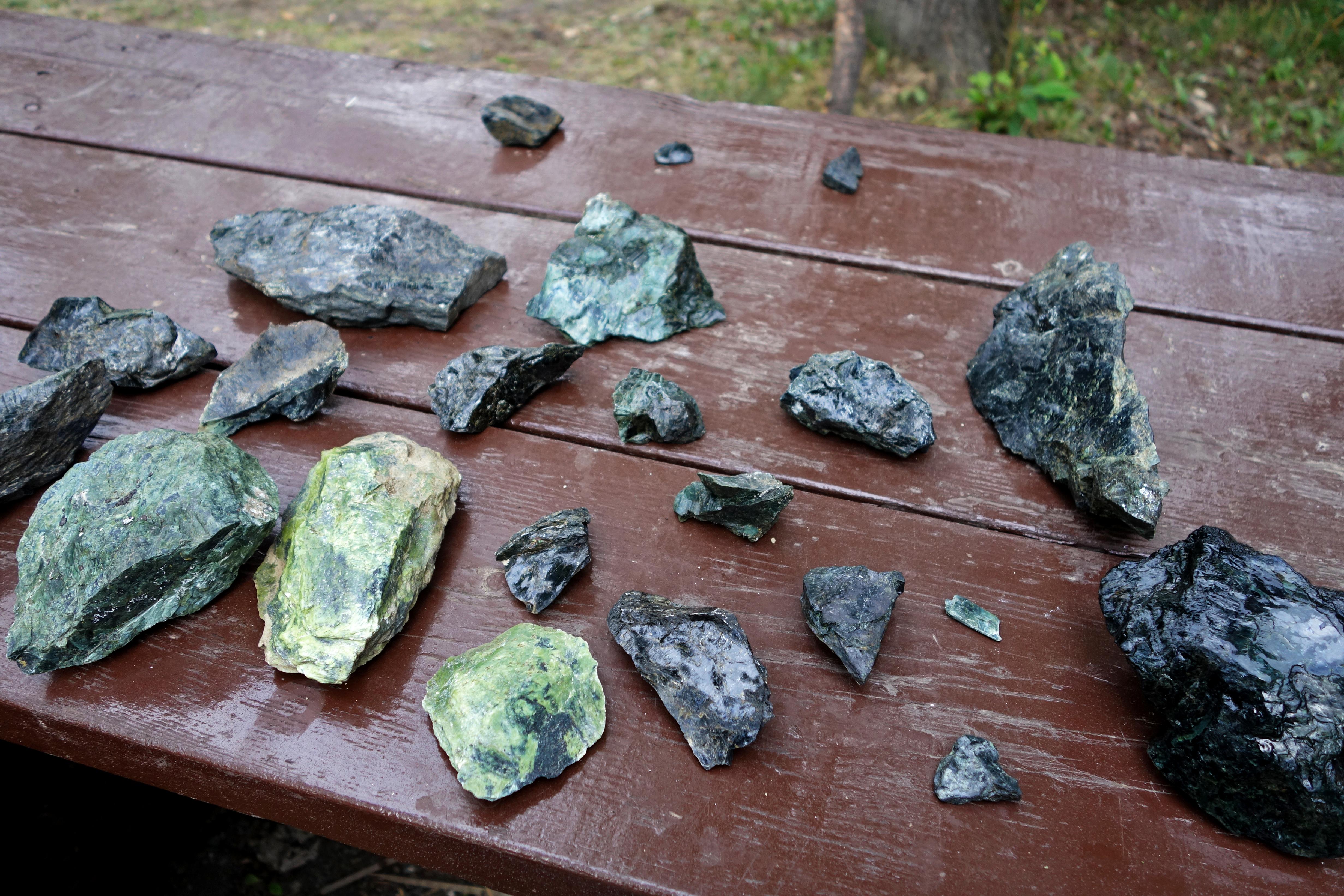
All we have to do is find a tumbler!
My blood sugars stayed in the normal range for most of the day. I kept well hydrated, ate a shotblok every hour, and corrected blood sugars before I had any serious highs or lows. I did manage to fall quite low after our first ridge; 3 shotblocks and a 10-15 minute break brought my blood sugars up to the normal range. Other than that, it was a good day.
Keep your fingers crossed for an extended Summer!
– Ash
Hi Ashika,
I am researching for a possible trip into the area and would love to visit Shulaps Range. What attracts me is that you can get to the alpine with not a huge elevation gain.
Regarding the Jim Creek FSR – there seems to be no information whatsoever on it – I have it on my old edition of Backroads, but otherwise nothing – even hard to find it on google Earth – how bad was it when you were there? Do you know if it is still accessible?
You mentioned accessing LaRochelle and Holbrook – how was access there? I am thinking of hiking up Sebring Peak from the LaRochelle branch – do you think it would be a good option? There seems to be a ‘Holbrook Creek’ branch – have you explored that?
Thank you!
great shots, nice to see; I’ve wanted to hike the Shulaps for years, being raised in the area, but never had time or energy.
Be advised that there is now an elevation ban for motorized vehicles for the Shulaps and Camelsfoot ranges, not sure how high but look up the Bridge River Valley Trails FB page they have a post about it.
Next time you want to hike the Shulaps I recommend you try hiking up from the Yalakom side; there’s various roads that run up into the alpine though at a certain point it’s now hiking or mountain biking only.
One you might want to consider is the Hell Creek Mine Road, which runs up out of the Buck Creek Road area of Yalakom; and there’s a more recent logging main that runs up from Road 40 just west/upstream from the “Bridge of the 23 Chipmunks” that crosses the Yalakom. Hell Creek Mine is way above the canyon on its south rim, but the road has to go around behind the final peak in the range (the one visible from Moha/Yalakom junction with the waterfall coming off it); the mine is abandoned.. it’s where the jade boulder the SFU Quadrangle’s reflecting pool came from.
Peridotite Creek, the last valley to the left as you go up the Yalakom before you get to Big Dog and the Quartz/Poison Mountain aread, is gated as it’s all staked for gold, which lays about on the surface as glittering high-grade gold ore; that’s the Yalakom find of ’41 that’s never been developed; there’d be guards up there, ‘no trespassing’ even though SFAIK it’s not fenced.
Mike, thank you very much for the beta! We were up again in 2016 and 2017, I haven’t had time to post about it yet – but I will soon. We explored Larochelle a little this summer and found a few old mine stakes in the Holbrook Creek area.
Hell Creek Mine and Peridotite are both on the list to explore. We need to spend more time up the Yalakom during future trips. There are lots of different valleys out there I’d love to see.
We also follow the South Chilcotin facebook group (https://www.facebook.com/southchilcotin/) for updates on different accesses. The motor vehicle ban is above 1920m (link: https://archive.news.gov.bc.ca/releases/news_releases_2013-2017/2015FLNR0059-000518.htm), much of the shulaps meadows have been chewed up by dirtbikes already.
Feel free to share some pics if you get out that way. Thanks for touching base and hope you enjoyed the holidays.
Hi there! I was in this same area last 9 years ago now. I’d like to head back there this summer, this time taking along my now teenage daughter. When I did go I remember not driving too far up the old Jim Creek road as it got very steep / sketchy, but I can’t remember specifics. Since you’ve been up there much more recently, would you be able to give me some idea of how far one can “reasonably” 4 wheel drive up that road, and if there is a more or less obvious place to stop and park?
Thanks!
Darrin
Hi Darrin, I’m sending you an email to get some more details. Keep a lookout for it from: ashika.parsad@gmail.com